Sea of Galilee
The first-century boat, harbors, anchors, fishing weights, species, processing installations, taxation and changing shorelines illuminate the lake economy behind fishermen, crossings and crowds without authenticating an individual voyage or miracle.
Cross References — Peter and Andrew | Capernaum Harbor | Gospel Miracles | Roman Galilee
The Miraculous Catches — Fishing Practice in Luke 5 and John 21
Gospel fishing narratives — Lake of Gennesaret (Sea of Galilee), 1st Century AD in The Miraculous Draught of Fishes by Raphael, Vatican Museums“Master, we have toiled all the night, and have taken nothing: nevertheless at thy word I will let down the net. And when they had this done, they inclosed a great multitude of fishes: and their net brake. ” — Luke 5:5–7, KJVIn Luke 5:1–11Raphael, The Miraculous Draught of Fishes, 1515 AD, Victoria and Albert Museum, London. Luke 5:1–11, KJV. Luke places Jesus beside the Lake of Gennesaret, where Simon’s crew has fished unsuccessfully overnight. After teaching from Simon’s boat, Jesus directs another cast; the resulting catch requires help from a second boat. The narrative concludes with Simon, James and John leaving their occupation to follow Jesus. , Simon
El Greco, Saint Peter, about 1600 AD; later devotional portrait. Simon Peter is the fisherman whose boat Jesus enters in Luke 5. The Synoptic Gospels identify him and his brother Andrew as fishermen near Capernaum; John 21 again presents Peter leading a fishing expedition. reports an unsuccessful night, washed nets, a renewed cast and assistance from another boat
Raphael, The Miraculous Draught of Fishes, 1515–1516 AD, Victoria and Albert Museum, London. Luke’s second boat is not incidental scenery. The account describes a cooperative fishing operation in which Simon signals partners to help control a catch too large for one crew and vessel. . The sequence situates the theological call of the disciples within recognizable work: fishers labor at night, maintain equipment onshore and depend on partners when a catch exceeds one crew’s capacity.
John 21:1–14After Raphael, The Miraculous Draught of Fishes, print, British Museum, London. John 21:1–14, KJV: “Simon Peter saith unto them, I go a fishing. They say unto him, We also go with thee…. and that night they caught nothing.” At daybreak the disciples follow a direction from the shore, obtain a large catch and come ashore to bread, fish and a charcoal fire. reuses several details after the Resurrection: fruitless night fishing
American Colony Photo Department, Sea of Galilee near Tiberias, early 20th Century AD, Library of Congress. Fishing after dark avoided some daytime heat and could take advantage of fish movements in shallower water. The Gospels report the timing but do not identify the precise net type, target species or location of either catch. , an empty net, direction from shore and a catch dragged to land
Niccolò Vicentino after Raphael, The Miraculous Draught of Fishes, 16th Century AD, Metropolitan Museum of Art, New York. John 21:8 says the smaller vessel approached while the disciples were “dragging the net with fishes.” Verse 11 then has Simon Peter draw the net onto land. The movements distinguish bringing a loaded net alongside the boat from finally hauling it ashore. . The practical details make the narratives intelligible within the lake’s fishing culture, but compatibility with known practice does not verify either miraculous catch.
Two Narratives, Different Settings
Luke places the first catch near the beginning of Jesus’ public ministry. The event leads into the call of James and JohnIsrahel van Meckenem, James the Greater and John, late 15th Century AD, Metropolitan Museum of Art, New York. Luke 5:10 identifies James and John, sons of Zebedee, as Simon’s fishing partners. Mark 1:19–20 depicts the brothers working with their father, hired workers and a boat before responding to Jesus’ summons. . John places its catch after the Resurrection and gives it a recognition-and-restoration function. The narratives resemble one another, but their chronology, participants and literary purposes are not identical.
John uniquely numbers 153 fishAfter Raphael, Miracle of the Draught of Fishes, Bowyer Bible print, 18th Century AD. John 21:11, KJV: “Simon Peter went up, and drew the net to land full of great fishes, an hundred and fifty and three.” Numerous symbolic explanations have been proposed, but the Gospel itself does not explain the number. and describes a charcoal fire
Duccio di Buoninsegna, The Calling of Peter and Andrew, 1308–1311 AD, National Gallery of Art, Washington. The Greek word anthrakia denotes a charcoal fire. John uses it in John 18:18, where Peter warms himself during his denials, and again in John 21:9 before Jesus questions Peter. The repeated term forms an important literary connection. with fish and bread already prepared. These features serve John’s narrative theology as well as its lakeside setting.
Fishing Practice and Material Context
Excavated boats, anchors, net weights, hooks, harbors and processing installations establish an active fishing economy around the Sea of GalileeTamuz, Sea of Galilee Overview, 2014 AD, Wikimedia Commons. The freshwater lake is called the Sea of Galilee in Matthew and Mark, the Lake of Gennesaret in Luke, and the Sea of Tiberias in John. These names refer to the same body of water. during the 1st Century AD. They explain how the reported work could operate; none can be assigned to the two Gospel episodes.
Evidence – Luke and John independently supply literary descriptions of fishing activity. Archaeology and historical research establish boats, nets, landing places, fishing settlements and commercial production around the lake.
Conclusion – The narratives employ coherent fishing actions and a credible lakeside occupational setting. That correspondence contextualizes the accounts but does not independently establish supernatural causation or identify the precise boats, nets, crews or landing places.
Criticisms – Similarity between Luke 5 and John 21 may reflect remembered tradition, deliberate literary echo, shared narrative motifs or some combination. Archaeological compatibility cannot decide among those literary explanations.
Citation – Luke 5:1–11 and John 21:1–14, King James Version; K. C. Hanson, “The Galilean Fishing Economy and the Jesus Tradition,” Biblical Theology Bulletin 27, no. 3 (1997): 99–111; Raimo Hakola, “The Production and Trade of Fish as Source of Economic Growth in the 1st Century AD Galilee,” Novum Testamentum 59, no. 2 (2017): 111–130.
File Under – Evidence for Jesus Christ > Jesus’ Ministry > Archaeological Sites > Sea of Galilee > The Miraculous Catches
Cross References – Jesus Ministry | Gospel Miracles | The Apostles | The Resurrection


Fishing Families — Partnerships, Hired Workers and the Lake Economy
 ‘Calling of The Apostles’ by Domneico Ghirlandaio (1449-1494 ) depicting Gospel and economic evidence from 1st Century AD Galilee“And straightway he called them: and they left their father Zebedee in the ship with the hired servants, and went after him.” — Mark 1:20, KJVMark 1:16–20
Domenico Ghirlandaio, Calling of the First Apostles, 1481 AD, Sistine Chapel, Vatican City. Mark 1:16–20, KJV: Simon and Andrew are “casting a net into the sea,” while James and John are “in the ship mending their nets.” Verse 20 leaves Zebedee in the boat “with the hired servants,” revealing equipment, kinship and paid labor within the narrative. places Zebedee
Domenico Ghirlandaio, Calling of the First Apostles, 1481 AD, Sistine Chapel, Vatican City. Zebedee is named as the father of James and John. Mark depicts him remaining in the family boat with hired workers when his sons follow Jesus. The text provides no biography beyond his family and occupational setting. , his sons and paid hired workers
After Raphael, The Miraculous Draught of Fishes, 16th Century AD, Ashmolean Museum, Oxford. The Greek misthōtoi means wage earners or hired workers. Their presence indicates labor beyond Zebedee’s immediate sons, but it does not establish that the family was wealthy by modern standards. maintaining a boat-and-net operation when James and John depart. In Luke 5:7–10
After Raphael, Miraculous Draught of Fishes, 16th Century AD, Metropolitan Museum of Art, New York. Luke 5:7–10, KJV: Simon’s crew “beckoned unto their partners, which were in the other ship,” and Luke identifies James and John as “partners with Simon.” The wording presents cooperation between crews rather than an isolated fisherman. , the sons of Zebedee, James and John
Unknown artist, Jesus calls James and John from their boat; their father Zebedee stands behind them, woodcut, Wellcome Collection, via Wikimedia Commons, CC BY 4.0.James and John were the sons of Zebedee and fishing partners of Simon. In Luke 5:7–10, they respond when Simon’s extraordinary catch overwhelms the fishing operation: the nets begin to break, Simon’s partners are signaled to help, and the two boats become so full that they are in danger of sinking. Luke alone explicitly identifies James and John as Simon’s partners in this catch. Mark 1:19–20 instead presents them mending nets in their boat with Zebedee and hired servants when Jesus calls them; Mark does not narrate the overflowing catch. Matthew’s parallel calling account (Matthew 4:21–22) likewise mentions the boat and Zebedee but not the catch. Thus Luke supplies the partnership and catch setting, while Mark and Matthew preserve a shorter calling tradition. are Simon’s partners and respond when his catch overwhelms one vessel.
These details place the fishermen within a household economyDavid Shankbone, Domestic Ruins at Capernaum, 2008 AD, Israel. In an ancient household economy, relatives commonly formed both the domestic unit and the productive workforce. Boats, nets, catches, food preparation and exchange could involve family members, partners, laborers and local brokers. in which kinship, equipment, labor and cooperative agreements overlapped. Historical research therefore cautions against imagining either solitary subsistence fishing or modern independent entrepreneurs. The Gospels describe organized work without revealing each family’s wealth, legal arrangements or exact position within Galilee’s fishing trade.
Kinship and Partnership
The Synoptic accounts connect four fishermen through family and work: Simon and AndrewGuido Reni, Saint James the Greater, about 1636–1638 AD; later devotional portrait. James and John are the sons of Zebedee. Mark presents them mending nets in their father’s boat; Luke calls them Simon’s partners. Later Christian art identifies James through pilgrim attributes that do not come from the Gospel fishing narrative. are Zebedee’s sons; and Luke calls the latter pair koinōnoi, associates or partners, of Simon. K. C. Hanson cautions that ancient labor should be reconstructed through kinship and political relationships rather than modern business categories: “The family functioned as both a producing and consuming unit.”
The accounts do not specify whether the families owned every boat or net, leased fishing rights, shared catches by contract or worked through larger patrons. “Partners” indicates organized cooperation; it is not a surviving partnership agreement.The Regulated Lake Economy
Fishing took place within the territory of Herod AntipasSea of Galilee Map, 1903 AD; historical map showing the lake’s settlements and regional geography. Herod Antipas governed Galilee from 4 BC to AD 39 as a Roman client ruler. He founded Tiberias on the lake’s western shore and administered a territory in which fishing, agriculture, tolls and urban markets interacted. . Taxes, tolls, leases and market controls formed part of the broader political economy, although surviving evidence does not permit a complete reconstruction of the rules governing Simon or Zebedee.
CapernaumCapernaum Synagogue Ruins, modern archaeological photograph, Israel. Capernaum was a fishing settlement on the lake’s northwestern shore and a principal setting in the Synoptic ministry narratives. Excavated houses, harbor remains and fishing-related objects contextualize the village economy but cannot identify a particular crew’s equipment. and Magdala
Zeller Zalmanson, Magdala on the Sea of Galilee, 2021 AD, Israel. Magdala was a substantial 1st-Century AD lakeside settlement associated with fishing, trade and fish processing. Its archaeology supplies regional economic context; no excavated installation can be assigned to a named Gospel fisherman. supply different archaeological windows into settlement, harbor activity, domestic life and fish processing. Together with the ancient Galilee boat and harbor remains, they support the existence of a developed lake economy without proving the specific calls, catches or family arrangements narrated in the Gospels.
Evidence – Mark identifies nets, a boat, brothers, their father and hired workers. Luke identifies two cooperating boats and calls James and John Simon’s partners. Archaeology establishes the settlements and material infrastructure of a substantial regional fishing economy.
Conclusion – The Gospel fishermen are portrayed within credible family-based and cooperative labor arrangements. The evidence does not establish their precise income, ownership structure or economic class.
Criticisms – Models emphasizing elite extraction and severe exploitation should not be treated as the only reconstruction. Raimo Hakola argues that fishing production and trade could also stimulate regional economic growth. Both approaches depend partly on comparative evidence because Galilee’s surviving administrative records are incomplete.
Citation – Mark 1:16–20 and Luke 5:1–11, King James Version; K. C. Hanson, “The Galilean Fishing Economy and the Jesus Tradition,” Biblical Theology Bulletin 27, no. 3 (1997): 99–111, especially 100–104; Raimo Hakola, “The Production and Trade of Fish as Source of Economic Growth in the 1st Century AD Galilee,” Novum Testamentum 59, no. 2 (2017): 111–130.
File Under – Evidence for Jesus Christ > Jesus’ Ministry > Archaeological Sites > Sea of Galilee > Fishing Families
Cross References – Jesus Ministry | The Apostles | Gospel Miracles | The Resurrection


The Ancient Galilee Boat — A First-Century Fishing Vessel from the Sea of Galilee
Shelley Wachsmann, nautical archaeologist regarding the Kibbutz Ginosar hull, 1986“It does seem that the boat fits this time range and is of the type that would have been used by Jesus and his disciples.”Underwater archaeologist Shelley Wachsmann, who directed the excavation as the Israel Antiquities Authority’s inspector of underwater antiquities, assessed the hull’s dating against the Gospel era. The discovery came after two fishermen brothers, Moshe Lufan and Yuval Lufan, fishing on the Sea of GalileeWarfieldian, Ancient Boat of Sea of Galilee, Wikimedia Commons, CC BY-SA 4.0.Sea of Galilee
A freshwater lake whose fishing villages supported a substantial first-century fishing economy. The boat discovered near Kibbutz Ginosar is physical evidence for the kind of working vessel used in this environment. The Gospels repeatedly place Jesus among fishermen and boats on this lake:
“And as he walked by the sea of Galilee, he saw Simon and Andrew his brother casting a net into the sea: for they were fishers. And Jesus said unto them, Come ye after me, and I will make you to become fishers of men. And straightway they forsook their nets, and followed him.” — Mark 1:16–18, KJV , discovered the buried ancient hull outline on the lakebed near Kibbutz GinosarGodot13, Yigal Allon Center, Kibbutz Ginnosar, photograph, Israel.Kibbutz Ginosar
An agricultural community on the northwest shore of the Sea of Galilee near ancient Magdala, where the boat was found and is now housed in the Yigal Allon Museum. during a 1986 drought that exposed the northwest shore . Radiocarbon testing and hull-construction analysis date the vessel to roughly the 1st century BC through the mid-1st century AD, a range that overlaps the era of Jesus’ ministry.
The hull’s mortise-and-tenon joinery and mixed timber repairs match the type of working fishing boat described in Mark 4:39Rembrandt van Rijn, Christ in the Storm on the Sea of Galilee, 1633 AD, formerly Isabella Stewart Gardner Museum.Mark 4:39 — KJV
“And he arose, and rebuked the wind, and said unto the sea, Peace, be still. And the wind ceased, and there was a great calm.” A storm-stilling narrative set on the same lake where the boat was found., where Jesus calms a storm from within a fishing boat. At roughly 27 feet long, the hull could have carried up to fifteen occupants. The find is a physical artifact, not a text.How the boat was dated
Radiocarbon testing placed the hull’s timber within a wide band centered near 40 BC, while pottery recovered inside the boat — including a cooking pot and an oil lamp — combined with nail and joinery styles to narrow the working range to roughly 50 BC–AD 50. Shelley Wachsmann and colleagues published the excavation results jointly with the Israel Antiquities Authority.
The hull shows evidence of repeated repairs using at least twelve different wood types, suggesting decades of continuous use — possibly approaching a century — before its owners stripped it of reusable parts and let it sink.What the find does and does not prove
The boat is the same type of vessel used by Galilean fishermen during Jesus’ lifetime, and its recovery gives scholars a rare, physical reference point for Gospel-era lake craft construction and capacity. Its dating range overlaps Jesus’ ministry, but no inscription, artifact, or record links this specific hull to Jesus or any named disciple. The popular name “Jesus Boat” reflects its era, not a documented connection.Evidence – A first-century-range fishing boat recovered intact from the Sea of Galilee lakebed near Kibbutz Ginosar, matching Gospel-era construction and lake-fishing use.
Conclusion – The vessel is physical confirmation of the type, scale, and construction of fishing boats operating on the Sea of Galilee during the period of Jesus’ ministry.
Criticisms – Dating carries a wide margin of error, and there is no evidence connecting this specific hull to Jesus or his disciples; its popular name reflects thematic resonance rather than documented provenance.
Citation – Shelley Wachsmann, “The Galilee Boat—2,000-Year-Old Hull Recovered Intact,” in The Galilee Jesus Knew (Washington, DC: Biblical Archaeology Society, 2008); Mark 4:39, KJV.
File Under – Evidence for Jesus Christ > Jesus’ Ministry > Historical & Archaeological Evidence > Sea of Galilee
Cross References – Miracles & Testimonies | The 12 Apostles


Josephus — The Working Lake Behind the Gospel Crossings
Flavius Josephus, Jewish historian describing the lake in AD 67“Yet had they a great number of ships gotten ready upon the lake, that, in case they were beaten at land, they might retire to them; and they were so fitted up, that they might undertake a sea-fight also.” — Josephus, The Jewish War 3.10.1, William Whiston translationFlavius Josephus describes preparations at TaricheaeAbraham Graicer, Aerial View of Magdala, 2015, Sea of Galilee, Israel.Taricheae — A lakeside town attacked by Roman forces in AD 67. Its exact location remains debated; many researchers associate it with Magdala, while others place it south of Tiberias. Josephus’ report establishes a defended settlement with many vessels, not a certain archaeological identification. during the AD 67 revolt
Portable Antiquities Scheme, Aureus of Vespasian, AD 69–79, British Museum record.AD 67 revolt — The Galilean phase of the First Jewish-Roman War brought Vespasian and Titus to the lake. Josephus’ vessels appear in a wartime account written about events several decades after the Gospel ministry period., when numerous vessels stood ready on the Lake of Gennesareth
William Sanday and Paul Waterhouse, Map of the Sea of Galilee, 1903, Sacred Sites of the Gospels.Lake of Gennesareth — Josephus’ name for the freshwater lake also called the Sea of Galilee or Sea of Tiberias. Gennesareth could also designate the fertile plain along its northwestern shore.. He identifies the town, conflict, waterway and vessels, but does not describe their usual peacetime ownership, routes or employment.
Written in The Jewish War during the late 1st Century AD, his report concerns warfare rather than Jesus. Nevertheless, it independently depicts a populated lake supporting substantial boat activity. That setting illuminates the boats, fishermen, crowds and crossings reported in Mark 3:7–10Adriaen van Stalbemt, Christ Preaching at the Sea of Galilee, 17th Century AD, private collection.Mark 3:7–10, KJV — “And he spake to his disciples, that a small ship should wait on him because of the multitude, lest they should throng him.” The narrative assumes that a boat could be summoned as practical crowd management along the lakeshore., Luke 5:1–11
Raphael, The Miraculous Draught of Fishes, 1515, Victoria and Albert Museum, London.Luke 5:1–11, KJV — “And he entered into one of the ships, which was Simon’s, and prayed him that he would thrust out a little from the land.” Luke places teaching, nets, hired labor and two cooperating boats at the Lake of Gennesaret. and John 6:16–24
Henry Ossawa Tanner, The Disciples See Christ Walking on the Water, about 1907, Des Moines Art Center.John 6:16–24, KJV — “And entered into a ship, and went over the sea toward Capernaum.” The following verses also mention other boats and a crowd seeking Jesus, presenting the lake as a functioning transportation corridor. without verifying those particular journeys.
What Josephus Actually Describes
Josephus wrote as a participant in the Galilean war and later as a historian living under Roman patronage. In The Jewish WarUnknown illuminator, Flavius Josephus, The Jewish War, medieval manuscript, Historisches Archiv der Stadt Köln, Ms. 163.The Jewish War — Josephus first composed an account in his ancestral language and produced the surviving Greek work for readers within the Roman world, probably in the AD 70s. Its descriptions are indispensable but must be read with attention to his political position and rhetorical purposes. 3.10.1, Taricheae possesses many ships before the Roman assault. Later in the same chapter, Vespasian
Unknown Roman mint, Aureus of Vespasian, AD 71, Classical Numismatic Group.Vespasian — Roman commander of the Judaean campaign in AD 67 and emperor from AD 69–79. Josephus says Vespasian ordered vessels prepared for pursuit on the lake after Taricheae fell. orders vessels prepared, and Josephus says materials and craftsmen were plentiful. The account demonstrates maritime capacity during AD 67, although war mobilization cannot be converted into a census of ordinary fishing boats.
How It Meets the Gospel Geography
Mark 4:35–41Rembrandt van Rijn, Christ in the Storm on the Sea of Galilee, 1633, formerly Isabella Stewart Gardner Museum, Boston.Mark 4:35–41, KJV — “Let us pass over unto the other side. And when they had sent away the multitude, they took him even as he was in the ship.” Mark also says “other little ships” accompanied them, presenting travel as part of a wider lake traffic pattern. narrates a departure with “other little ships,” while Luke presents fishermen working from paired vessels and John depicts boats traveling toward Capernaum
Eduard Marmet, Sea of Galilee from Capernaum, 2016, Capernaum, Israel.Capernaum — A fishing settlement on the lake’s northwestern shore and a principal setting for Jesus’ Galilean ministry in the Gospels. Archaeology establishes the village and lakeside setting, not any individual voyage.. Josephus does not name Jesus in these passages or describe ministry travel. His evidence is therefore independent contextual correspondence, not event corroboration.
Architecture, Archaeology and Text
The shoreline survey has identified harbors, breakwaters and anchorages around the lake; the excavated 1st Century BC–1st Century AD boat shows one vessel type; and Josephus supplies contemporary literary evidence for extensive vessel use. A later Roman naval biremeAfter a Roman relief from Praeneste, Roman Naval Bireme, published 1888, public-domain illustration.Naval bireme — An oared war vessel with two banks or arrangements of oars. This image illustrates Roman naval form generally; Josephus does not specify that Vespasian’s improvised lake vessels were standard Mediterranean biremes. should not be imposed upon the smaller local craft. Together, the sources reconstruct a working maritime landscape while leaving vessel ownership, individual routes and Gospel episodes historically unproven.
Evidence – Josephus independently reports numerous ships at Taricheae, anchors, small local craft and the rapid preparation of Roman pursuit vessels in AD 67. Archaeological harbors and the excavated Galilee boat provide separate material context for the lake’s maritime infrastructure.
Conclusion – The combined literary and archaeological evidence establishes that the 1st Century AD Sea of Galilee supported settlements, landing places, fishing and substantial boat movement. This makes the Gospel travel setting historically intelligible but does not authenticate a particular crossing, teaching episode or miracle.
Criticisms – Josephus describes emergency wartime mobilization roughly four decades after the customary dating of Jesus’ ministry. His numbers and battle narrative require source criticism, Taricheae’s exact location remains disputed, and conditions in AD 67 cannot simply be projected unchanged into the AD 20s.
Citation – Flavius Josephus, The Jewish War 3.10.1 and 3.10.6–9, trans. William Whiston; Shelley Wachsmann, The Sea of Galilee Boat: An Extraordinary 2000 Year Old Discovery, Plenum Press, 1995; Mendel Nun, Sea of Galilee: Newly Discovered Harbours from New Testament Days, Kibbutz Ein Gev, 1989.
File Under – Evidence for Jesus Christ > Jesus’ Ministry > Archaeological Sites > Sea of Galilee > Josephus — The Working Lake Behind the Gospel Crossings
Cross References – Galilean Ministry | The Apostles | Gospel Miracles



Gennesaret — The Fertile Plain Beside the Lake
 Gospel geography — northwestern lakeshore, 1st Century AD“And when they were gone over, they came into the land of Gennesaret. And when the men of that place had knowledge of him, they sent out into all that country round about, and brought unto him all that were diseased.” — Matthew 14:34–35, KJVIn Matthew 14:34–36
Jan Jansson and Georg Hornius, Map of the Holy Land, 1662 AD; later historical rendering/Wikimedia Commons. Matthew 14:34–36, KJV — “And when they were gone over, they came into the land of Gennesaret…. And besought him that they might only touch the hem of his garment.” Matthew places the arrival after the lake crossing and describes people traveling through the surrounding country to bring the sick. and Mark 6:53–56
Berthold Werner, Sea of Galilee Near Capernaum, 2010 AD, Israel. Mark 6:53–56, KJV — “And when they had passed over, they came into the land of Gennesaret, and drew to the shore.” Mark describes movement through villages, cities and countryside after the boat lands. The passage reports healings; geography can contextualize but cannot verify them. , the disciples’ boat reaches the land of Gennesaret
Israel_photo_gallery, Sea of Galilee from the Mount of Beatitudes, 2014 AD, Israel. The Plain of Gennesaret lies along the lake’s northwestern shore, broadly between the Capernaum area and Magdala. It is a shoreline district rather than a separate lake, city or modern political territory. , where people carry the sick from surrounding settlements. This location was a compact, well-watered plain on the northwestern shore between the Capernaum region and Magdala.
Its shoreline connected boats, villages, roads and productive agricultural land. That geography helps explain the rapid narrative movement from a lake crossing to crowds circulating through “all that country.” The landscape fits the reported sequence of shore, villages and countryside, but neither its fertility nor its location independently verifies the healings.A Plain, District and Lake Name
The name GennesaretMatson Photograph Collection, Sea of Galilee Lake of Gennesaret, early 20th Century AD, Library of Congress. “Gennesaret” could identify the fertile plain and neighboring district on the western shore. Luke 5:1 extends the name to the lake itself. The related forms Gennesareth, Ginosar and Chinnereth reflect transmission through different languages and periods. is used in more than one geographical sense. Matthew and Mark refer to the land or district; Luke calls the body of water the Lake of Gennesaret. The modern settlement of Ginosar preserves a related form of the ancient name.
The plain extends approximately four miles north to south and up to about two miles inland. Steep hills border it on three sides, while its eastern edge opens to the lake. Springs, seasonal streams, rich alluvial soil and a warm low-elevation climate supported intensive cultivation.Josephus Describes Its Fertility
The historian Flavius JosephusFlavius Josephus, posthumous artistic portrait; no contemporary portrait is known. Flavius Josephus was a 1st-Century AD Jewish historian and former commander in Galilee. His geographical descriptions are independent of the Gospel narratives, although his rhetorical praise must still be read critically. praises the district in Jewish War 3.516–521
Josephus, Jewish War, manuscript copied about 1470–1475 AD, Laurentian Library, Florence. In Jewish War 3.516–521, Josephus describes Gennesaret’s favorable soil, water and climate and lists crops associated with different seasons. The passage concerns the regional landscape, not Jesus or a Gospel episode. . He describes unusually fertile soil and a climate capable of supporting walnuts, palms, figs, olives and grapes. His language is enthusiastic and partly rhetorical, but it independently identifies Gennesaret as a productive and distinctive shoreline district.
This agricultural setting clarifies why the Gospels can move quickly among boats, landing places, villages, roads, farms and crowds. It does not establish the population total, the exact path followed after landing or the identity of anyone who approached Jesus.Gospel Movement Through the Plain
Mark says the travelers drew to shoreGrauesel, Sea of Galilee Shoreline Near Tabgha, 2010 AD, Israel. Mark 6:53 uses language for completing the crossing and bringing the boat to land. The verse names Gennesaret but not a constructed harbor, quay or exact landing point. , after which recognition spreads through the surrounding territory. Boats could approach stretches of beach as well as constructed landing places; the text does not identify which kind was used.
Matthew and Mark share closely related wording and are not independent archaeological witnesses. Their agreement establishes a shared Gospel tradition locating the episode in Gennesaret. Josephus independently corroborates the district’s existence and character, not the reported healing event.Evidence – Matthew and Mark locate a post-crossing episode in the land of Gennesaret. Josephus independently describes the same northwestern lakeshore district as fertile and intensively cultivated. The terrain links shoreline access with villages, roads and agricultural land.
Conclusion – Gennesaret supplies a coherent geographical setting for the Gospel movement from boat to shore and through surrounding settlements. This correspondence supports the narrative’s regional plausibility without verifying the healings.
Criticisms – Josephus’ luxuriant description may contain rhetorical exaggeration. Matthew’s version also depends substantially on Mark, so the parallel accounts should not be counted as two wholly independent geographical testimonies.
Citation – Matthew 14:34–36 and Mark 6:53–56, King James Version; Flavius Josephus, The Jewish War 3.516–521, translated by H. St. J. Thackeray, Loeb Classical Library 210, Harvard University Press, 1927; K. C. Hanson, “The Galilean Fishing Economy and the Jesus Tradition,” Biblical Theology Bulletin 27, no. 3 (1997): 99–111.
File Under – Evidence for Jesus Christ > Jesus’ Ministry > Archaeological Sites > Sea of Galilee > Gennesaret
Cross References – Jesus Ministry | Gospel Miracles | Jesus Teachings | The Apostles


One Lake, Three Gospel Names — Galilee, Gennesaret and Tiberias
 Gospel terminology — one lake viewed from different settings“And Jesus went up into a mountain, and there he sat with his disciples. And the passover, a feast of the Jews, was nigh.” — John 6:3–4, KJVJohn 6:1–4
Adriaen van Stalbemt, Christ Preaching at the Sea of Galilee, 17th Century AD; later European painting. John 6:1–4, KJV — “Jesus went over the sea of Galilee, which is the sea of Tiberias.” John places the feeding narrative beside the lake and supplies two names for the same body of water. introduces the feeding narrative beside “the sea of Galilee, which is the sea of Tiberias.” Matthew and Mark normally use Sea of Galilee
Itamar Grinberg, Sea of Galilee Aerial View, 2010 AD, Israel Ministry of Tourism. “Sea of Galilee” identifies the lake by its surrounding region. Matthew 4:18 and Mark 1:16 use this name when introducing the fishermen called beside its shore. ; Luke writes Lake of Gennesaret
Gerd Eichmann, Lake Gennesaret, 2010 AD, northern Israel. Luke 5:1 calls the water the Lake of Gennesaret, using a name connected with the fertile northwestern plain. “Lake” translates Greek limnē, while Matthew, Mark and John generally use thalassa, “sea.” ; John also uses Sea of Tiberias
Dennis Jarvis, Tiberias and the Sea of Galilee, 2011 AD, Israel. The Sea of Tiberias takes its name from Tiberias, the city Herod Antipas founded on the western shore in the early 1st Century AD and named for Emperor Tiberius. John 6:1 identifies it with the Sea of Galilee. .
These are not three different destinations. They are regional, local and political names for one freshwater lake. The variation helps locate each Gospel within a changing landscape of settlements and usage. Different names do not create a geographical contradiction, although they may reflect the terminology familiar to each evangelist and audience.Sea of Galilee
Matthew 4:18Domenico Ghirlandaio, Calling of the First Apostles, 1481–1482 AD, Sistine Chapel, Vatican City. Matthew 4:18, KJV — “And Jesus, walking by the sea of Galilee, saw two brethren, Simon called Peter, and Andrew his brother, casting a net into the sea.” The name identifies the lake by the wider Galilean region. and Mark 1:16
Domenico Ghirlandaio, Calling of the First Apostles, 1481 AD, Sistine Chapel, Vatican City. Mark 1:16, KJV — “Now as he walked by the sea of Galilee, he saw Simon and Andrew his brother casting a net into the sea.” Mark uses the same regional name as Matthew. use “Sea of Galilee” when introducing Simon and Andrew’s fishing work. The name connects the lake with the territorial and cultural region in which much of the Synoptic ministry is set.
Calling it a “sea” does not require an ocean. Hebrew yam and Greek thalassa could be used for substantial inland waters. Ancient naming practices do not follow modern scientific classifications rigidly.Lake of Gennesaret
Luke 5:1Raphael, The Miraculous Draught of Fishes, about 1515–1516 AD, Victoria and Albert Museum, London. Luke 5:1, KJV — “And it came to pass, that, as the people pressed upon him to hear the word of God, he stood by the lake of Gennesaret.” Luke’s terminology joins the lake with the fertile district along its northwestern shore. is the New Testament’s only use of ‘Lake of Gennesaret’ (aka,Kinneret) Luke’s preference for “lake” is geographically precise in modern terms, but it should not be turned into proof that Luke personally surveyed the water.
The form Gennesaret is related to older ChinnerethSea of Galilee from a Map of Canaan, 19th Century AD; public-domain historical map. Chinnereth or Kinneret is the lake’s older biblical name, appearing in passages including Numbers 34:11 and Joshua 13:27. The precise origin of the name is uncertain; the popular claim that it derives from the lake’s harp-like shape is not securely established. or Kinneret traditions. Similar forms appear as names for the lake, a settlement and the adjoining plain during different periods.
Sea of Tiberias
The city of TiberiasAmerican Colony Photo Department, Tiberias and the Sea of Galilee, early 20th Century AD, Library of Congress. Tiberias was founded by Herod Antipas on the lake’s western shore, probably around AD 18–20, and named for the reigning emperor Tiberius. It became Antipas’ administrative capital and eventually lent its name to the lake. was a new political foundation during the period of Jesus’ ministry. Its increasing prominence explains why “Sea of Tiberias” became an intelligible designation for later readers.
John 21:1Henry Ossawa Tanner, The Disciples See Christ Walking on the Water, about 1907 AD, Des Moines Art Center. John 21:1, KJV — “After these things Jesus shewed himself again to the disciples at the sea of Tiberias.” John applies the Tiberias name to the setting of the post-Resurrection fishing narrative. again uses the Tiberias designation for the post-Resurrection fishing episode. John does not imply that the disciples moved to another lake between the Galilean ministry and the later appearance.
Why the Naming Matters
The three names orient to different aspects of one place:
– Galilee identifies the surrounding region.
– Gennesaret connects the water with its northwestern plain.
– Tiberias reflects the growing importance of Antipas’ city and Roman-period political geography.
The names offer legitimate historical and literary context. They do not by themselves establish the authors’ identities, composition dates or eyewitness status.Evidence – Matthew and Mark use Sea of Galilee; Luke uses Lake of Gennesaret; John explicitly equates the Sea of Galilee with the Sea of Tiberias. Historical geography connects Gennesaret with the northwestern plain and Tiberias with Antipas’ western-shore capital.
Conclusion – All three Gospel designations refer to the same freshwater lake. Their variation reflects regional geography, shoreline settlements and changing political prominence rather than contradictory locations.
Criticisms – Naming patterns alone cannot date a Gospel precisely. An author could preserve an older name, employ a newer name for an audience or combine both, as John 6:1 does.
Citation – Matthew 4:18; Mark 1:16; Luke 5:1; John 6:1 and 21:1, King James Version; Flavius Josephus, The Jewish War 3.506–521; Sean Freyne, Galilee from Alexander the Great to Hadrian, University of Notre Dame Press, 1980; Harold W. Hoehner, Herod Antipas, Cambridge University Press, 1972.
File Under – Evidence for Jesus Christ > Jesus’ Ministry > Archaeological Sites > Sea of Galilee > Three Gospel Names
Cross References – Jesus Ministry | Jesus Last Week | The Resurrection | Gospel Miracles


Tiberias — Antipas’s New Capital on the Sea of Galilee
Urban archaeology — western lakeshore, founded about AD 19“Howbeit there came other boats from Tiberias nigh unto the place where they did eat bread, after that the Lord had given thanks.” — John 6:23, KJVJohn 6:22–24Sea of Galilee from Capernaum, modern photograph, northern Israel. John 6:22–24, KJV — “There came other boats from Tiberias…. When the people therefore saw that Jesus was not there, neither his disciples, they also took shipping, and came to Capernaum, seeking for Jesus.” The passage presents boats arriving from Tiberias and transporting people toward Capernaum. mentions boats arriving from Tiberias
David Shankbone, Domestic Ruins at Capernaum, 2008 AD, Israel. Capernaum was a Jewish fishing settlement on the northwestern shore and a major setting in the Synoptic ministry narratives. John 6 presents movement toward Capernaum after the feeding episode. . That brief notice places a newly founded political capital within the lake’s transportation network.
Herod AntipasClassical Numismatic Group, Bronze Coin of Herod Antipas, AD 30, Wikimedia Commons. Herod Antipas governed Galilee and Perea from 4 BC until AD 39 as a Roman client tetrarch. He appears in the Gospels in connection with John the Baptist and, in Luke, Jesus’ Passion hearing. No contemporary portrait of Antipas is known; his coins generally avoid human portraits. founded the city about AD 19–20, named it for Emperor Tiberius
Classical Numismatic Group, Tiberius on a Coin of Herod Philip, AD 30–31, Wikimedia Commons. Tiberius ruled the Roman Empire from AD 14 to 37. Antipas named his new capital Tiberias to honor the emperor and advertise loyalty within Rome’s client-ruler system. and made it the administrative center of Galilee. Archaeology reveals a planned urban settlement with streets, public buildings, water installations and later monumental development. Tiberias confirms an expanding urban shore during the Gospel period, but John does not report Jesus entering the city or conducting a public ministry there.
A Deliberately Founded Capital
The Jewish historian Flavius JosephusFlavius Josephus, Antiquitates Iudaicae, medieval manuscript, Cologne Cathedral Library, Germany. In Jewish Antiquities 18.36–38, Josephus attributes Tiberias’s foundation to Herod Antipas, describes its location near the lake and reports difficulties attracting settlers because construction had disturbed older graves. that Antipas established Tiberias beside the Lake of Gennesaret
Tamuz, Sea of Galilee Overview, 2014 AD, Wikimedia Commons.Lake of Gennesaret
Luke’s name for the freshwater lake more commonly called the Sea of Galilee. The Gospels also call it the Sea of Tiberias, while the older biblical and modern Hebrew name is Kinneret or Chinnereth. “Gennesaret” can additionally designate the fertile plain along the lake’s northwestern shore. These names reflect different periods, nearby settlements and regional usage; they do not identify separate bodies of water.. The foundation transferred political gravity toward the lake and provided the tetrarch with a city bearing the emperor’s name.
Josephus also reports that houses were built over older burial placesJewish Burial-Cave Entrance and Blocking Stone, Israel; contextual archaeological photograph. Contact with graves could transmit ritual impurity under Jewish purity law. Josephus says the discovery of older tombs made residence at Tiberias objectionable to some potential Jewish settlers. , creating a ritual-purity problem
PikiWiki Israel, Ritual Bath at Qumran, Second Temple period; contextual image of Jewish purification architecture. Jewish purity traditions treated contact with a corpse or grave as a source of ritual impurity. Josephus reports that Antipas nevertheless populated Tiberias through grants and compulsory settlement. . He says Antipas recruited inhabitants through incentives and compulsory settlement. The account illustrates tension between royal urban planning and local Jewish practice without proving that all Galileans rejected the city.
Material Evidence and Urban Form
Excavations have uncovered portions of a planned street system, civic buildings, water installations, later bathhouses and remains proposed as an Antipas palacePikiWiki Israel, Tiberias Archaeological Garden, Tiberias, Israel. Yizhar Hirschfeld’s excavations identified a monumental complex as Antipas’s palace. Its identification and precise construction chronology remain under scholarly review, so it should be described as proposed rather than certain. . Not every exposed structure belongs to the city’s founding generation. Tiberias continued growing through the Late Roman, Byzantine and Islamic periods, requiring careful stratigraphic dating
Archaeological Park at Tiberias, Israel; visible remains represent several occupational periods. Stratigraphy studies the sequence of deposited layers and structures. At a continuously occupied city such as Tiberias, it prevents later Roman or Byzantine remains from being assigned automatically to Antipas’s original foundation. . Coins minted by Antipas also illuminate royal policy. Rather than displaying his portrait, the surviving issues employ plants, wreaths and inscriptions compatible with Jewish resistance to human images on coinage.
What John’s Notice Establishes
John 6:23 presents boats “from Tiberias,” indicating that the city was intelligible as a departure point in the evangelist’s geographical world. The statement does not identify their owners, prove a scheduled ferry service or establish that the boats belonged to Antipas.
More importantly, the Fourth Gospel never explicitly says that Jesus entered Tiberias. The city’s absence from the reported itinerary should not be filled with an unsupported reconstruction merely because it stood near other ministry locations.Evidence – Josephus attributes the city’s foundation to Antipas; coins and excavated remains illuminate its political and urban development; John 6:23 associates boats from Tiberias with travel across the lake.
Conclusion – Tiberias establishes that Jesus’ lakeside ministry unfolded beside a newly developing royal capital connected to Roman client rule and regional transportation. No surviving Gospel states that Jesus ministered within the city.
Criticisms – Archaeologists continue to debate the date and identification of particular monumental remains, including the proposed palace. Later structures cannot be projected automatically into Antipas’s original city.
Citation – John 6:22–24, King James Version; Flavius Josephus, Jewish Antiquities 18.36–38, translated by Louis H. Feldman, Loeb Classical Library 433, Harvard University Press, 1965; Harold W. Hoehner, Herod Antipas, Cambridge University Press, 1972; Morten Hørning Jensen, Herod Antipas in Galilee, Mohr Siebeck, 2006.
File Under – Evidence for Jesus Christ > Jesus’ Ministry > Archaeological Sites > Sea of Galilee > Tiberias
Cross References – Jesus Ministry | Ministry Timeline | Jesus Last Week | Arrest Trial


Herod Antipas — Urbanization Around Jesus’ Galilean Ministry
 Historical assessment — Galilee under Herod AntipasLiterary, numismatic and archaeological evidence places Jesus’ Galilean ministry within a territory governed by Herod Antipas and increasingly organized around the rebuilt city of Sepphoris and the newly founded lakeside capital of Tiberias.The evidence concerns the political and economic setting of Galilee
Tamuz, Sea of Galilee Overview, 2014 AD, Wikimedia Commons. Galilee was the northern territory governed by Herod Antipas during most of Jesus’ public ministry. Its population included rural Jewish villages, estate agriculture, fishing communities and growing urban centers. between 4 BC and AD 39. Antipas governed as a client tetrarch
Roman Empire in AD 14, historical map/Wikimedia Commons. A tetrarch governed a subdivision of a larger kingdom under Roman authority. Antipas exercised local control over Galilee and Perea while depending upon imperial recognition and remaining subordinate to Rome. under Rome, rebuilt Sepphoris
Abraham Graicer, Aerial View of Sepphoris, 2013 AD, Lower Galilee, Israel. Sepphoris was an important Galilean city near Nazareth. Antipas rebuilt it early in his reign before shifting his capital to Tiberias. Archaeology documents urban development but does not establish that Jesus worked in or visited the city. and founded Tiberias during the probable period of Jesus’ ministry.
Those projects connected taxation, royal patronage, construction, markets and lake transportation. They demonstrate that rural villages did not exist in isolation from expanding cities. Nevertheless, urban development does not prove that Jesus entered either capital, worked on its buildings or directed his teaching against a specific Antipas policy.The Ruler Named in the Gospels
Luke 3:1–2Saint Luke the Evangelist, later Christian painting, Hispanic Society of America, New York. Luke 3:1–2, KJV — “In the fifteenth year of the reign of Tiberius Caesar, Pontius Pilate being governor of Judaea, and Herod being tetrarch of Galilee…. the word of God came unto John the son of Zacharias in the wilderness.” Luke locates John’s ministry within contemporary imperial and regional government. identifies “Herod” as tetrarch of Galilee when John the Baptist begins preaching. The title refers to Antipas, not his father, Herod the Great
Copper Coin of Herod the Great, 1st Century BC, historical illustration/Wikimedia Commons. Herod the Great ruled the larger kingdom until his death around 4 BC. Rome then divided much of his territory among his sons. Antipas received Galilee and Perea. . Mark and Matthew connect Antipas with the imprisonment and execution of John the Baptist
Caravaggio, Salome Receives the Head of John the Baptist, about 1607–1610 AD, National Gallery, London. John the Baptist criticized Antipas’s marriage to Herodias. Mark 6:17–29 and Matthew 14:3–12 attribute John’s imprisonment and execution to the tetrarch’s household and banquet. . Luke later reports that some Pharisees warned Jesus that Antipas wanted to kill him. Luke 13:31–33
Jacob Jordaens, Christ Among the Pharisees, 17th Century AD; later Flemish painting. Luke 13:31–33, KJV — “Get thee out, and depart hence: for Herod will kill thee.” Jesus answers, “Go ye, and tell that fox….” The passage supplies a literary portrayal of tension with Antipas but does not preserve an administrative record from the tetrarch. therefore gives Antipas a more direct narrative role than the city bearing his emperor’s name.
Coins and Political Accommodation
Antipas issued aniconic coinsClassical Numismatic Group, Bronze Coin of Herod Antipas, AD 30; palm branch and wreath design. “Aniconic” means avoiding representations of people or deities. Antipas’s coins generally used plants, wreaths and inscriptions rather than his portrait, a policy compatible with Jewish objections to human images. bearing reeds, palms, wreaths and Greek inscriptions rather than royal portraits. The coins simultaneously honored Roman political authority and avoided some imagery likely to offend Jewish subjects.
This balancing act warns against describing Galilee as either completely isolated from Greco-Roman culture or culturally indistinguishable from a Roman provincial city. Rural Jewish practices, Herodian political power and wider Mediterranean economic forms coexisted.Did Urbanization Impoverish Galilee?
Scholars disagree over the economic effect of Antipas’s building program. Some models emphasize taxes, rents and elite extraction needed to finance royal cities. Others point to construction, markets, manufacturing and fish processing as possible sources of regional growth.
**Morten Hørning Jensen**, a historian of Herodian Galilee, reviews the literary, numismatic and archaeological evidence without treating either severe economic crisis or general prosperity as archaeologically demonstrated across every community. The surviving evidence varies substantially from one settlement to another.Jesus and the Missing Cities
The Gospels name villages and smaller settlements repeatedly but never narrate a ministry visit to Tiberias or Sepphoris. That absence may be historically meaningful, narratively selective or accidental; the texts do not explain it.
Accordingly, it is reasonable to place Jesus’ activity within a Galilee affected by Antipas’s cities. It is not reasonable to claim without further evidence that Jesus worked in Sepphoris, preached in Tiberias or designed particular teachings as coded attacks on their architecture.Evidence – Josephus documents Antipas’s reign and urban foundations; coins preserve his titles and imagery; archaeology documents growing urban centers; the Gospels name Antipas and place ministry activity throughout his territory.
Conclusion – Jesus’ Galilean ministry occurred amid significant Herodian urban development and Roman client rule. This setting can clarify travel, labor, markets and political tensions without adding unreported city visits to the Gospel narratives.
Criticisms – Reconstructions that make Antipas’s cities the controlling explanation for every parable, conflict or economic saying exceed the evidence. Conversely, treating the ministry villages as isolated from nearby cities understates Galilee’s regional connections.
Citation – Luke 3:1–2 and 13:31–33; Mark 6:14–29; Matthew 14:1–12, King James Version; Flavius Josephus, Jewish Antiquities 18.27–28 and 18.36–38; Morten Hørning Jensen, Herod Antipas in Galilee: The Literary and Archaeological Sources on the Reign of Herod Antipas and Its Socio-Economic Impact on Galilee, Mohr Siebeck, 2006; Jonathan L. Reed, Archaeology and the Galilean Jesus, Trinity Press International, 2000.
File Under – Evidence for Jesus Christ > Jesus’ Ministry > Archaeological Sites > Sea of Galilee > Herod Antipas
Cross References – Jesus Ministry | Ministry Timeline | Jesus Last Week | Arrest Trial


Galilee Synagogues
The Gospel accounts repeatedly place Jesus teaching in synagogues throughout Galilee, but the archaeological evidence varies significantly from site to site. Excavated pre-AD 70 synagogues The excavated synagogue at Gamla, destroyed during the Roman capture of the town in AD 67. Wikimedia Commons.Pre-AD 70 synagogues are Jewish assembly buildings securely or plausibly dated before the Roman destruction of Jerusalem in AD 70. Galilean examples include Gamla and the two excavated synagogues at Magdala. These sites demonstrate that synagogue institutions existed while the Jerusalem Temple still operated; they do not establish that Jesus entered a particular excavated building. at Magdala and Gamla establish that Jewish communities maintained dedicated places for Scripture reading, teaching and communal assembly during the period in which the Gospels locate Jesus’ ministry.
The evidence does not support treating every surviving Galilean synagogue as a building from Jesus’ lifetime. Magdala’s two Early Roman synagogues and Gamla’s destruction context provide comparatively strong chronological evidence. By contrast, the monumental buildings visible at Capernaum and Chorazin The monumental black-basalt synagogue at Chorazin. The visible building is later than Jesus’ ministry. Wikimedia Commons.Capernaum and Chorazin preserve impressive later synagogues. The visible Capernaum limestone building is generally dated to late antiquity, while Chorazin’s basalt synagogue is commonly dated to the late Roman or Byzantine period. Earlier remains require careful evaluation and should not automatically be identified as the buildings mentioned in the Gospels. are later, although earlier occupation or structural remains beneath them may illuminate the development of their Jewish communities.
The section compares synagogue plans, chronology, inscriptions, decoration and community functions. It examines inward-facing benches and assembly halls The Gamla synagogue’s rectangular assembly space and wall benches. Wikimedia Commons.Early synagogue halls commonly placed stone benches along several walls around an open central space. This arrangement supported public reading, teaching, discussion and community deliberation without requiring the later basilica plan found in many Roman and Byzantine synagogues., ritual baths, Torah-related imagery, donor inscriptions and the relationship between local synagogues and the Jerusalem Temple.
Special attention is given to the Magdala Stone imagery The Magdala Stone, bearing menorah and Temple-related imagery. Photograph by Hanay; Wikimedia Commons.The Magdala Stone was found inside the synagogue uncovered in 2009. Its carved menorah and architectural imagery appear to evoke the Jerusalem Temple, demonstrating that participation in a local synagogue could coexist with reverence for the Temple before AD 70. The block’s precise function remains debated., Gamla’s securely bounded destruction date and Chorazin’s later basalt architecture, including its inscribed Seat of Moses
 The inscribed basalt seat from the Chorazin synagogue, commonly called the Seat of Moses. Wikimedia Commons.The so-called Seat of Moses is an inscribed basalt chair found at Chorazin. Its designation recalls Matthew 23:2, but the artifact belongs to the later synagogue and cannot be presented as the chair mentioned in Jesus’ saying.. The central historical distinction remains consistent: archaeology can confirm the kinds of institutions, buildings and community practices presupposed by the Gospel narratives without proving that Jesus spoke in a specific surviving structure.
Topics Covered — Gospel reports of synagogue teaching; synagogue terminology and functions; Magdala’s two Early Roman synagogues; the Magdala Stone and Temple imagery; Gamla’s pre-AD 70 assembly hall; wall benches and central teaching spaces; ritual baths near synagogues; Capernaum’s later limestone synagogue and debated earlier basalt remains; Chorazin’s later basalt synagogue; the Seat of Moses inscription; Jewish art and donor inscriptions; synagogue and Temple relationships; dating methods; settlement continuity; and the limits of connecting excavated buildings with individual Gospel events.
Planned Slides and Cards — Galilee Synagogues Before AD 70 — What Archaeology Establishes; Dina Avshalom-Gorni — Why Two Magdala Synagogues Matter; The Magdala Stone — Temple Imagery in a Galilean Synagogue; Expert Assessment — Interpreting the Magdala Stone; Gamla — A Synagogue Destroyed in AD 67; Expert Assessment — Dating the Gamla Assembly Hall; Chorazin’s Basalt Synagogue — A Later Building and Earlier Settlement; Expert Assessment — What Chorazin Can Establish; Capernaum’s Synagogue Sequence — Later Monument and Earlier Remains; Expert Assessment — The Limits of Identifying Jesus’ Synagogue; Synagogue, Temple and Community Before AD 70; and The Cumulative Case for Galilean Synagogue Context.
Cross References — Gospels and Archaeology | Capernaum Excavations | Magdala Synagogue | Bethsaida and Chorazin | Cana and Villages | Jewish Culture
Galilee Synagogues Before AD 70 — What Archaeology Establishes
 Comparative archaeology — Magdala, Gamla and Capernaum evidence“And Jesus went about all the cities and villages, teaching in their synagogues, and preaching the gospel of the kingdom, and healing every sickness and every disease among the people.” — Matthew 9:35, KJVThe Matthew 9:35 report
Guercino, Saint Matthew and the Angel, 1622, Capitoline Museums; public domain.Matthew 9:35, KJV: “And Jesus went about all the cities and villages, teaching in their synagogues, and preaching the gospel of the kingdom, and healing every sickness and every disease among the people.” The verse summarizes Matthew’s presentation of Jesus’ itinerant Galilean ministry; it does not identify every synagogue reportedly visited. places synagogue teaching throughout Jesus’ itinerant ministry. Excavated buildings at Magdala
Magdala was a prosperous Jewish settlement on the western shore of the Sea of Galilee. Its excavated synagogues, streets, ritual installations and commercial remains illuminate the regional environment assumed by the Gospel ministry narratives.Image: Ancient Magdala synagogue, Wikimedia Commons. and Gamla
Ancient synagogue ruins at Gamla. Photograph by Davidbena; Wikimedia Commons.Magdala and Gamla preserve two important archaeological settings for Jewish communal assembly before AD 70. Magdala stood on the western shore of the Sea of Galilee; Gamla occupied a defensible ridge northeast of the lake. demonstrate that such institutions existed before AD 70. Magdala preserves two Early Roman synagogues; Gamla’s assembly hall, with synagogue wall benches
Layout of the synagogue at Gamla. Wikimedia Commons.Stone benches lining several walls allowed an assembled community to face inward toward readers, teachers and other participants. The arrangement differs from the later basilica-style synagogues familiar from the late Roman and Byzantine periods. and an open central area, remained in use until Gamla’s destruction in AD 67.
The buildings establish settings for Torah reading and teachingA Torah scroll prepared for reading. Wikimedia Commons.Torah means “instruction” or “teaching” and commonly designates the five books of Moses. Synagogues supplied local settings for Scripture reading, interpretation, prayer, legal discussion and community gatherings while the Jerusalem Temple still stood. and community gathering. They do not identify a building Jesus entered or verify a reported sermon. The Capernaum basalt remains
The monumental limestone synagogue at Capernaum. Wikimedia Commons.The visible limestone synagogue is generally dated centuries after Jesus. Dark basalt remains beneath and around it attest earlier occupation, but their date, plan and identification as the synagogue mentioned in the Gospels remain debated. therefore require more caution than Magdala or Gamla.
What the Synagogues Looked Like
The earliest excavated synagogues were not miniature versions of the Jerusalem Temple. Their inward-facing benches, columns and central floor created flexible assembly rooms rather than sanctuaries organized around animal sacrifice. The buildings could accommodate Scripture reading, teaching, deliberation, prayer and communal administration.
The Magdala synagogue complexExcavated synagogue at ancient Magdala. PikiWiki Israel; Wikimedia Commons.The synagogue uncovered in 2009 contained benches, mosaic floors, painted plaster and the carved Magdala Stone. Coins and pottery place its use in the Early Roman period, before the destruction of Jerusalem in AD 70. was decorated more richly than Gamla. That difference shows that ancient Galilean synagogues did not follow one mandatory floor plan or decorative program.
The Magdala Stone
The carved Magdala StoneThe Magdala Stone with menorah and Temple-related imagery. Wikimedia Commons.The decorated limestone block stood near the center of the 2009 synagogue. Its menorah and architectural imagery appear to evoke the Jerusalem Temple, although scholars continue debating the function of the stone and the interpretation of individual carvings. connects a Galilean gathering place symbolically with Jerusalem’s Temple. It demonstrates that synagogue participation and Temple loyalty were not necessarily competing alternatives before AD 70.
Why Gamla Matters
Gamla was destroyed during the Jewish revolt against RomeThe Conquest of Jerusalem by Emperor Titus by Nicolas Poussin (1594–1665), 1635, Kunsthistorisches Museum, Vienna, AustriaThe First Jewish Revolt began in AD 66. Roman forces captured Gamla in AD 67 and Jerusalem in AD 70. Because Gamla was not rebuilt as a later synagogue center, its destruction supplies a firm upper boundary for the building’s use. in AD 67. Its abandonment protects the site from confusion with a later Roman or Byzantine synagogue occupying the same location.
Evidence – Magdala and Gamla preserve excavated communal buildings used by Jewish populations before AD 70. Their benches, central spaces, associated ritual installations, coins, pottery and destruction contexts document synagogue life during the Gospel period.
Conclusion – Archaeology confirms that local synagogues were established features of the Galilean world in which the Gospels place Jesus’ teaching. It corroborates the institutional and geographical setting, not any particular sermon, healing or visit.
Criticisms – Building function and dating remain debated at some locations. Capernaum’s visible synagogue is later than the Gospel period, and identifying its underlying basalt remains as the exact earlier synagogue exceeds what has been securely excavated.
Citation – Lee I. Levine, The Ancient Synagogue: The First Thousand Years, 2nd ed., Yale University Press, 2005; Mordechai Aviam and R. Steven Notley, editors, The Synagogue of Mary Magdalene and the Stone of Magdala, 2022; Shmarya Guttman, Gamla excavation reports.
File Under – Jesus Christ > Jesus’ Ministry > Archaeological Sites > Galilee Synagogues > Synagogues Before AD 70
Cross References – Magdala Synagogue | Capernaum Excavations | Jesus Teachings


Dina Avshalom-Gorni — Why Two Magdala Synagogues Matter
 Dina Avshalom-Gorni, archaeologist — Magdala assessment, 2021“The discovery of a second synagogue in this Galilean settlement casts light on the social and religious lives of the Jews in the area.” — Dina Avshalom-GorniDina Avshalom-Gorni offered this assessment after the second Magdala synagogue
Ancient synagogue remains at Magdala. PikiWiki Israel; Wikimedia Commons.A second Early Roman-period synagogue was announced in 2021. It lay near a residential street and less than 200 meters from the decorated synagogue uncovered in 2009. was announced in December 2021. The two buildings occupied different parts of ancient Migdal on Galilee
Israel Zeller, Magdala Center on the Sea of Galilee, 2021; CC BY 2.5.Ancient Magdala, also called Migdal, stood on the western shore of the Sea of Galilee. It was a fishing, processing and commercial settlement connected to the lake’s regional economy.: the 2009 synagogue stood in a commercial area, while the later discovery was associated with a residential street. Their proximity suggests that local Torah study
Menachem Menachemi, Torah Reading, Tiberias, 2009–10; CC BY 2.5.Before AD 70, synagogue activities could include public Scripture reading, instruction, prayer, legal discussion and communal meetings. Archaeology rarely preserves evidence identifying exactly which activities occurred on a particular day. and community assembly were distributed through the settlement rather than confined to one monumental center.
The discovery strengthens the Gospel-era setting but does not show that Jesus visited MagdalaJesus Teaching in the Synagogue, stained glass, St. James’s Church, London; CC BY-SA 4.0.The Gospels report teaching in Galilean synagogues but do not explicitly narrate Jesus entering a synagogue at Magdala. Archaeology therefore establishes an appropriate setting, not his presence inside either excavated building., nor that Mary Magdalene
Caravaggio, Penitent Magdalene, c. 1594–1596, Galleria Doria Pamphilj, Rome, public domain via Wikimedia Commons.Luke 8:1–3 names her as one of the women who traveled with and supported Jesus, “of whom seven demons had gone out”; she witnessed the crucifixion (Mark 15:40; John 19:25) and burial (Mark 15:47), and all four Gospels place her at the tomb, where John makes her the first witness to the risen Jesus — “I have seen the Lord” (John 20:18). The popular image of her as a reformed prostitute rests on a later conflation with the unnamed woman of Luke 7 and Mary of Bethany, consolidated by Gregory the Great in 591 and rejected by modern scholarship; the title “apostle to the apostles” appears in a third-century commentary attributed to Hippolytus. Caravaggio’s seated, averted figure with discarded jewels reflects the penitent iconography, not the Gospel scenes themselves. attended either synagogue or any reported teaching occurred there.
Who Made the Assessment
Avshalom-Gorni is an Israeli archaeologist associated with the excavation and interpretation of the second synagogue. Her conclusion concerns the social implications of finding two communal buildings in one Early Roman-period Galilean settlement—not the historicity of a particular Gospel episode.What the Second Building Contained
The building was constructed from basalt and limestone and included a principal hall, adjoining rooms, benches and column bases. Plastered and painted wall fragments indicate that it was more than an undecorated storage room.
A small room reportedly contained a stone shelf that excavators proposed may have stored Torah scrollsLawrie Cate, Open Torah Scroll, 2009; CC BY 2.0.Torah scrolls contain the Hebrew text of Genesis, Exodus, Leviticus, Numbers and Deuteronomy. Organic scroll material normally decays, so archaeologists usually infer scroll storage from architectural fittings and comparisons rather than surviving parchment.. That interpretation is plausible but should remain identified as an archaeological proposal rather than a recovered scroll deposit.
Why Two Synagogues Matter
The two buildings complicate the assumption that a small settlement necessarily maintained only one synagogue. Location may have reflected neighborhood convenience, family or occupational groups, chronological overlap, differing communal functions or population growth. Archaeology has not yet demonstrated which explanation is correct.
The discovery also shows why “synagogue” should not be reduced to a later church-like worship model. In the 1st Century AD, the Greek word synagōgēCodex Sinaiticus, Matthew 8:28–9:23, 4th Century AD; public domain.Synagōgē is the Greek word for an assembly, gathering or the place in which a community gathered. Its New Testament use may refer either to the congregation or its building, depending on context., and the institution served overlapping educational, religious and civic purposes.
Evidence – Coins, pottery, glass, architectural remains, benches, columns and painted plaster date the second Magdala building to the Early Roman period and support its identification as a synagogue.
Conclusion – Two synagogues within one settlement indicate that Torah study and communal assembly could be neighborhood-level institutions in 1st Century AD Galilee.
Criticisms – The buildings’ periods of use may not have overlapped completely. Their discovery cannot identify individual attendees, demonstrate that Jesus taught there or prove that Mary Magdalene worshipped in either structure.
Citation – Dina Avshalom-Gorni, statement accompanying the University of Haifa announcement of the second Magdala synagogue, Dec. 12, 2021; quotation reported by The Times of Israel and The Jerusalem Post. See also excavation reporting by Dina Avshalom-Gorni, Arfan Najar and Achia Cohen-Tavor.
File Under – Jesus Christ > Jesus’ Ministry > Archaeological Sites > Galilee Synagogues > Two Magdala Synagogues
Cross References – Magdala Synagogue | Gospel Archaeology | Jesus Teachings


Interpreting the Magdala Stone — Temple Model or Torah Table?
 Zeev Weiss, archaeologist — the stone’s debated synagogue function“Our study demonstrates that this table was not intended to be used for reading the Torah, but rather functioned as a low stand upon which the scroll was placed before the Torah-reading ceremony, during the breaks between the readers, and after completion of the ceremony.”Zeev Weiss addresses a central question raised by the Magdala Stone
The carved limestone block stood inside Magdala’s pre-AD 70 synagogue. Its top and sides carry rosettes, architectural forms and imagery interpreted in relation to Jerusalem’s Temple and synagogue worship. See “The Magdala Stone — Temple Imagery in a Pre-AD 70 Synagogue” for the completed profile.Image: Magdala stone, Wikimedia Commons.: what purpose did it serve? In his 2021 analysis, Weiss compares its dimensions, placement and ornamentation with synagogue furniture
Synagogue furniture includes installations used for Scripture reading, teaching and communal assembly. The stone’s position inside Magdala’s principal synagogue is therefore essential to interpreting its function.Image: Ancient Synagogue of Magdala, Wikimedia Commons..
Its imagery evokes the Second TempleThe seven-branched menorah is the stone’s clearest Temple-related image. Other carvings have been connected with sacred architecture and ritual objects, although several identifications remain disputed.Image: Magdala Stone menorah replica, Wikimedia Commons., but Temple symbolism does not settle function. The object may have supported Torah reading while symbolically bringing Jerusalem’s sanctuary into a Galilean assembly. That explanation preserves both dimensions: practical synagogue use and a visual connection with the Temple.
The interpretation is not unanimous. Earlier treatments commonly described the object as a Temple modelThe phrase “Temple model” summarizes an interpretation in which the stone’s carved panels collectively evoke the sacred furnishings and spatial organization of Jerusalem’s sanctuary. It does not mean the block reproduces the Temple at architectural scale.Image: Carved side of the Magdala Stone, Wikimedia Commons. or a symbolic representation of the sanctuary. Weiss instead emphasizes the object’s placement and possible liturgical use as a table associated with Torah reading
Pre-AD 70 synagogues served as places of assembly, instruction and engagement with Scripture. The precise form of their reading furniture remains a subject of archaeological study.Sefer Torah on parchment written in Hebrew in a Sefardic square script in the 18th centur, Wikimedia Commons..
The competing interpretations are not mutually exclusive. A functional table could also carry a symbolic program linking a local Galilean congregation with Jerusalem. What the stone establishes securely is that Temple-centered imagery circulated inGalileeItamar Grinberg, Sea of Galilee View, photograph, Israel.Galilee
A northern district of ancient Palestine defined by agricultural basins and trade routes connecting the Mediterranean coast to the Jordan Valley. before the devastating Roman destruction of JerusalemDavid Roberts, The Siege and Destruction of Jerusalem by the Romans Under the Command of Titus, A.D. 70, 1850 (known through Louis Haghe’s lithograph), public domain via Wikimedia Commons.The Roman siege under Titus (April–September 70 CE) ended the First Jewish–Roman War: the walls were breached, the Second Temple burned in the late summer, and Josephus, an eyewitness, narrates the campaign in The Jewish War. The event stands behind Gospel sayings such as Mark 13:1–2 and Luke 21:20–24, though scholars debate whether those prophecies predate the destruction. Roberts’s canvas is a nineteenth-century reconstruction, not a view of the event itself. in 70 AD. What it cannot establish is that every carved feature has been correctly identified or that one reconstruction of synagogue worship is certain.
Evidence – The stone’s archaeological placement, carved menorah, architectural imagery, dimensions and wear provide direct evidence for the object; its exact function remains an interpretation.
Conclusion – The Magdala Stone demonstrates an active visual relationship between a Galilean synagogue and Jerusalem’s Second Temple while leaving room for debate over whether it functioned principally as a Torah table, symbolic sanctuary or both.
Criticisms – Individual motifs are disputed, and surviving evidence does not preserve an ancient explanation of the stone’s use. Interpretations must not be presented as inscriptions identifying its function.
Citations – Zeev Weiss, “The ‘Magdala Stone Table’: Its Function and Role in Determining the Liturgical Furniture in the Ancient Synagogue,” Journal of Roman Archaeology 34, no. 2 (2021), 608–631; Dina Avshalom-Gorni, Arfan Najar and Rina Talgam, studies and excavation publications concerning the Magdala synagogue and stone.
File Under – Jesus Christ > Jesus’ Ministry > Archaeological Sites > Galilee Synagogues > Interpreting the Magdala Stone
Cross References – Bible Archaeology | Jesus’ Teachings | Jesus’ Ministry


Magdala’s Synagogues — A Gospel-Era Ministry Setting
 Gospel setting — synagogue teaching around 1st Century AD Galilee“And he preached in their synagogues throughout all Galilee, and cast out devils.” — Mark 1:39, KJVMark 1:39
“And he preached in their synagogues throughout all Galilee, and cast out devils.” Mark presents synagogue teaching as a recurring feature of Jesus’ Galilean ministry rather than an activity confined to one named building.Image: Frans Hals, Saint Mark, Wikimedia Commons. describes movement through multiple Galilean synagogues. The excavated buildings at Magdala
The Gospels do not state that Jesus entered a Magdala synagogue. Archaeology therefore supports the regional synagogue setting, not a particular unrecorded visit. The discovery of two assembly buildings in one settlement also cautions against imagining that every town possessed only one synagogue or that the surviving structure must be the location of a named Gospel episode.The first synagogue, excavated beginning in 2009, contained the Magdala Stone, decorated floors and evidence of organized communal use. A second synagogue announced in 2021 was smaller and located elsewhere in the settlement. Archaeologist Adi Erlich explained: “The fact that we have found two synagogues shows that the Jews of the Second Temple period were looking for a place for religious, and perhaps also social, gatherings.”
The quotation describes an archaeological inference, not proof of the activities conducted during every gathering. The buildings nevertheless complicate older assumptions that formal synagogues were rare before AD 70 or that Galilean villages depended exclusively on Jerusalem’s Temple for organized religious life. Second Temple JudaismSecond Temple Judaism refers broadly to Jewish life between the rebuilding of Jerusalem’s Temple in the late 6th Century BC and its destruction in AD 70. Local synagogues and the Jerusalem sanctuary performed related but different functions.Image: Magdala Stone carving, Wikimedia Commons. could sustain both local assemblies and continued devotion to the Jerusalem sanctuary.
Evidence – Two excavated synagogue buildings, associated domestic and ritual remains and the Magdala Stone document Jewish communal life at the settlement during the Gospel era.
Conclusion – Magdala provides direct archaeological evidence for the synagogue network that forms the setting of Gospel reports about teaching throughout Galilee.
Criticisms – No surviving inscription names Jesus as a visitor, and no Gospel explicitly reports him teaching at Magdala. The evidence establishes opportunity and setting, not the occurrence of a particular episode.
Citations – University of Haifa and Israel Antiquities Authority reports on the second Magdala synagogue, 2021; Dina Avshalom-Gorni, Arfan Najar and Rina Talgam, publications on Magdala’s synagogue archaeology; Mark 1:21–39, KJV.
File Under – Jesus Christ > Jesus’ Ministry > Archaeological Sites > Galilee Synagogues > Magdala’s Synagogues
Cross References – Jesus’ Teachings | Jesus’ Ministry | Gospel Miracles | Bible Archaeology


Northern Regions
Caesarea Philippi, the Pan sanctuary, the territories of Philip and routes toward Tyre and Sidon supply the political, religious and geographical context for journeys beyond central Galilee.
Cross References — Peter’s Confession | Herodian Rule | Tyre and Sidon | Gospel Geography
Caesarea Philippi — A City at the Jordan Headwaters
Caesarea Philippi, a northern capital beside a Jordan headwater“And Jesus went out, and his disciples, into the towns of Caesarea Philippi” — Mark 8:27, KJV, excerptMark 8:27Andrea Mantegna, St. Mark the Evangelist, c. 1450 AD, Städel Museum, Frankfurt; Wikimedia Commons, public domain. Later art.Mark 8:27 — KJV
“And Jesus went out, and his disciples, into the towns of Caesarea Philippi: and by the way he asked his disciples, saying unto them, Whom do men say that I am?” The location is the settlements associated with Caesarea Philippi, and the question occurs along the way. The verse names neither a temple nor the Pan cave. places Jesus and his disciples among the settlements of Caesarea PhilippiCaesarea Philippi, engraving in A Dictionary of the Bible, 1887 AD; Internet Archive/Wikimedia Commons, public domain. Historical view, not a reconstruction of Jesus’ time.Caesarea Philippi / Paneas / Banias
A city beside a major Jordan headwater at the southern foot of Mount Hermon. Philip developed Paneas as his capital and named it Caesarea. The additional name Philippi distinguishes it from the coastal Caesarea. Its district could include settlements outside the urban center., where he asks how others identify him during his 1st-Century AD public ministry. The named district belonged to Philip’s tetrarchyDEGA MD, Philip’s Tetrarchy, 2024 AD; Wikimedia Commons, CC BY-SA 4.0. Modern political map, not a portrait of Philip.Philip’s tetrarchy
Philip, a son of Herod the Great and a ruler distinct from the apostle Philip, governed northeastern territories from 4 BC to 34 AD. A tetrarchy was a subordinate territorial rulership; by this period the title did not require four equal districts. Paneas served as his capital., beyond central Galilee, beside a major headwater of the JordanChmee2, Jordan River at Jordan River Park, 2011 AD; Wikimedia Commons, CC BY 3.0. A downstream river view, not the spring at Paneas.Jordan headwaters
The Jordan system is fed by several northern headwaters, including the Hermon/Banias stream. Calling Paneas a place at the Jordan’s fountains does not make its spring the river’s only source. The system connects the northern uplands with the lake and the lower valley..
Matthew 16:13Rembrandt, Saint Matthew and the Angel, 1661 AD, Louvre, Paris; Wikimedia Commons, public domain. Later art.Matthew 16:13 — KJV
“When Jesus came into the coasts of Caesarea Philippi, he asked his disciples, saying, Whom do men say that I the Son of man am?” The KJV’s word ‘coasts’ here means the district or region, not a seashore. Matthew names a regional setting rather than an excavated speaking place. likewise supplies a regional setting. Ancient testimony and excavated remains establish a real northern city, its political identity and its religious landscape. The setting is firmer than the speaking place: neither Gospel names the cave, a sanctuary courtyard or a particular village as the location of the conversation. The later ruins must therefore be dated individually.A Northern Capital at a Spring
The city grew beside the spring and below Mount HermonMatson Photograph Collection, Snow-Clad Hermon, Library of Congress; Wikimedia Commons, public domain. Historical mountain landscape.Mount Hermon
The mountain massif north of Paneas belongs to the geography of the Jordan headwaters. Its presence explains the city’s upland setting. It does not establish the mountain of the Transfiguration, which the Gospels leave unnamed.. Its water, fertile surroundings and routes gave the site importance beyond an isolated mountain shrine. The imperial city name and the surrounding villages belong to the same regional geography, but they describe different scales of settlement.
The name must also be distinguished from Caesarea MaritimaGovernment Press Office, Caesarea Roman Theater, 1995 AD; Wikimedia Commons. Coastal Caesarea, a different city from Caesarea Philippi.Caesarea Maritima
The Mediterranean port built by Herod the Great was a different city from inland Caesarea Philippi. Similar imperial names can confuse Gospel geography. A coastal theater or harbor photograph cannot illustrate the Paneas sanctuary.. The coastal city’s harbor, governor’s residence and later Christian traditions cannot be transferred to this inland capital simply because both were called Caesarea.Philip’s Territory and the Gospel District
Luke 3:1Lindisfarne Gospels, Luke opening, c. 700 AD, British Library; Wikimedia Commons, public domain. Contextual manuscript page, not Luke 3:1.Luke 3:1 — KJV
“and his brother Philip tetrarch of Ituraea and of the region of Trachonitis,” Excerpt from Luke’s opening political synchronism. The verse identifies Philip’s northeastern rule; it does not date Jesus’ Caesarea Philippi journey or define every administrative boundary. names Philip among the rulers surrounding the beginning of the ministry. That political notice helps orient the northern landscape, while the Caesarea Philippi accounts describe a later narrated journey. A territory map is useful for that relationship; it is not a recovered itinerary.Gugganij, Banias Spring and Sanctuary Cliff, 2007 AD; Wikimedia Commons, CC BY-SA 3.0. The headwater setting survives; the visible structures belong to different periods. The spring and cliff explain the location’s enduring attraction. They do not identify where a traveling group stopped to speak. A regional name supplies context without exact coordinates.
An Older Biblical Landscape
Deuteronomy 3:9Philippe de Champaigne, Moses with the Ten Commandments, 1648 AD; Wikimedia Commons, public domain. Later art illustrating the traditional association of Deuteronomy with Moses.Deuteronomy 3:9 — KJV
“(Which Hermon the Sidonians call Sirion; and the Amorites call it Shenir;)” The verse preserves several ancient names for Hermon. It supplies Old Testament geographical context, not testimony that Jesus visited a particular northern site. places the mountain within a much older biblical vocabulary. The several names remind readers that this border landscape had different cultural descriptions long before the Gospel period. That continuity of geography should be distinguished from continuity of a building, cult or local story.What the Excavated City Adds
Published excavations document the civic center and long occupation history. Those remains are evidence for urban life and changing use of the site. Their particular dates matter: a building visible today may illuminate an earlier landscape only indirectly, and its appearance cannot establish that Jesus entered it.Evidence – Mark and Matthew name the Caesarea Philippi district; ancient history and archaeology establish the city and its headwater setting.
Conclusion – The Gospel location fits an identifiable northern political and geographical landscape, while the conversation’s precise spot remains unspecified.
Criticisms – Modern photographs of the Pan cave or later ruins can suggest a precision absent from the Gospel wording.
Citation – Mark 8:27; Matthew 16:13; Luke 3:1; Deuteronomy 3:9, KJV; Josephus, Jewish Antiquities 18.28; Vassilios Tzaferis and Shoshana Israeli, Paneas I, IAA Reports 37, 2008, publisher’s site-history summary and excavation overview; Israel Nature and Parks Authority, Hermon Stream (Banias) Nature Reserve, history and archaeology. Thumbnail: Bahnfrend, Cave of Pan, Banias, 2019 AD, Wikimedia Commons, CC BY-SA 4.0.
File Under – Evidence for Jesus Christ > Jesus’ Ministry > Archaeological Sites > Northern Regions > Caesarea Philippi — A City at the Jordan Headwaters
Cross References – Jesus Travels | Chronologies And Timelines | Twelve Apostles


Josephus — Philip’s Development and Naming of Caesarea
Flavius Josephus, Jewish historian writing under Rome in 93–94 AD“When Philip also had built Paneas, a city at the fountains of Jordan, he named it Caesarea.”Flavius JosephusPortrait of Flavius Josephus, 1780 AD, Rijksmuseum, Amsterdam; Wikimedia Commons, CC0. Imagined posthumous portrait.Flavius Josephus
A Jewish historian of the 1st Century AD whose surviving works describe the Herodian rulers and Roman-era Judaea. His account of Philip’s urban development supplies external political history, not an independent report of Jesus’ northern journey. The image is a later imagined portrait., writing in 93–94 AD, reports in Jewish AntiquitiesJosephus’ Works, German edition, 1552 AD; photograph by Andreas Praefcke, Wikimedia Commons, public domain. Later printed transmission, not Book 18’s original manuscript.Jewish Antiquities 18.28
Josephus’ historical work, completed in 93–94 AD, narrates the Jewish past down to his own era. Book 18 reports Philip’s development of Paneas. The quoted English wording is a later translation, not an English statement written by Josephus. that Philip developed Paneas at the Jordan headwaters and named it Caesarea. His notice supplies an ancient account of Philip’s capitalBanias, Ancient Caesarea Philippi, c. 1910 AD, Oregon State University Special Collections; Wikimedia Commons, no known copyright restrictions.Paneas, Philip’s capital
The settlement at the Jordan headwaters was developed under Philip and called Caesarea. The older name Paneas and the later form Banias refer to the same historical site. The photograph illustrates the landscape’s later appearance, not Philip’s building program., separate from the Gospel narratives of Jesus’ northern travels with his disciples.
Mark 8:27Anthonie Blocklandt van Montfoort, Mark the Evangelist, 1574 AD, Centraal Museum, Utrecht; Wikimedia Commons, public domain. Later art.Mark 8:27 — KJV
“And Jesus went out, and his disciples, into the towns of Caesarea Philippi: and by the way he asked his disciples, saying unto them, Whom do men say that I am?” The location is the settlements associated with Caesarea Philippi, and the question occurs along the way. The verse names neither a temple nor the Pan cave. places Jesus and his disciples in the settlements associated with that city. Josephus explains why a northern city bore the imperial name, while the Gospel gives the journey its narrated setting. Independent civic history supports the named regional setting. The historian does not report this conversation, name a house visited by Jesus or identify a place where an apostle stood.A City Name with Political Meaning
Josephus’ sentence describes development and naming. It does not imply that Philip created an entirely unoccupied place: Paneas already had an older religious identity. Naming the expanded city Caesarea aligned a regional capital with imperial authority.
As a client rulerCNG, coin issued by Philip with a portrait of Tiberius; Wikimedia Commons, CC BY-SA 3.0. The head is the emperor’s, not Philip’s.Client ruler
A local ruler whose position depended on the Roman imperial order. Philip’s coinage used imperial portraits, including Tiberius, illustrating allegiance and public political messaging. The coin is evidence for Philip’s government; it is not a portrait of Philip or an artifact linked to Jesus., Philip belonged to the political world that shaped northern travel and settlement. The ruler, his capital and the emperor commemorated by its name must be distinguished from the participants in a Gospel episode.Two Sources Answer Different Questions
Josephus supplies the civic explanation; Mark supplies the narrated movement of Jesus and his disciples. Their convergence concerns the existence and identity of the district. It does not make the historian a second witness to every event Mark locates there.Rh0809, Herod Philip’s Tetrarchy, 2019 AD; Wikimedia Commons, CC BY-SA 4.0. A modern orientation map of the northeastern territories, not a surveyed Gospel route. The map makes the political relationship visible, but borders and paths require their own historical evidence. A matching place name does not duplicate an event.
Reading a Translated Ancient Notice
The quotation follows William Whiston’s English translation at section 18.28. Different editions may spell the place names differently. The short excerpt retains the passage’s civic claim without joining it to words about another town or silently modernizing its wording.
Josephus wrote after Philip’s reign. His testimony is ancient external history rather than a surviving administrative record from the building works. It remains valuable precisely when its subject and chronological distance are stated clearly.What This Adds to the Northern Journey
A real ruler, city and naming policy give the Gospel district a historical framework. That framework makes a location intelligible. It does not supply an excavated trace of the traveling group, recover the dialogue or decide how the evangelists shaped the scene.Evidence – Josephus explicitly connects Paneas, Philip and the name Caesarea; Mark independently names the associated settlements as a Gospel setting.
Conclusion – Josephus provides external civic context for Caesarea Philippi, rather than external attestation of Jesus’ conversation there.
Criticisms – A place-name agreement is narrower than event corroboration; the historical account also postdates Philip’s reign.
Citation – Flavius Josephus, Jewish Antiquities 18.28, William Whiston translation, wording verified in Lexundria; Mark 8:27, KJV; Society for Classical Studies, Coinage and the Client Prince: Philip the Tetrarch’s Homage to the Roman Emperor, abstract; Vassilios Tzaferis and Shoshana Israeli, Paneas I, IAA Reports 37, 2008. Thumbnail: John Sartain, imagined Josephus portrait, 1880 AD, New York Public Library/Wikimedia Commons, public domain.
File Under – Evidence for Jesus Christ > Jesus’ Ministry > Archaeological Sites > Northern Regions > Josephus — Philip’s Development and Naming of Caesarea
Cross References – Non Christian Sources | Chronologies And Timelines | Jesus Travels


Paneas — The Pan Sanctuary and the Gospel District
Paneas sanctuary, religious landscape beneath the cliff at Banias“When Jesus came into the coasts of Caesarea Philippi” — Matthew 16:13, KJVMatthew 16:13Codex Sinaiticus, Matthew opening, 4th Century AD; Wikimedia Commons, public domain. Contextual manuscript page, not Matthew 16:13.Matthew 16:13 — KJV
“When Jesus came into the coasts of Caesarea Philippi, he asked his disciples, saying, Whom do men say that I the Son of man am?” The KJV’s word ‘coasts’ here means the district or region, not a seashore. Matthew names a regional setting rather than an excavated speaking place. locates Jesus in the district of PaneasBahnfrend, Cave of Pan, Banias, 2019 AD; Wikimedia Commons, CC BY-SA 4.0. Modern view.Paneas / Caesarea Philippi
The older Greek place-name preserves the association with Pan. The city later bore the imperial name Caesarea Philippi; Banias is its later name. A sanctuary and an urban district are related places, not interchangeable descriptions of an exact Gospel location., known as Caesarea Philippi. The sanctuary of PanNicolas Poussin, Pan and Syrinx, 1637 AD, Gemäldegalerie Alte Meister, Dresden; Wikimedia Commons, public domain. Later mythological art, not ritual evidence from Paneas.Pan and the Paneas sanctuary
A Greek deity associated with pastoral life and wild places. His cult gave Paneas its name and helps explain the sanctuary beside the cliff and spring. Poussin’s much later mythological painting illustrates Pan’s identity; it is not a record of ceremonies at Banias. below its cliff supplies a religious landscape for this 1st-Century AD journey beyond central Galilee. Cave, spring, niches and buildings record changing worship and construction rather than one intact monument from Jesus’ lifetime.
Mark 8:27Giacomo Ceruti, Saint Mark the Evangelist, c. 1738–1740 AD, Santa Lucia, Padua; Wikimedia Commons, public domain. Later art.Mark 8:27 — KJV
“And Jesus went out, and his disciples, into the towns of Caesarea Philippi: and by the way he asked his disciples, saying unto them, Whom do men say that I am?” The location is the settlements associated with Caesarea Philippi, and the question occurs along the way. The verse names neither a temple nor the Pan cave. names nearby settlements in the city’s surrounding district. Neither Gospel says Jesus entered the sanctuary or asked his question before the cave. Recent excavation also revises the cave-front complex’s identification. The landscape supplies context without locating the encounter. Each visible feature needs its own date before it can represent the Gospel period.A Sanctuary with Several Historical Layers
The place’s association with Pan preceded Philip’s city. The sanctuary occupied the cliff and terrace beside the spring, while the city extended beyond the sacred precinct. A visit to the district need not mean participation in its worship or entry into a particular enclosure.
Rock-cut niches, architectural fragments and successive buildings preserve material evidence for the sanctuary. Their accumulation over time is why a photograph of the whole terrace cannot be labeled simply as the setting Jesus saw.The Cave and the Temple Are Different Questions
The existence of an imperial temple at Paneas and the identification of its surviving footprint are separate historical claims. An AugusteumTemple of Augustus at Pula, historical photochrom, Library of Congress; Wikimedia Commons, public domain. A different imperial sanctuary in Croatia, not Herod’s lost Paneas temple.Augusteum
A sanctuary honoring the emperor Augustus. Ancient literary testimony places an imperial temple at Paneas, but a modern identification of one excavated building as that temple requires its own dating and architectural evidence. The illustrated Pula temple is contextual, not the Paneas structure. denotes imperial worship, not a name for every building beside the cave. The recent investigation challenges one traditional identification; it does not erase the wider sanctuary’s ancient religious history.EdoM, Pan Sanctuary at Banias, 2005 AD; Wikimedia Commons, public domain. Rock-cut niches and terrace remains illustrate the sanctuary’s layered fabric, not a demonstrated Gospel speaking place. A shrine visible in the landscape can illuminate the surrounding religious world. It cannot prove that Jesus pointed to it while speaking. A suggestive backdrop still requires an explicit textual link.
The Gospel’s Actual Geographical Claim
Mark describes the settlements of Caesarea Philippi and a conversation along the way. Matthew provides the wider district. The texts establish a northern narrative setting, while the archaeology establishes a sacred and urban landscape there. Joining those two observations is reasonable; narrowing the conversation to a cave-mouth platform exceeds them.Why the Recent Excavation Matters
The cave-front complex is now interpreted as a later Roman water-and-dining enclosure before its subsequent religious use. The associated temple east of it has a different construction history. Those distinctions prevent the entire terrace from being assigned one date or one function. Later Christian reuse adds another phase, not evidence that the early Gospel scene occurred inside it.Evidence – Ancient sources and excavated remains attest the Paneas sanctuary; the Gospels name the Caesarea Philippi region, not its sacred enclosure.
Conclusion – The sanctuary supplies religious and geographical context for the northern journey, with the precise Gospel encounter left unlocated.
Criticisms – Interpreting the cave as the object of a Gospel saying requires a connection the geographical verses do not state. Assigning all terrace ruins to one early phase also ignores their different histories.
Citation – Mark 8:27 and Matthew 16:13, KJV; Vassilios Tzaferis and Shoshana Israeli, Paneas I, IAA Reports 37, 2008; Israel Nature and Parks Authority, Hermon Stream (Banias) Nature Reserve, history and archaeology; Adi Erlich and Ron Lavi, Dine and Worship, Bulletin of ASOR 392, 2024, pp. 207–237, abstract; their Banias preliminary report, Hadashot Arkheologiyot 137, 2025, historical and archaeological summary. Thumbnail: Berthold Werner, sanctuary capital, 2008 AD, Wikimedia Commons, public domain.
File Under – Evidence for Jesus Christ > Jesus’ Ministry > Archaeological Sites > Northern Regions > Paneas — The Pan Sanctuary and the Gospel District
Cross References – Jesus Travels | Non Christian Sources | Twelve Apostles


Adi Erlich and Ron Lavi — Reassessing the Cave Terrace
Adi Erlich, archaeologist; assessment jointly published with Ron Lavi“The excavation results do not support the identification of the site as the location where the Augusteum temple was built by Herod.”Adi Erlich and Ron Lavi, who directed the 2019–2021 excavations at Caesarea PhilippiIsrael Zeller, Pan Sanctuary at Banias, 2021 AD; PikiWiki/Wikimedia Commons, CC BY 2.5. Modern view.The Cave-Front Complex at Caesarea Philippi
The area opposite the Pan cave was formerly identified as the footprint of Herod’s Augusteum. Excavations in 2019–2021 revealed a different sequence. The revision concerns this particular compound; it does not mean that every nearby temple was built after Jesus’ lifetime., reject one established temple identification in their 2025 preliminary report on the basis of newly exposed remains. Their statement concerns the cave-front compound previously attributed to HerodGeorges Reverdy, Herod, 1553 AD, Promptuarium Iconum Insigniorum; Wikimedia Commons, public domain. Imagined posthumous likeness.Herod the Great
The king who ruled before Jesus’ public ministry, distinct from Herod Antipas and from Philip. Ancient accounts associate him with an imperial temple at Paneas. The disputed issue here is which remains, if any, identify that temple. The 1553 AD likeness is imagined. as an AugusteumCarole Raddato, Temple of Augustus at Pula, 2013 AD; Wikimedia Commons, CC BY-SA 2.0. Contextual imperial temple in Croatia, not the Paneas building.Augusteum
A temple or sanctuary dedicated to Augustus. The excavators dispute the identification of the cave-front compound as Herod’s imperial temple. Their conclusion concerns a proposed archaeological footprint, not the meaning of the ancient temple’s dedication. honoring AugustusAegidius Sadeler after Pieter Stevens, Augustus, 1607 AD, Library of Congress; Wikimedia Commons, public domain. Later engraving.Augustus
Rome’s first emperor, whose name and cult were honored by regional rulers. An Augusteum was a sanctuary dedicated to him. His portrait here is a later engraving, not a likeness recovered from the Paneas excavation..
They instead date the Roman complex to the last third of the 1st Century AD, after Jesus’ ministry. That revision matters when the ruins are used to illustrate Mark 8:27Evangelist Mark Seated in His Study, Byzantine manuscript illumination, Walters Art Museum, Baltimore; Wikimedia Commons, public domain artwork. Later art.Mark 8:27 — KJV
“And Jesus went out, and his disciples, into the towns of Caesarea Philippi: and by the way he asked his disciples, saying unto them, Whom do men say that I am?” The location is the settlements associated with Caesarea Philippi, and the question occurs along the way. The verse names neither a temple nor the Pan cave.. The cave-front complex cannot supply an unchanged Gospel backdrop. The correction leaves the wider sanctuary’s history intact and gives no archaeological identification of where Jesus and his disciples spoke.The Scope of the Correction
The authors’ conclusion concerns the compound directly opposite the cave. An ancient report that Herod built an imperial temple in Paneas does not guarantee that this particular excavated location was its footprint. Keeping the city, the sanctuary and one proposed temple site distinct makes the correction intelligible.A Later Roman Reception Space
In their 2024 study, the excavators attribute the complex to Agrippa IIHerod Agrippa II, 1553 AD, Guillaume Rouillé’s Promptuarium Iconum Insigniorum; Wikimedia Commons, public domain. Imagined posthumous likeness.Herod Agrippa II
A later Herodian ruler of the 1st Century AD, distinct from Philip and from Agrippa I. Erlich and Lavi attribute the cave-front complex to his reign. That attribution is an archaeological interpretation; the structure does not bear an excavated name of Jesus. The image is later imagined art. and interpret it as a nymphaeum-tricliniumAmphipolis, House of Neptune and Amphitrite, Herculaneum, photographed 2014 AD; Wikimedia Commons, CC BY-SA 2.0. Contextual Roman water-and-dining court in Italy, not Paneas.Nymphaeum-triclinium
A setting combining a decorative water feature with a dining or reception space. The excavators interpret the Paneas compound as a royal hosting area facing a water-filled grotto, followed by cultic use. The Herculaneum example illustrates the combination in Roman Italy; it is not the excavated Paneas plan.. The water-filled cave, courtyard installations and arrangements for reception provide the basis for that reading.Berthold Werner, Banias Spring, Cave and Niches, 2008 AD; Wikimedia Commons, public domain. This older photograph shows the landscape before the 2019–2021 investigation; it does not display the newly excavated plan. The interpretation explains a particular architectural phase and its subsequent use. It does not mean the cave first existed then, or that worship of Pan began only after the Gospel period. The revised date applies to a particular complex.
What the Date Changes for Gospel Readers
The last third of the 1st Century AD is later than the public ministry narrated in Mark. Illustrating the earlier journey with this compound therefore requires an explicit chronological qualification. The nearby temple east of the cave-front area was separately investigated and was dated by the report to the 1st Century AD at the latest; the two results should not be flattened into one site-wide date.Evidence and Interpretation
The observed architecture, water installations and construction sequence are the material evidence. A royal reception function, association with Agrippa II and subsequent ritual interpretation are the excavators’ explanations of that evidence. Their preliminary report makes an important correction while leaving further historical questions open. A corrected reconstruction strengthens the reading of the evidence, rather than producing a new witness to Jesus’ presence.Evidence – The excavators describe a later Roman open compound and water installations at the cave entrance, with subsequent changes of function.
Conclusion – Their reassessment changes the identification and dating of a particular visible area; it supplies no precise archaeological location for the Gospel conversation.
Criticisms – The wider religious landscape includes differently dated structures. The interpretation of function and royal patronage should not be confused with a single dated phase for the entire sanctuary.
Citation – Adi Erlich and Ron Lavi, Banias, Hadashot Arkheologiyot 137, 2025, Historical and Archaeological Summary, first paragraph; verbatim quotation from that paragraph. The same authors, Dine and Worship: The Roman Complex in Front of the Pan Grotto in Paneas/Caesarea Philippi, Bulletin of ASOR 392, 2024, pp. 207–237, DOI 10.1086/731707, abstract; Mark 8:27, KJV. Portrait: אמיתי ארליך, 2022 AD, Wikimedia Commons, CC BY-SA 3.0.
File Under – Evidence for Jesus Christ > Jesus’ Ministry > Archaeological Sites > Northern Regions > Adi Erlich and Ron Lavi — Reassessing the Cave Terrace
Cross References – Jesus Travels | Chronologies And Timelines | Non Christian Sources


Decapolis Shore
Hippos, Gadara, Gerasa, Kursi and eastern-shore routes frame the Gospel traditions set across the lake. Competing locations and variant place-names make topographical conclusions provisional.
Cross References — Eastern Shore | Gerasene Tradition | Roman Cities | Gospel Geography
Kursi — A Byzantine Monastery Beside the Decapolis Shore
Kursi monastery — eastern Galilee shore, Byzantine period“And they came over unto the other side of the sea, into the country of the Gadarenes.” — Mark 5:1, KJVIn Mark 5:1–20Paul Bril, Landscape With the Exorcism of the Gerasene Demoniac, 1601 AD, Alte Pinakothek, Munich; public domain.Mark 5:1–20 — KJV
Mark describes Jesus crossing the sea, meeting a man among tombs and sending unclean spirits into swine that rush down a steep place into the water. Manuscripts vary over the regional name rendered “Gadarenes” in the KJV., Jesus crosses to the lake’s eastern side of GadarenesDaniel Case, Galilee-Golan Panorama From Umm Qais, 2008; CC BY-SA 3.0.Gadarenes
People associated with Gadara, the Decapolis city represented by the ruins at modern Umm Qais. Gadara stood southeast of the Sea of Galilee, although its territory may have extended toward the lake and Jordan Valley. “Gadarenes” appears in the KJV and parts of the manuscript tradition; other witnesses read forms associated with Gerasa or Gergesa. and meets a man living among tombs.
Centuries later, Christians built a large Byzantine monasteryPikiWiki Israel, Kursi Monastery Complex, photographed 2021, eastern Sea of Galilee; CC BY 2.5.Byzantine monastery
A walled religious complex with a basilica, atrium, domestic rooms, service installations and burial spaces. Its monumental scale documents organized pilgrimage and monastic life, not a 1st-Century AD settlement. at Kursi
An archaeological site on the eastern shore of the Sea of Galilee, near Wadi Samakh. Excavations exposed a large late 5th- to 8th-Century AD Christian complex containing a basilica, monastery, mosaics, baptistery, hostel, bathhouse and hillside chapel. Its remains document Byzantine Christian pilgrimage and commemoration; they do not independently identify the location of the Gospel exorcism., near the only sharply-descending lakeside slope in the vicinity. Road construction exposed the ruins in 1970; excavations followed from 1971 to 1974.
The complex included a three-aisled basilicaAvram Graicer, Kursi Basilica, photographed 2015, Kursi National Park; Wikimedia Commons.Three-aisled basilica
A longitudinal church divided by column rows into a central nave and two side aisles. The Kursi church had an atrium, mosaic floors and adjoining monastic facilities., mosaics, baptistery, bathhouse, hostel-like rooms and a hillside chapel near a prominent boulder. These remains establish later Christian commemoration, not the exorcism’s location or historicity.What the Complex Contained
The walled compound extended over several acres and combined worship, lodging, food production, water storage and burial. Its church received patterned mosaic pavements; an inscription dates a baptistery mosaicCrispins C. Crispian, Byzantine Mosaic at Kursi, photographed 2016; Wikimedia Commons. The photograph supplies mosaic context rather than depicting the dated inscription itself.Baptistery mosaic
The baptistery belonged to the church complex and contained a Greek dedicatory inscription dating its mosaic pavement to 585 AD. A baptistery was the part of a church used for Christian initiation by baptism. The inscription helps establish one documented phase in the complex’s architectural development; it does not date the beginning of the local Gospel association. to 585 AD. Olive-processing equipment and a marble-lined bathhouse illuminate the monastery’s economy and hospitality.
The hillside chapelPikiWiki Israel, Kursi Hillside, photographed 2021, eastern Sea of Galilee; CC BY 2.5.Hillside chapel
Excavators found a small chapel south of the monastery beside a large boulder. Its apse and successive mosaic floors show that pilgrims marked a more specific place within the broader sacred landscape. stood above the main enclosure. The relationship between that chapel, the boulder and the Gospel’s “steep place” belongs to Byzantine interpretation
The association created or monumentalized by Christians during the Byzantine period, centuries after the reported Gospel event. Kursi’s church, monastery and hillside chapel show that Christians identified this landscape with the exorcism tradition by Late Antiquity. Such construction establishes the existence of that later belief, but its date prevents it from functioning as direct 1st-Century AD testimony., not to independently preserved 1st-Century AD documentation.Lake Access and Anchorage
Survey and geophysical work have identified ancient shoreline installations near Kursi, supporting access by boat and a connection between the monastery and the lake. The proposed Kursi anchoragePikiWiki Israel, Kursi Beside the Sea of Galilee, photographed 2021; CC BY 2.5.Kursi anchorage
Stone features and subsurface investigations near the changing shoreline have been interpreted as landing infrastructure. Dating and function require caution because lake levels and later construction altered the coast. makes the pilgrimage center geographically intelligible but does not identify the landing place of Mark 5.
The Kursi monastic complex on the eastern shore of the Sea of Galilee. PikiWiki Israel, 2021; CC BY 2.5.
Three Gospel Presentations
Matthew 8:28–34Unknown mosaicist, Exorcism of the Gerasene Demoniac, early 6th Century AD, Sant’Apollinare Nuovo, Ravenna; public domain.Matthew 8:28–34 — KJV
Matthew describes two demon-possessed men coming from the tombs and places the encounter in “the country of the Gergesenes” in the KJV. The number of men and regional designation differ from Mark’s presentation. narrates two men; Mark 5 and Luke 8:26–39Julius Schnorr von Carolsfeld, The Gerasene Demoniac, 1860 AD, Die Bibel in Bildern; public domain.Luke 8:26–39 — KJV
Luke narrates one afflicted man, tombs, swine and a return voyage. The KJV reads “country of the Gadarenes,” while critical editions preserve a complex set of geographic variants. one. Their place-names also vary in surviving manuscripts and translations.
Evidence – Kursi preserves a major Byzantine monastery, basilica, mosaics, service buildings and hillside chapel created around a Christian localization of the eastern-shore exorcism tradition.
Conclusion – Archaeology securely establishes a substantial late antique pilgrimage center and its lakeside setting. It does not establish Kursi as the original Gospel location.
Criticisms – The monastery begins centuries after Jesus’ ministry. The Gospel place-name tradition is textually unstable, and proposed harbor features, chapel associations and precise destruction phases remain interpretive questions.
Citation – Vassilios Tzaferis, The Excavations of Kursi-Gergesa, ‘Atiqot 16, 1983; Vassilios Tzaferis, Nurit Feig, Alexander Onn and Eli Shukron, “New Archaeological Finds From Kursi-Gergesa,” ‘Atiqot 79, 2014, pp. 175–197; Matthew 8:28–34; Mark 5:1–20; Luke 8:26–39, KJV.
File Under – Evidence for Jesus Christ > Jesus’ Ministry > Archaeological Sites > Decapolis Shore > Kursi Monastery
Cross References – Ministry Miracles | Jesus Travels | Sea of Galilee | Northern Regions


Vassilios Tzaferis — What Kursi’s Monastery Actually Establishes
Vassilios Tzaferis, archaeologist, Kursi excavation report, 2014 AD“It is quite evident that the hostelry and the small but compact bathhouse were built within the monastery compound”Vassilios Tzaferis wrote this in his 2014 report on renewed excavations at KursiModern photograph of the Kursi archaeological site; PikiWiki Israel, Wikimedia Commons.Kursi, eastern Sea of Galilee
The monastery on the eastern shore marks a later Christian place of pilgrimage. Its buildings are archaeological evidence for Byzantine devotion, not a physical trace of a first-century exorcism., beside the eastern Sea of GalileeModern view toward the eastern hills; Wikimedia Commons.Sea of Galilee
The freshwater lake bordered Galilee on the west and the Kursi district on the east. The Gospels narrate a crossing and a herd descending toward its water, but several shoreline settings are possible.. The quoted buildings are a pilgrim hostelryKursi monastery remains; contextual photograph, not an identified hostel room; PikiWiki Israel, Wikimedia Commons.Monastery hostelry
A guest lodging within the monastic compound. Tzaferis connects the bathhouse to the hostel excavated in 1970–1971; their placement and finds illuminate facilities for travelers centuries after the Gospel period. and bathhouseKursi site context, not a claimed photograph of the bathhouse; PikiWiki Israel, Wikimedia Commons.Kursi monastery bathhouse
Excavated in renewed work from 2001 to 2003, this compact building had a furnace, heated-water pools, a hot room and a cool room. Pottery and stratigraphy place its use in the second quarter of the seventh century AD. The photograph shows other Kursi masonry, not the excavated bathhouse., whose excavated evidence belongs to the ByzantineLater monastic architecture at Kursi; Wikimedia Commons.Byzantine period at Kursi
The eastern Roman Christian period in which the church and monastery developed. Tzaferis dates the bathhouse’s operation specifically to the second quarter of the seventh century AD; that is much later than the Gospel setting. monastery, centuries after Jesus’ ministry.
The buildings document later Christian pilgrimage at Kursi. They do not locate the encounter with the demoniac and swine. The three Gospel accounts—Matthew 8:28–34“there met him two possessed with devils, coming out of the tombs” (8:28); “the whole herd of swine ran violently down a steep place into the sea” (8:32).Matthew narrates two men. The KJV reads “Gergesenes” at 8:28; textual witnesses differ. Nothing here names a Byzantine monastery., Mark 5:1–20First-century Galilee boat; lake-crossing context, with no link to this specific episode; Wikimedia Commons.Mark 5:1–20 — KJV
“the herd ran violently down a steep place into the sea” (5:13); “he departed, and began to publish in Decapolis” (5:20).Mark focuses on one man and later proclamation in the Decapolis. The KJV place-name is “Gadarenes”; other witnesses vary. Neither detail identifies the landing as Kursi., and Luke 8:26–39A Herd of Pigs, Metropolitan Museum of Art; thematic illustration, not a Gospel reconstruction.Luke 8:26–39 — KJV
“the country of the Gadarenes, which is over against Galilee” (8:26); “the herd ran violently down a steep place into the lake” (8:33).Luke describes one man and a return crossing. The KJV geographical reading does not identify an excavated building or a particular slope.—differ in details and transmit competing geographical names.
Tzaferis’s excavations explain how later Christians used and remembered this shore; the first-century location remains a separate question.
What Tzaferis Excavated
The earlier Kursi work exposed a church, monastery and lodging for visitors. Renewed excavation in 2001–2003 brought to light the compact bathhouse. Tzaferis documented its water supply, furnace, heated pools, hot room and cool room. He connected it with the hostel excavated in 1970–1971, and dated its use to the second quarter of the seventh century AD by pottery and stratigraphy.
The hostel and bathhouse make practical sense within a destination receiving Christian travelers. A hillside chapelRemains of Kursi’s upper chapel, modern photograph; Wikimedia Commons.Kursi hillside chapel
A small sanctuary above the main complex served later local veneration. Like the monastery and bathhouse, its surviving remains date Christian use of the landscape, not the Gospel encounter itself. also marks veneration above the larger monastery. These findings establish the scale and organization of a later pilgrimage center. They do not date the Gospel event or identify a first-century dwelling beside the shore.Kursi basilica and monastic remains, modern photograph by Roded Shlomo / PikiWiki Israel. The visible buildings are later than the Gospel narratives.
The Names Behind the Identification
Gospel manuscripts and translations preserve names associated with GadaraLandscape near ancient Gadara, modern photograph; Wikimedia Commons.Gadara and its territory
Ancient Gadara stood at modern Umm Qais southeast of the lake. A territorial designation can refer to a wider district; the excavated city itself is not the boat’s lakeshore landing., GerasaGerasa/Jerash, contextual city photograph; Wikimedia Commons.Gerasa
Ancient Gerasa at modern Jerash lies much farther from the Sea of Galilee. A textual reading associated with this city creates a geographical difficulty if the city center is taken as the exact shore of the encounter., and GergesaKursi church and monastery, later commemoration; Wikimedia Commons.Gergesa
A lakeside name in ancient Christian geographical discussion and some textual witnesses. Its proposed link to Kursi is a historical identification, not a place-name proved by the monastery’s seventh-century bathhouse.. Gadara’s district could extend beyond its city, while Gerasa’s urban center is distant from the lake. Later Christian writers favored a lakeside Gergesa, and Kursi’s slope became part of that identification. The spelling question, the scale of a city’s territory, and the actual shore landing each require separate arguments.
The monastery shows that Christians commemorated this landscape centuries afterward. It cannot determine which geographical reading was earliest or establish that the encounter happened at the precise site of its church.A Distinct Alternative
Richard Bauckham proposed Tel HadarTel Hadar, a distinct proposed locality north of Kursi; Wikimedia Commons.Tel Hadar
A mound north of Kursi proposed by Richard Bauckham as an alternative to the traditional Kursi identification of Gergesa. The proposal remains debated and does not turn the monastery into first-century evidence. as Gergesa instead of Kursi. This is a scholarly proposal, not an excavated confirmation of the exorcism. Tzaferis’s monastic findings remain significant whichever lakeside identification proves most plausible: they document Byzantine and early Islamic use of Kursi, while the geographical case for the Gospel episode remains open.
Later work at Kursi Beach also tests occupation and shoreline structures independently of Tzaferis’s monastic excavations. A hillside resemblance, a later church, and a possible landing should not be combined as though they were one securely dated first-century find.Evidence – Excavated architecture, pottery and stratigraphy document a hostel and a bathhouse used within the Kursi monastic complex in the seventh century AD.
Conclusion – The Kursi finds establish later Christian pilgrimage and commemoration; they do not establish the precise setting of the Gospel exorcism.
Criticism – Manuscript place-names, possible city territories and alternative lakeside identifications limit an exact Kursi claim. The preserved structures are centuries later than the narrated event.
Citation – Vassilios Tzaferis, “New Archaeological Finds from Kursi-Gergesa,” ‘Atiqot 79 (2014), pp. 175–197, quotation p. 184; Tzaferis, “The Excavation of Kursi-Gergesa,” ‘Atiqot 16 (1983); Richard Bauckham, “Gergesa Is Tel Hadar, Not Kursi,” Revue Biblique 122 (2015), pp. 268–283; Matthew 8:28–34; Mark 5:1–20; Luke 8:26–39, KJV.
File Under – Evidence for Jesus Christ > Jesus’ Ministry > Archaeological Sites > Decapolis Shore > Tzaferis on Kursi
Cross References – Miracles & Testimonies | Jesus’ Travels | Findings & Theories


The Feeding of the Four Thousand — Decapolis Route and an Unfixed Shore
Eastern Galilee landscape; the feeding place remains unidentified“And they that did eat were four thousand men, beside women and children.” — Matthew 15:38, KJVMatthew 15:38Modern Galilee shore context; no claim that the meal occurred here.Matthew 15:38 — KJV
“And they that did eat were four thousand men, beside women and children.” Matthew counts the crowd after the meal; the verse does not name a village or specify the crowd’s ethnicity. counts four thousand men besides women and children after a meal beside the Sea of Galilee
Freshwater lake between Galilean communities and eastern districts. Boats and shore routes connected settlements around it; changing water levels complicate reconstructions of ancient landings.. Mark describes a route from Tyre and SidonModern Tyre, Lebanon; geographical context.Tyre and Sidon
Phoenician coastal cities north of Galilee. Mark 7:24–31 places travel from this area toward the Decapolis, but does not map each stage. to Mark 7:31Hippos/Sussita, a Decapolis city above the lake; modern aerial photograph.Mark 7:31 — KJV
“And again, departing from the coasts of Tyre and Sidon, he came unto the sea of Galilee, through the midst of the coasts of Decapolis.” Mark places the ensuing healing in this broad region; it does not name the later feeding site., a healing of a deaf man who had difficulty speaking (Mark 7:32–37Hippos, modern site view; region context, not the healing location.Mark 7:32–37 — KJV
“And they bring unto him one that was deaf, and had an impediment in his speech” (7:32). Mark narrates this healing after the Decapolis itinerary and before the feeding; the sequence does not identify a village.), and then the feeding of four thousand. Matthew’s earlier crowd praises “the God of Israel” (Matthew 15:31Modern Torah scroll ceremony; contextual image for Israelite scriptural tradition, not the Gospel crowd.Matthew 15:31 — KJV
“Insomuch that the multitude wondered, when they saw the dumb to speak, the maimed to be whole, the lame to walk, and the blind to see: and they glorified the God of Israel.” The phrase does not by itself settle the crowd’s ethnicity.). The sequence invites a regional reading, but neither Gospel identifies a shore or excavated site for the meal.
The lake connected landing places and roads serving Jewish communities and cities within the Decapolis
A shifting grouping of Hellenized cities east and south of Galilee under Roman influence. Hippos overlooked the eastern shore; Gadara lay farther southeast. “Decapolis” describes a region in Mark 7:31, not a coordinate for the feeding.. A crossing after the meal is explicit in Mark 8:10Later Galilee fishing boat; context for lake crossing.Mark 8:10 — KJV
“And straightway he entered into a ship with his disciples, and came into the parts of Dalmanutha.” This is the destination after the feeding in Mark, not the named site of the meal; the location of Dalmanutha is debated.; the route before it is less precise. The landscape makes movement between communities plausible without proving the crowd was uniformly Gentile.What the Two Accounts Actually Locate
Matthew 15:29Codex Sinaiticus, Matthew opening; contextual manuscript, not this verse.Matthew 15:29 — KJV
“And Jesus departed from thence, and came nigh unto the sea of Galilee; and went up into a mountain, and sat down there.” Matthew gives a lakeside hill setting but no town for the subsequent healing and feeding. says Jesus came near the Sea of Galilee and went up a mountain; 15:32–39 describes seven loaves, a few fishes, four thousand men besides women and children, and departure by boat. Mark 7:31 names the Decapolis in the preceding itinerary; Mark 8:2–9
“I have compassion on the multitude, because they have now been with me three days, and have nothing to eat:” (8:2). Seven loaves and a few fishes are distributed; about four thousand eat and seven baskets remain. Mark 8:10 then records a boat crossing.. Mark 8:1 names no town or landing place. Matthew 8:1 concerns a different scene, when Jesus descends from a mountain, and cannot supply this missing location. Matthew’s “coasts of Magdala” in the KJV at Matthew 15:39Modern archaeological view of Magdala; no evidence that the feeding was there.Matthew 15:39 — KJV
“And he sent away the multitude, and took ship, and came into the coasts of Magdala.” The KJV destination follows the meal; Greek witnesses have different place-name readings, including Magadan. is after the feeding, and manuscripts differ over that destination.
HipposHippos/Sussita, modern aerial photograph.Hippos/Sussita
Decapolis city on a ridge above the eastern lake. Its elevated city center was not itself a shore landing or an identified feeding place., Kursi, the northeast shore, and other proposed settings may help visualize routes. Bethsaida-JuliasEt-Tell, one proposed Bethsaida site; identification contested.Bethsaida-Julias
Town associated with the northeastern lake region and Philip the tetrarch; proposed locations include et-Tell and el-Araj. This separate identification debate does not fix the feeding site. belongs to a disputed northeastern identification and should not be silently treated as the feeding site. No known excavation independently locates this meal.Hippos and the lake, modern aerial photograph; this view does not locate the feeding.
Scriptural Resonance and the Crowd
The Exodus 16:4Torah scrolls; modern photograph illustrating the textual tradition of Exodus.Exodus 16:4 — KJV
“Behold, I will rain bread from heaven for you.” The wilderness manna account is a possible scriptural resonance for a crowd fed in a remote place; the Gospel does not explicitly identify its setting with Sinai. manna account and Isaiah’s promise of restored sight and hearing (Isaiah 35:5–6Isaiah manuscript; contextual illustration of the prophetic book.Isaiah 35:5–6 — KJV
“Then the eyes of the blind shall be opened, and the ears of the deaf shall be unstopped.” Isaiah continues with the lame and the speechless; compare Matthew 15:30–31 and Mark 7:32–37 as literary echoes, not proof that a location has been identified.) can help readers understand the narrative’s biblical language. Matthew 15:31’s “God of Israel” has been read both as a Gentile response to Israel’s God and as Jewish covenant language. Neither reading follows automatically from an archaeological map.
The earlier feeding of five thousand (Mark 6:30–44Later Tabgha mosaic in a historic photograph; no Gospel-period artifact.Mark 6:30–44 — KJV
“And they that did eat of the loaves were about five thousand men” (6:44). Mark’s earlier feeding has five loaves, two fishes and twelve baskets. Its differences from Mark 8:1–10 matter to the comparison.; Matthew 14:13–21Historic photograph of the later Tabgha mosaic; commemoration, not event evidence.Matthew 14:13–21 — KJV
“And they did all eat, and were filled: and they took up of the fragments that remained twelve baskets full” (14:20). Matthew’s earlier feeding is distinct in narrative placement and numbers from 15:32–39.) has different numbers, fragments, and narrative placement. The famous loaves-and-fishes mosaicFifth-century AD Tabgha pavement; photograph of the restored mosaic.Tabgha loaves-and-fishes mosaic
Fifth-century AD pavement in the Church of the Multiplication, depicting fish beside bread. It records later Christian commemoration and cannot identify the four-thousand site. at TabghaLater church at Tabgha; pilgrimage context.Tabgha
Northwestern lake district with a later church and loaves-and-fishes mosaic. Christian tradition connects it with the feeding of five thousand, not a secure excavation of the four-thousand meal. is later Christian commemoration generally linked with that other feeding, not physical evidence locating the four thousand.Limits of the Geographic Argument
An eastern route can be inferred from Mark’s sequence, but lake crossings, population mixtures, later place names, and the absence of a named feeding settlement prevent pinpointing the event. A predominantly Gentile crowd is a debated literary and historical inference, not an established demographic count. The geography gives context to the narrative, not a material trace of a miracle.Evidence – Mark 7:31 and 8:1–10 supply an itinerary and feeding sequence; Matthew 15:29–39 supplies a lakeside setting and the crowd’s praise. The lake and eastern cities form a plausible regional framework.
Conclusion – The Decapolis route makes an eastern setting possible, but neither text nor archaeology identifies the feeding site or conclusively determines the crowd’s ethnicity.
Criticism – Scholars disagree whether Matthew’s “God of Israel” suggests Gentile observers or a Jewish crowd; the broad itinerary also allows more than one lakeside location.
Citation – Matthew 15:29–39; Mark 7:31–37; 8:1–10; Exodus 16:4; Isaiah 35:5–6, KJV; J. R. C. Cousland, “The Feeding of the Four Thousand Gentiles in Matthew?,” Novum Testamentum 41 (1999), pp. 1–23; Benjamin Hussung, “Jesus’s Feeding of the Gentiles in Matt 15:29–39,” JETS 63 (2020), pp. 473–489.
File Under – Evidence for Jesus Christ > Jesus’ Ministry > Archaeological Sites > Decapolis Shore > The Feeding of the Four Thousand — Decapolis Route and an Unfixed Shore
Cross References – Jesus’ Travels | Miracles & Testimonies | Teachings & Parables | Findings & Theories


J. R. C. Cousland — Why the Feeding Site and Crowd Remain Debated
Cousland tests the route, location, and crowd in Matthew“the topographical data were ultimately insufficient to establish the locale of the feeding of the four thousand.”In his 1999 study of Matthew 15:29–39“they glorified the God of Israel” (15:31); “I have compassion on the multitude” (15:32); “they that did eat were four thousand men” (15:38). Matthew moves from healing and praise to the meal. The words do not identify every person’s ethnicity or the precise shore., J. R. C. Cousland tested a common argument: Mark’s Decapolis route and Matthew’s “God of Israel”Early printed Mishnah; contextual image for Jewish tradition, centuries later than Matthew.Matthew 15:31 — KJV
Matthew says the healed crowd “glorified the God of Israel.” Some read this as a Gentile expression; Cousland argues it fits Jewish scriptural and covenantal praise. The wording alone does not identify a village or the ethnicity of every listener. might indicate a Gentile crowd on the eastern side of the lake.
Matthew’sRembrandt, Saint Matthew and the Angel, 1661 AD, Louvre Museum; later art. Matthew
The first Gospel in canonical order, traditionally attributed to the apostle Matthew but anonymous in its text. Commonly dated about AD 80–90, it uses much of Mark while organizing teaching into major discourses and repeatedly interpreting Jesus through Israel’s Scriptures. Its special material requires separate historical evaluation. quoted conclusion addresses the location, not whether the narrative occurred. The route cannot select one feeding site from the possible shores.
Cousland goes further and argues that Matthew envisages a Jewish crowd. That ethnic conclusion remains contested, making his geographic limit especially valuable as a separate finding. The later Tabgha mosaic commemorates a different feeding and cannot settle the site.How Cousland Tests the Claim
Cousland weighs Mark 7:31Kursi monastery, centuries later; the scene does not locate the feeding.Mark 7:31 — KJV
“he came unto the sea of Galilee, through the midst of the coasts of Decapolis.” This broad itinerary precedes the healing and feeding, without naming the place of the meal. against Matthew 15:29–39 and asks whether the feeding must be placed in Gentile territory. Matthew says “near unto the sea of Galilee” rather than naming Hippos, Kursi, or Bethsaida. His topographical dataSea of Galilee at Tiberias, 1862; contextual landscape.Topographical data
Details of position, routes, hills, water, and distances used to test a proposed location. In this case Mark’s Decapolis itinerary is broad, while Matthew names no village for the feeding; topography constrains possibilities without furnishing coordinates. conclusion prevents a broad regional itinerary from becoming a precise site identification.
He then compares Matthew 15:31 with Jewish uses of “God of Israel,” including scriptural language associated with Israel’s history. Other scholars argue the phrase makes sense from outsiders praising Israel’s God. The disagreement concerns Matthew’s portrayal of the crowd, not a newly excavated feeding place.Loaves-and-fishes mosaic at Tabgha, later commemoration associated with another feeding.
The Old Testament Comparison
Exodus 16:4–18Modern Torah scrolls; context for Exodus as a scriptural book.Exodus 16:4–18 — KJV
“I will rain bread from heaven for you” (16:4); “gather of it every man according to his eating” (16:16). The wilderness manna narrative supplies a possible literary resonance; it gives no location for the Gospel feeding.narrates bread supplied in the wilderness. Isaiah 35:5–6Isaiah scroll image; manuscript context.Isaiah 35:5–6 — KJV
“Then the eyes of the blind shall be opened, and the ears of the deaf shall be unstopped” (35:5). Isaiah continues with the lame and speechless; the comparison is literary, not an archaeological identification. describes blind eyes, deaf ears, and the lame leaping—language adjacent to Matthew’s healing summary. These are interpretive parallels, not coordinates for the Gospel episode. Cousland’s method reminds the reader to test literary associations separately from the route around the lake.What This Companion Adds
The paired geography card maps the options; this assessment shows why a scholar can accept the Decapolis reference while rejecting an exact eastern-shore placement. Even agreement that Jesus moved in or near a Gentile sphere would not establish the composition of every crowd or the site of the meal.Evidence – Cousland’s published analysis explicitly evaluates the topographic and ethnic arguments surrounding Matthew 15:29–39.
Conclusion – The quoted sentence supports a restrained geographic conclusion; Cousland’s separate Jewish-crowd interpretation remains a scholarly position, not a fact settled by terrain.
Criticism – Benjamin Hussung’s 2020 analysis argues instead that Matthew’s literary context supports a Gentile crowd. The opposing readings should be identified, not collapsed into consensus.
Citation – J. R. C. Cousland, “The Feeding of the Four Thousand Gentiles in Matthew? Matthew 15:29–39 as a Test Case,” Novum Testamentum 41, no. 1 (1999), pp. 1–23, quotation p. 22; Benjamin Hussung, “Jesus’s Feeding of the Gentiles in Matt 15:29–39,” Journal of the Evangelical Theological Society 63, no. 3 (2020), pp. 473–489; Matthew 15:29–39; Mark 7:31–8:10, KJV.
File Under – Evidence for Jesus Christ > Jesus’ Ministry > Archaeological Sites > Decapolis Shore > J. R. C. Cousland — Why the Feeding Site and Crowd Remain Debated
Cross References – Jesus’ Travels | Miracles & Testimonies | Teachings & Parables | Findings & Theories
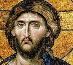


The Demoniac, the Decapolis and the Steep Shore
Eastern shore features suggest several locations, none established“And the herd ran violently down a steep place into the sea.” — Mark 5:13, KJVThe three accounts are Matthew 8:28–34Historical swineherd engraving; thematic illustration, not a Gospel scene.Matthew 8:28–34 — KJV
Matthew describes two afflicted men coming from tombs and a herd plunging into the sea. Its KJV place-name is “Gergesenes”; textual witnesses differ. The text names no excavated tomb or harbor., Mark 5:1–20Ancient Galilee boat; material context for lake crossings, not the Gospel vessel.Mark 5:1–20 — KJV
Mark describes a boat landing, one man among tombs, swine descending into the sea, and the healed man later publicizing the event in Decapolis (5:20). The KJV says “Gadarenes” at 5:1; Greek witnesses vary among regional names. and Luke 8:26–39
Luke has one man, tombs, a herd that plunges into the lake, and a return crossing. The KJV reads “Gadarenes” at 8:26. The lake reference constrains geography but does not identify a particular slope.. Together they give a crossing to the eastern side, an encounter near tombs, swine, and a descent into water. Mark ends by locating the healed man’s proclamation in the Decapolis. Those details narrow the kind of landscape a proposed setting must explain; they do not mark one verified shoreline point.
The eastern side had varied slopes, settlements, landing places, and routes. Its archaeology refutes the idea of an empty shore, but a harbor or tomb without a secure connection to the narrative is contextual evidence only. The variants Gadara, Gerasa, and Gergesa make the textual question as important as the terrain.Three Names and Two Scales of Geography
Gospel manuscripts and translations transmit names associated with GadaraUmm Qais/Gadara with Sea of Galilee in the background.Gadara
Decapolis city at modern Umm Qais, southeast of the Sea of Galilee. A wider district could have reached nearer the water; the urban ruins themselves are not a lakeside landing., Gerasa
Decapolis city at modern Jerash, much farther from the Sea of Galilee. The reading raises a distance problem if it names the city itself; a wider regional usage or textual change must be argued rather than assumed. and Gergesa
A name associated by later geographical traditions with the lake’s eastern side. Its relationship to Kursi, Tel Hadar, and manuscript readings is disputed; resemblance of names alone cannot establish a 1st-century village.. A city, its district, and a smaller lakeside locality need not occupy the same point. Yet the variant readings cannot be harmonized simply by assigning each name a different scale; the manuscript evidence and ancient geography must both be examined.
Matthew reports two men, whereas Mark and Luke focus on one. Mark alone supplies the approximate two-thousand figure for the herd. These differences belong in a geographic argument because selecting only a convenient detail can make a location appear more certain than the evidence allows.Gadara’s wider landscape; its urban ruins are not the lakeside landing.
Landing, Tombs and Slope
A boat could reach more than one eastern landing. Burial places occurred in the broader region, and several slopes descend toward the lake. Kursi’s steep terrain and later monastery explain its pilgrimage appeal; nearby shoreline investigations have generated proposals about access and occupation. The dating and function of individual features must be established before they are used as a 1st-century match.
Likewise, Isaiah 65:4
“Which remain among the graves, and lodge in the monuments, which eat swine’s flesh.” The combination of graves and swine is a contextual scriptural comparison, not a prediction identifying the Mark 5 location. joins graves and swine within an older prophetic setting. That thematic parallel helps a reader recognize ancient Jewish associations, but it is not independent testimony that the event occurred at Kursi or any other candidate.Comparing Candidates Without Declaring a Winner
Kursi has strong evidence of Byzantine commemoration. Hippos
Decapolis city on a ridge above the eastern lake. Its elevated city center was not itself a shore landing or an identified feeding place. overlooks the eastern shore but its urban center is elevated; Gadara and especially Gerasa pose distance questions if treated as the exact landing city. Tel Hadar and other lakeside proposals remain hypotheses. Bethsaida-Julias
Town associated with the northeastern lake region and Philip the tetrarch; proposed locations include et-Tell and el-Araj. This separate identification debate does not fix the feeding site. belongs to a separate northeastern identification debate and cannot be imported as the location merely because it borders the lake.
A convincing identification would need a defensible textual reading, a plausible route and lakeside topography, and appropriately dated evidence. No existing package proves the exorcism site.Evidence – The Synoptic texts describe a crossing, tombs, swine and a descent to water; eastern-shore terrain and occupation offer several possible settings.
Conclusion – The landscape makes the narrative geographically intelligible but does not archaeologically verify the exorcism or pinpoint its site.
Criticism – Gerasa, Gadara and Gergesa vary across textual witnesses; later Christian Kursi remains and proposed harbor features cannot by themselves fill the 1st-century evidentiary gap.
Citation – Matthew 8:28–34; Mark 5:1–20; Luke 8:26–39; Isaiah 65:4, KJV; Michal Artzy and Jennifer Munro, “Kursi, the Site of the ‘Miracle of the Swine’?,” Early Christianity 14, no. 3 (2023), pp. 379–391; Vassilios Tzaferis, The Excavations of Kursi-Gergesa, ‘Atiqot 16 (1983).
File Under – Evidence for Jesus Christ > Jesus’ Ministry > Archaeological Sites > Decapolis Shore > The Demoniac, the Decapolis and the Steep Shore
Cross References – Jesus’ Travels | Miracles & Testimonies | Teachings & Parables | Findings & Theories


Michal Artzy and Jennifer Munro — Testing the Kursi Shore Identification
Excavated Kursi strata challenge a precise Gospel site identification“the conclusions drawn from the topographical features of Wadi e-Kursi do not seem to be supported by the archaeological finds”In their 2023 peer-reviewed report, Michal Artzy and Jennifer Munro ask whether the familiar slope and the later monastic landscape are matched by excavated evidence for the Gospel period. The quoted sentence concerns the site identification. A plausible slope still needs dated occupation before it becomes a securely located settlement of Jesus’ time.
Their caution sharpens the companion geography card: a visually compelling shore, a monastery built centuries later, and a proposed landing cannot be merged into a single chain of 1st-century proof. The excavated layers and the later monastery answer different historical questions.What Their Excavations Actually Found
The researchers describe renewed investigations at Kursi Beach, including buildings, a proposed breakwater
A stone barrier protecting a landing from waves. An ancient-looking shore structure may have several construction or reuse phases; Artzy and Munro say the Kursi feature’s date is not decisive, with Iron Age II or earlier possible. and limited probes at Tel Kursi
A small mound near Kursi Beach. Limited probes found Iron Age material; Artzy and Munro report no securely identified Hellenistic or early Roman occupation in those excavated areas.. They report Byzantine-periodKursi monastery remains from later Christian use.Byzantine period
Here the eastern Roman era during which Christians developed the Kursi pilgrimage center. A Byzantine building is evidence for later activity, not automatically a 1st-century structure. structures associated with the broader pilgrimage landscape and Iron AgeTel Hazor, comparative earlier site illustration, not a Kursi find.Iron Age
An archaeological period far earlier than the 1st century AD; the local Iron II horizon is roughly 10th–6th centuries BC. Older pottery at Tel Kursi cannot establish Gospel-period settlement. material in a probed layer. The precise construction date of the breakwater remains uncertain; an older feature is not automatically a functioning 1st-century harbor.
They report no substantial early Roman occupationIron II pottery from Megiddo, a different site and era; illustrates why a pottery date must not be shifted to the Roman period.Early Roman occupation
Material securely dated to the late 1st century BC or 1st century AD would be relevant to the Gospel-period setting. Absence in limited trenches does not prove nobody lived anywhere nearby, but it limits claims based on excavated remains. in the areas investigated. This is a meaningful limitation on the Kursi identification, while the restricted extent of excavation keeps it from proving that every nearby place was unoccupied.How the Alternatives Fare
The traditional Kursi localization arose in later Christian pilgrimage and fits aspects of the visible terrain. Richard Bauckham proposed Tel Hadar
A site north of Kursi proposed by Richard Bauckham as an alternative Gergesa identification. Its placement and name argument are debated; Artzy and Munro note that a securely established Gospel-period occupation is a separate question. north of Kursi. Artzy and Munro question whether either candidate has the needed Hellenistic or early Roman material; they leave future discovery capable of changing the comparison.
The Gospel’s variant regional names and the distinction between city and territory remain separate textual issues. Their archaeological finding does not choose the original wording of Matthew, Mark, or Luke.Scripture and Chronology
Mark 5:1–20“they came over unto the other side of the sea” (5:1); “the herd ran violently down a steep place into the sea” (5:13); “began to publish in Decapolis” (5:20). Mark narrates one afflicted man and a later regional proclamation; manuscript place-names vary.and Luke 8:26–39Codex Sinaiticus page of Matthew 7:27–8:28; textual context, not Luke.Luke 8:26–39 — KJV
“they arrived at the country of the Gadarenes, which is over against Galilee” (8:26); “the herd ran violently down a steep place into the lake” (8:33). Luke describes one man and a return crossing; its KJV geographical reading is not a secure site identification.describe a crossing, one afflicted man and swine; Matthew 8:28–34“there met him two possessed with devils, coming out of the tombs” (8:28); “the whole herd of swine ran violently down a steep place into the sea” (8:32). Matthew’s two-men account and place-name witnesses must be considered alongside Mark and Luke.describes two men. Mark 5:20
“And he departed, and began to publish in Decapolis how great things Jesus had done for him: and all men did marvel.” Mark situates the man’s later proclamation in a broad regional setting; this does not name the boat’s landing site. says the man proclaimed his experience in the Decapolis. Isaiah 65:4
“Which remain among the graves, and lodge in the monuments, which eat swine’s flesh”. Isaiah describes a different prophetic setting. The shared images of tombs and swine do not establish a Gospel location. mentions graves and swine in a different prophetic context. None of these texts dates the visible Kursi monastery, whose construction belongs to Late AntiquityKursi church, later Christian architecture.Late Antiquity
The later Roman and early Byzantine centuries, broadly from the 3rd through 7th centuries AD in this setting. Kursi’s major Christian buildings belong centuries after the 1st-century Gospel narratives..Evidence – Artzy and Munro’s excavations and review distinguish the later Kursi pilgrimage complex, uncertain shoreline features, Iron Age evidence and the missing securely identified Gospel-period occupation in their trenches.
Conclusion – Their study weakens a confident identification of Kursi as the exact encounter site while leaving the wider eastern-shore question open to further evidence.
Criticism – Limited excavation and shifting shoreline conditions mean the absence of early Roman finds in sampled areas is a constraint, not a proof that no early Roman activity existed anywhere nearby.
Citation – Michal Artzy and Jennifer Munro, “Kursi, the Site of the ‘Miracle of the Swine’?,” Early Christianity 14, no. 3 (2023), pp. 379–391, quotation p. 389; DOI: 10.1628/ec-2023-0024; Matthew 8:28–34; Mark 5:1–20; Luke 8:26–39, KJV.
File Under – Evidence for Jesus Christ > Jesus’ Ministry > Archaeological Sites > Decapolis Shore > Michal Artzy and Jennifer Munro — Testing the Kursi Shore Identification
Cross References – Jesus’ Travels | Miracles & Testimonies | Teachings & Parables | Findings & Theories


===== START SEC 11 SAMARIA JACOBS WELL =============
Samaria & Jacob’s Well
Mount Gerizim, Samaritan settlement, proposed Sychar locations, water sources and the traditional Jacob’s Well setting illuminate John 4 and Jewish-Samaritan relations while leaving the reported encounter historically unverified by archaeology.
Cross References — Woman at the Well | Mount Gerizim | Samaritan Worship | Gospel Geography
===== START SEC 12 JORDAN JERICHO =============
Jordan & Jericho
Baptismal geography, rival Bethany-beyond-the-Jordan proposals, Jericho’s Herodian landscape, roads and the Jordan Valley environment reconstruct movement through the region without fixing every Gospel location beyond dispute.
Cross References — John the Baptist | Baptism of Jesus | Jericho Ministry | Travel to Jerusalem
===== START SEC 13 POOL OF BETHESDA =============
Bethesda Pool
The double-pool complex north of the Temple Mount and its perimeter and central colonnades provide a close architectural parallel to John 5:2’s five covered walkways. The remains illuminate the setting, not the reported healing.
Cross References — Johannine Signs | Jerusalem Ministry | Ritual Purification | Gospel Geography
‘Five Porticoes’ — Bethesda’s Double-Pool Topography Findings
Bethesda pool complex; Second Temple Jerusalem complex“Now there is at Jerusalem by the sheep market a pool, which is called in the Hebrew tongue Bethesda, having five porches.” — John 5:2, KJVJohn 5:2Domenichino, Saint John the Evangelist, c. 1621–1629 AD, National Gallery, London; later artistic representation.John 5:2 — KJV
“Now there is at Jerusalem by the sheep market a pool, which is called in the Hebrew tongue Bethesda, having five porches.” The KJV’s “sheep market” reflects an older rendering; many modern translations supply “Sheep Gate.” places a pool near Jerusalem’s Sheep Gate and gives it five covered porticoes. Excavations beside the Church of St. AnneShmulikc1204, Church of Saint Anne, 2021 AD, Jerusalem.Church of St. Anne
The surviving Romanesque church was built in the 12th Century AD. Its grounds preserve the complicated Bethesda excavation area, including ancient reservoirs and later Roman, Byzantine and Crusader structures. exposed two adjacent reservoirs separated by a broad dam or dike. Colonnades could occupy the four outer sides and the central divider, providing a credible architectural setting for five covered walkways rather than requiring a five-sided pool.
The result supports the writer’s knowledge of an unusual Second Temple-periodAriely, Pool of Bethesda model, 2008 AD, Israel Museum, Jerusalem; modern reconstruction.Second Temple period
For this site, the relevant phase belongs to Jerusalem before the Temple’s destruction in 70 AD. The museum model is interpretive: it helps visualize the double-pool arrangement but is not itself archaeological evidence. landmark. It does not prove that every reconstructed roofline is correct, date the Gospel by itself, or independently establish the healing narrated in John 5:1–18Artus Wolffort, Christ Healing the Lame at the Pool of Bethesda, 17th Century AD; later artistic interpretation.John 5:1–18 — KJV
The passage reports a healing at Bethesda and the ensuing Sabbath controversy. Archaeology can test the setting’s topography; it cannot independently verify the reported healing or its theological interpretation..What the excavated plan can establish
The complex lies north of the Temple MountTemple Mount, Jerusalem, via Wikimedia Commons.The Temple platform in Jesus’ Jerusalem. The Temple Mount was the elevated precinct containing Herod’s expanded Temple complex. John places Jesus in Jerusalem during festival visits and describes activity connected with the Temple (John 2:13–22; 7:14; 10:22–23). The present platform and Islamic buildings are later than Jesus, although portions of the retaining walls preserve ancient masonry. Archaeology confirms the monumental setting without proving the precise location of every Johannine episode. area in the valley historically called Beth Zetha
Tamar Hayardeni, Map of the Pools of Bethesda excavations, 2010 AD, Jerusalem.Beth Zetha and Bethesda
Ancient manuscripts preserve several spellings, including Bethesda, Bethzatha and Bethsaida. “Beth Zetha” also names the northeastern valley or quarter. The variation cautions against building an argument on one English spelling.. Archaeological work uncovered a northern reservoir and southern basin divided by a substantial dam, together with remains from several periods. The central divider supplies a practical location for the fifth of the five porticoesDeror Avi, Pool of Bethesda model, 2006 AD, Israel Museum, Jerusalem; modern reconstruction.Portico
A roofed walkway supported by columns, called a stoa in Greek. John’s five porticoes can be understood as four around the outside and one across the divider between two basins. The precise superstructure is reconstructed. mentioned by John.
This correspondence is significant because the double-pool plan is unusual and topographically specific. It is safer, however, to say that archaeology makes John’sPapyrus 52 recto, preserving John 18, commonly dated to the 2nd Century AD; John Rylands Library/Wikimedia Commons. John
The fourth canonical Gospel, traditionally associated with John the son of Zebedee and internally linked to an unnamed “beloved disciple.” Most scholars date its final form about AD 90–100, while recognizing possible earlier traditions or editorial stages. Its chronology, extended discourses and repeated Jerusalem visits differ substantially from the Synoptic Gospels. description intelligible than that it “falsified” all earlier criticism: scholarly views were never uniform, and the surviving remains represent several building phases.Excavation history and layered remains
The modern identification developed through 19th- and 20th-Century AD investigation around St. Anne’s. The visible site combines water installations with later Roman and Byzantine structuresCarole Raddato, Roman and early Christian remains at Bethesda, 2014 AD, Jerusalem.Roman and Byzantine layers
After 70 AD—and especially after Jerusalem became Aelia Capitolina in the 2nd Century AD—the area acquired baths, healing-cult features and, later, Christian buildings. These later remains must not be projected automatically into John’s earlier setting., including healing-sanctuary and church remains. Stratigraphy, masonry and associated finds—not one isolated coin—establish the sequence.
The supplied claim that first-century coins “clinched” the identification was therefore removed. Coins can help date deposits, but disturbed fills and reused structures require assemblage-level analysis. The topographic match rests chiefly on location, waterworks and the two-reservoir plan.What this contributes—and what it cannot
The archaeology corroborates a real Jerusalem setting compatible with John’s five-portico description. It does not prove that the evangelist personally saw the pool, demonstrate a pre-70 AD final composition date, or authenticate the miracle. Present-tense wording in John 5:2 has entered the dating debate, but grammar and the site’s post-70 survival permit competing explanations.
The strongest conclusion is topographical, not miraculous: John’s narrative uses an identifiable and architecturally plausible setting whose complex history archaeology can partially reconstruct.Evidence – Excavation exposed two large reservoirs separated by a central dam, allowing four perimeter porticoes and a fifth along the divider; later structures document the site’s continuing reuse.
Conclusion – Bethesda’s plan provides substantial contextual corroboration for the unusual five-portico topography in John 5:2, without independently proving the healing or the Gospel’s date and authorship.
Criticisms – The precise appearance and dating of the porticoes are reconstructed from a deeply layered site, manuscript spellings vary, and scholars dispute what the present tense in John 5:2 contributes to dating the Gospel.
Citation – Urban C. von Wahlde, “The Puzzling Pool of Bethesda,” Biblical Archaeology Review 37.5, 2011, pp. 40–47, 64; Craig R. Koester, “The Healing at the Pool of Bethesda (John 5:1–18),” in Expressions of the Johannine Kerygma, WUNT 423, Mohr Siebeck, 2019, pp. 243–273; John 5:1–18, KJV.
File Under – Evidence for Jesus Christ > Jesus’ Ministry > Archaeological Sites > Pool of Bethesda > “Five Porticoes”
Cross References – Jerusalem Ministry | Johannine Signs | Jewish Practice | Cumulative Case


Bethesda’s Southern Pool — Ritual-Bath Interpretation and Its Limits
Urban C. von Wahlde — Bethesda interpretation; published 2011“In these lay a great multitude of impotent folk, of blind, halt, withered, waiting for the moving of the water.” — John 5:3, KJVUrban C. von Wahlde, a New Testament scholar whose research joins Johannine textsEarly New Testament manuscript fragment, via Wikimedia Commons.The Gospel and letters associated with John. “Johannine texts” normally refers to the Gospel of John and the three Johannine letters; Revelation is sometimes discussed separately because its authorship and style differ. These writings share themes such as testimony, life, light, love and conflict over Jesus’ identity. When used historically, the texts must be read as literary and theological works transmitted through manuscripts, not as modern eyewitness transcripts. Their geographical details remain important but require careful comparison with archaeology and other sources. with Jerusalem archaeology, proposed that Bethesda’s
Berthold Werner, Pool of Bethesda remains, photograph, Jerusalem. Bethesda
A double-pool complex north of the Temple area. Its surrounding colonnades and central divider offer a plausible architectural explanation for John 5:2’s five porticoes., northern reservoir stored water and supplied a southern mikvehRdusatko, Ritual bath near the Temple Mount, 2013 AD, Jerusalem.Mikveh
Hebrew for a collection of water used for ritual immersion. Archaeological examples commonly have steps, plastered surfaces and arrangements intended to meet Jewish purity requirements; not every ancient pool was a mikveh., or Jewish ritual-immersion pool. The model could explain the basins’ relationship and periodic water movement, but no surviving inscription labels either pool’s function.
John 5:3James Tissot, The Pool of Bethesda, c. 1886–1894 AD, Brooklyn Museum; later artistic interpretation.John 5:3 — KJV
“In these lay a great multitude of impotent folk, of blind, halt, withered.” The clause “waiting for the moving of the water” is absent from important early witnesses and is normally treated with John 5:4 as a later explanatory expansion. describes disabled people at the porticoes, while John 5:7Pool of Bethesda, Jerusalem, via Wikimedia Commons.The man’s explanation. In John 5:7, the sick man says that he has no one to place him in the pool when the water is stirred. The verse supports the narrative’s picture of a place associated with hoped-for healing, but it does not itself mention an angel. The reference to an angel appears in the longer form of John 5:3b–4
Manuscript evidence associated with John 5, via Wikimedia Commons.A disputed explanatory passage. The longer reading of John 5:3b–4 says that an angel periodically stirred the water and that the first person entering would be healed. The passage appears in the King James Version but is absent from the earliest Greek manuscripts and many modern translations. It probably arose as an explanatory addition to the man’s statement in verse 7, although the precise history of the wording cannot be reconstructed with complete certainty. The shorter text remains the critical-text reading., which is absent from the earliest and strongest manuscript witnesses. John 5:7 therefore requires careful textual distinction. preserves the man’s belief that stirred water offered healing. Neither statement identifies the southern basin archaeologically as a ritual bath. The interpretation is plausible contextual reconstruction, not direct proof of the pool’s function or of the reported healing.
How the ritual-bath model works
In von Wahlde’s reconstruction, the upper reservoir functioned as an otzer, or water-storage poolAriely, Pool of Bethesda model, 2008 AD, Israel Museum, Jerusalem; modern reconstruction.Otzer
A Hebrew term for a storage reservoir. The proposed upper pool could retain naturally collected water and replenish a lower immersion installation. Applying this model to Bethesda remains an interpretation of the hydraulic system.. Water passing into the lower basin would help satisfy the concern for naturally supplied “living” water and might produce visible disturbance.
Stepped ritual bathsRdusatko, Ritual bath near the Temple Mount, 2008 AD, Jerusalem.Temple-area ritual baths
Numerous immersion pools around ancient Jerusalem provide secure parallels for Jewish purification practice before 70 AD. They establish the broader custom, but their form cannot by itself determine the function of Bethesda’s much larger basin. at the demonstrate that immersion was common in late Temple MountTextual variation in John 5
The KJV includes the end of verse 3 and all of John 5:4Michael the Monk, Codex Vaticanus Graecus 354, John 5:4, 949 AD, Vatican Apostolic Library; a later manuscript containing the verse.John 5:4 — KJV
“For an angel went down at a certain season into the pool, and troubled the water.” This later manuscript illustrates the transmitted verse; several much earlier Greek witnesses omit it, and modern critical editions generally treat it as an explanatory addition., which explains the disturbance through an angel. Important early manuscripts omit that material, although verse 7 still has the man refer to the water being troubled.
The variant matters because archaeology should not be used to “confirm” the angel explanation. At most, the hydraulic proposal offers a natural setting in which intermittent water movement could become associated with healing belief. Textual history, ancient belief and archaeological function remain separate questions.Purity, healing and later reuse
Jewish ritual immersion concerned states of purity; it was not simply an ancient medical treatment. John’s narrative may place hopes for bodily restoration beside purification practices, but it does not say the crowd had come for ordinary Temple cleansing. The card therefore avoids claiming that ritual practice explains every person’s motive.
After Jerusalem’s Roman refoundation as Aelia CapitolinaDmitry Zelenov, Bethesda archaeological remains, 2021 AD, Jerusalem.Aelia Capitolina
The Roman colony established at Jerusalem under Emperor Hadrian in the 2nd Century AD. Pagan healing installations developed in the Bethesda area during later phases and should not automatically be read back into the early 1st-Century AD Gospel setting., the vicinity acquired Roman healing-cult features; later Christians added churches. Those phases show long-lived associations with healing and sacred space, but they cannot be treated as unchanged survivals from Jesus’ lifetime.Evidence – The double reservoir, water-management possibilities and numerous Jerusalem ritual baths make a storage-pool and immersion-pool model plausible; the Gospel independently portrays people awaiting disturbed water.
Conclusion – Ritual use is a valuable interpretation of Bethesda’s southern basin, but the basin is not inscriptionally identified as a mikveh, and archaeology does not establish why every person gathered there.
Criticisms – The pools are unusually large for standard ritual baths, the hydraulic sequence is reconstructed, later Roman healing installations complicate the site, and John 5:3b–4 is textually secondary in most critical judgments.
Citation – Urban C. von Wahlde, “The Puzzling Pool of Bethesda,” Biblical Archaeology Review 37.5, 2011, pp. 40–47, 64; Craig R. Koester, “The Healing at the Pool of Bethesda (John 5:1–18),” in R. Alan Culpepper and Jörg Frey, eds., Expressions of the Johannine Kerygma, WUNT 423, Mohr Siebeck, 2019, pp. 243–273; John 5:3–7, KJV.
File Under – Evidence for Jesus Christ > Jesus’ Ministry > Archaeological Sites > Pool of Bethesda > Southern Pool Interpretation
Cross References – Jerusalem Ministry | Johannine Signs | Ritual Purity | Pool of Siloam


The Paralytic at Bethesda — A Reported Healing in a Corroborated Setting
John 5:1–18 — Bethesda setting and Sabbath dispute in Jerusalem“Jesus saith unto him, Rise, take up thy bed, and walk. And immediately the man was made whole, and took up his bed, and walked: and on the same day was the sabbath.” — John 5:8–9, KJVJohn 5:8–9Giovanni Battista Crespi, Saint John the Evangelist, c. 1605 AD, National Gallery of Ireland; later artistic representation.John 5:8–9 — KJV
“Rise, take up thy bed, and walk. And immediately the man was made whole.” John reports the healing and places it on a Sabbath; archaeology can examine the location, but it cannot independently test the recovery. belongs to a narrative in which an unnamed disabled man encounters Jesus at the Pool of BethesdaJames Emery, Bethesda Pool ruins, 2007 AD, Jerusalem.Pool of Bethesda
A layered water complex north of the Temple area. Excavation revealed two adjacent reservoirs divided by a dam, with later Roman, Byzantine and Crusader construction superimposed on the earlier waterworks.. John supplies the five-portico plan, the Sheep Gate vicinity, a Semitic place-name and a conflict over carrying a sleeping mat on the SabbathUnknown artist, Sabbath candle-lighting, 1656 AD; historical woodcut.Sabbath
The weekly day of rest prescribed in Jewish law. In John 5 the controversy concerns carrying the mat and Jesus’ healing activity, moving the story from restoration into a dispute over authority and divine work..
Excavation makes the five-portico arrangementTamar Hayardeni, Pools of Bethesda in the Holyland Model, 2021 AD, Israel Museum, Jerusalem; modern reconstruction.Five porticoes
Four roofed colonnades could surround the double pool, with a fifth extending along the central divider. This explains the unusual number without requiring a pentagonal basin, although the roofs themselves are reconstructed. architecturally credible and corroborates John’s knowledge of a real Jerusalem setting. The Gospel does not supply a named eyewitness to this encounter or a date more exact than an unspecified festival during Jesus’ ministry. It does not archaeologically confirm that the healing occurred, identify the unnamed man or prove that the author personally witnessed the event.What John’s narrative actually claims
The man says he had been infirm for 38 years; the text does not say he had spent all 38 years at Bethesda. Jesus asks whether he wishes to be made whole, commands him to rise and carry his krabbatos, or sleeping matUnknown artist, Take Up Thy Bed and Walk, medieval ivory diptych, Victoria and Albert Museum, London; later art.Krabbatos
The Greek word denotes a humble pallet, mat or portable bed. Carrying it visibly demonstrates the narrative’s healing claim and simultaneously triggers the Sabbath objection in John 5:10., and John reports an immediate recovery.
The episode then becomes a dispute: the healed man is challenged for carrying the mat, Jesus defends his work by reference to his Father, and opponents interpret his words as making himself equal with God. The archaeology illuminates the setting, not those reported conversations or theological claims.The Sheep Gate and the Semitic place-name
The KJV says “by the sheep market,” whereas many modern translations read “by the Sheep Gate”
John locates Bethesda near Jerusalem’s sheep-related gate or area. The ancient gate’s exact remains are not securely identified with the present Lions Gate, but the Bethesda complex lies in the appropriate northeastern sector.. The Greek can be understood with an implied noun, and the location accords broadly with the northeastern area near Bethesda.
The existing Ottoman gateLions Gate, an Ottoman-era gate in Jerusalem’s Old City wall, via Wikimedia Commons.A later landmark near Bethesda. The present Lions Gate, also called St. Stephen’s Gate, belongs to the Ottoman-period walls of Jerusalem and is not the first-century Sheep Gate named in John 5:2. Its location near the traditional Bethesda site can help visitors orient themselves, but the visible gate cannot be identified as the gate through which Jesus or the healed man passed. Modern walls and gates preserve the city’s later history, not an unchanged Gospel-era street plan. must not simply be labeled the 1st Century AD Sheep Gate.
Manuscripts variously preserve Bethesda, Bethzatha and Bethsaida. John calls the name “Hebrew”; in ancient usage that label can encompass a local Aramaic or other Semitic formUnknown ancient scribe, Aramaic inscription from Tayma, 5th Century BC, Louvre Museum, Paris.Aramaic and “Hebrew”
Aramaic was widely used among Jews in the early Roman period. Greek writers could use “Hebrew” broadly for the ancestral or local Jewish language; the manuscript spellings of Bethesda remain evidence of transmission as well as local nomenclature.. The variation is evidence for textual history and local naming, not a simple authorship test.From compatible setting to historical conclusion
Craig S. Keener, a New Testament scholar and author of a two-volume commentary on John, treats accurate geographical detail as relevant to the Gospel’s historical background. Such knowledge may derive from an eyewitness, local tradition, earlier sources, repeated travel or reliable informants; archaeology alone cannot choose among them.
The defensible result is therefore cumulative but limited: Bethesda’s location and architecture weaken claims that the setting is wholly imaginary. They do not collapse every literary-critical question about John, establish the exact date of composition or convert archaeological context into physical evidence of a miracle.Evidence – John describes a named pool, five porticoes, a northeastern Jerusalem location and a Sabbath controversy; excavation supplies a compatible double-pool complex with a central divider.
Conclusion – Archaeology substantially corroborates the narrative setting and its unusual architecture, while the healing remains a claim of John’s text rather than an archaeologically demonstrable event.
Criticisms – The author is not named inside the Gospel, the five-portico superstructure is reconstructed, manuscript place-names vary and accurate geography does not by itself establish eyewitness authorship.
Citation – John 5:1–18, KJV; Urban C. von Wahlde, “The Puzzling Pool of Bethesda,” Biblical Archaeology Review 37.5, 2011, pp. 40–47, 64; Craig S. Keener, The Gospel of John: A Commentary, Vol. 1, Hendrickson, 2003, discussion of John 5:1–9.
File Under – Evidence for Jesus Christ > Jesus’ Ministry > Archaeological Sites > Pool of Bethesda > The Paralytic at Bethesda
Cross References – Johannine Signs | Sabbath Disputes | Jewish Practice | Pool of Siloam


Bethesda, Siloam and Capernaum — What John’s Geography Establishes
Johannine geography — Jerusalem and Galilee settings assessed cumulatively“And many other signs truly did Jesus in the presence of his disciples, which are not written in this book: But these are written, that ye might believe that Jesus is the Christ.” — John 20:30–31, KJVJohn 20:30–31Unknown scribe, Codex Alexandrinus, opening of John, 5th Century AD, British Library, London.John 20:30–31 — KJV
“These are written, that ye might believe that Jesus is the Christ.” The Gospel states its theological purpose openly; accurate geography and persuasive theological selection are not mutually exclusive. describes a selective, belief-oriented narrative rather than a gazetteer. Nevertheless, the Gospel repeatedly anchors episodes at identifiable places: Bethesda
A double-pool complex north of the Temple area. Its surrounding colonnades and central divider offer a plausible architectural explanation for John 5:2’s five porticoes. and the Pool of SiloamRhododendrites, Steps of the Pool of Siloam, 2016 AD, Jerusalem.Pool of Siloam
A large stepped pool at the southern end of the City of David water system was exposed beginning in 2004. It is widely identified with the Second Temple-period Siloam of John 9, although only part of the complex has been excavated. in Jerusalem, and CapernaumWikimedia contributor, Aerial view of Capernaum, 2000 AD, Galilee.Capernaum
A Jewish fishing village on the northwestern Sea of Galilee. Excavated houses, harbor remains and later synagogue and church buildings illuminate the village setting but do not label any event from John. in Galilee.
Archaeology and historical geography make several settings concrete and sometimes clarify otherwise puzzling wording. These places span distinct episodes and regions, so agreement is informative even though the literary relationships among the traditions remain debated.
The convergence supports informed geographical tradition, not a mathematical progression toward certainty. It neither verifies every location equally nor proves that one eyewitness supplied every detail; a writer can preserve reliable place memory while shaping events for literary and theological purposes.Jerusalem locations with material counterparts
At Bethesda, the excavated double pool explains five porticoes. At Siloam, stepped Second Temple-period remains accord with a public pool at the end of Jerusalem’s southern water system. The Temple complexBerthold Werner, Holyland Model of Herod’s Temple, 2008 AD, Israel Museum, Jerusalem; modern reconstruction.Temple complex
John places teaching and controversy in the Temple precincts. Herodian masonry, literary descriptions and excavated material establish the monumental setting, while the sanctuary itself was destroyed in 70 AD., purification vessels and water installations likewise supply context for Johannine Jerusalem scenes.
These correspondences differ in strength. Bethesda and Siloam have strong topographical identifications; a narrative’s precise room, speech or miracle usually remains beyond archaeology. Evidence must therefore be evaluated site by site rather than counted as identical “confirmations.”Galilean places and disputed identifications
Capernaum is securely located, and its early Roman occupation fits John’s Galilean setting. Cana of GalileeMirela Britchi, Kafr Kanna, 2014 AD, Galilee.Cana of Galilee
John locates the wedding sign and a royal official’s encounter at Cana. Kafr Kanna is the best-known traditional identification, while Khirbet Qana and other sites remain candidates; archaeology has not settled the location conclusively., however, remains disputed among locations like Kafr KannaBritchi Mirela, Orthodox church at Kafr Kanna, photographed 2014, via Wikimedia Commons, CC BY-SA 4.0.Traditional identification with Cana of Galilee. Kafr Kanna is a modern Arab town in Lower Galilee, northeast of Nazareth, and has long been associated by Christian tradition with the Cana named in John 2. The site is marked by churches and pilgrimage traditions connected with the wedding at Cana. However, the Gospel of John does not name Kafr Kanna; it simply says that Jesus attended a wedding at “Cana in Galilee” and turned water into wine there (John 2:1–11). John later places Jesus again at Cana when he heals the son of a royal official from Capernaum (John 4:46–54). Therefore, Kafr Kanna represents a historic Christian identification of Cana, not a location that can be proven from the Gospel text alone. The present pilgrimage complex should not be mistaken for a surviving first-century building or direct physical evidence that Jesus visited this exact modern town. and Khirbet Qana
“Location of Cana according to Edward Robinson,” map via Wikimedia Commons.Archaeological candidate for Cana of Galilee. Khirbet Qana is a ruined settlement in Lower Galilee, north of Kafr Kanna and near the Beth Netofa Valley. It has been proposed as the Cana of John’s Gospel because archaeological work indicates a Jewish settlement existed there during the periods relevant to Jesus, and because the site preserves later Christian remains associated with pilgrimage to Cana. Excavations have identified settlement remains, Jewish religious evidence, and a later Christian “veneration cave” containing features interpreted by some researchers as connected with the six stone jars in John 2. These discoveries support the site’s historical plausibility, but they do not prove that Jesus personally visited Khirbet Qana. The New Testament identifies only “Cana in Galilee.” If Khirbet Qana is the correct identification, Jesus may have traveled there for the wedding in John 2 and later returned during the healing episode in John 4:46–54; that conclusion remains probable or possible, not certain. among and other proposals. Listing Cana as archaeologically ‘verified’ therefore exceeds the evidence.
The same discipline applies to structures within known towns. Capernaum existed in the relevant period, but the visible limestone synagogue is later, and the traditional house of Peter cannot be assigned to its original owner by inscription. Secure geography, architectural interpretation and event identification are three different levels of claim.Gabbatha and the danger of inherited identifications
John 19:13 calls the judgment place “the Pavement,” or GabbathaB. M. Norris, Ecce Homo pavement, 2018 AD, Jerusalem.Gabbatha
John’s Aramaic place-name accompanies the Greek lithostrōton, “stone pavement.” The pavement beneath the Sisters of Zion complex is commonly dated to Hadrian’s 2nd Century AD rebuilding and is unlikely to be Pilate’s judgment surface.. Older guidebooks identified paving beneath the Sisters of Zion convent as this location, but much of it belongs to the later Roman city. Its survival does not verify John’s precise trial site.
This negative example strengthens the method: corroboration requires correct dating and context, not merely a traditional label. John may preserve a genuine place-name even when the modern visitor is shown the wrong pavement.What cumulative geographical agreement means
Joachim Jeremias, a German New Testament scholar specializing in ancient Jerusalem, reconstructed the city’s social and physical setting from texts and archaeology. James H. Charlesworth, a historian of early Judaism and Christian origins, has emphasized archaeology’s ability to illuminate Gospel environments. Neither scholar’s expertise turns material context into independent testimony to every narrated event.
Repeated accurate or plausible geographical details increase confidence that John preserves informed traditionsJerusalem Temple Mount, via Wikimedia Commons.A cautious historical conclusion. A text may preserve informed traditions when it reflects accurate local names, geography, customs or political circumstances. This does not mean that every speech or sequence has been independently confirmed. In John, references to Jerusalem, the Temple, Bethesda, Cana and Roman administration may preserve genuine knowledge of the region. Such details increase historical plausibility, but they must be weighed alongside literary arrangement, theological purpose and later textual transmission. about Judea and Galilee. They remain compatible with several models of composition: direct memory, community tradition, sources and editorial shaping. Geographical competence is evidence of access, not a signature of authorship.
Evidence – Bethesda, Siloam, Capernaum and the Temple setting have substantial geographical or archaeological support, while Cana and Gabbatha illustrate unresolved or corrected identifications.
Conclusion – The cumulative pattern supports John’s access to reliable Palestinian place traditions, but it cannot by itself establish eyewitness authorship, narrative independence or the historicity of every sign.
Criticisms – Places can be known through sources or communal memory; several identifications remain disputed; archaeological confirmation of a location does not authenticate the conversations, chronology or miracle assigned to it.
Citation – John 20:30–31, KJV; Joachim Jeremias, Jerusalem in the Time of Jesus, Fortress Press, 1969; Craig R. Koester, “The Healing at the Pool of Bethesda,” in Expressions of the Johannine Kerygma, Mohr Siebeck, 2019, pp. 243–273; James H. Charlesworth, ed., Jesus and Archaeology, Eerdmans, 2006.
File Under – Evidence for Jesus Christ > Jesus’ Ministry > Archaeological Sites > Gospel Geography > John’s Geographical Pattern
Cross References – Pool of Bethesda | Pool of Siloam | Capernaum | Jerusalem Sites


Pool of Siloam
The Pool of Siloam of John 9:7 — where Jesus sent the man born blind to wash — surfaced in 2004 when workers repairing a sewage pipe in the City of David uncovered an ancient stepped pool. Slides/cards below treat the find, the adjacent Hezekiah’s Tunnel feeding it, and the Siloam Inscription that corroborates the site’s identification.Steps exposed in 2004 led to excavation of part of a large Second Temple-period pool widely identified with John 9:7. Its phases, water supply and pilgrimage setting must be distinguished from Hezekiah’s earlier tunnel and later Byzantine commemoration.
Cross References — Johannine Signs | Jerusalem Ministry | Hezekiah’s Tunnel | City of David
The Second Temple Pool of Siloam 2004 Discovery
Ronny Reich and Eli Shukron — Jerusalem salvage excavation, 2004–2005“And said unto him, Go, wash in the pool of Siloam, (which is by interpretation, Sent.) He went his way therefore, and washed, and came seeing.” — John 9:7, KJVDuring sewer work in 2004, stone steps appeared near Birket el-Hamra at the southern end of the City of DavidAvney Moreshet collection, City of David and Siloam area, Jerusalem.City of David
The narrow ridge south of Jerusalem’s later Temple platform contains the earliest urban core and its ancient water systems. The modern archaeological park overlaps the Palestinian neighborhood of Silwan.. Israel Antiquities Authority archaeologists Ronny Reich and Eli Shukron exposed monumental steps descending toward a large, partly unexcavated pool built during the Second Temple periodPikiWiki Israel, Second Temple-period Pool of Siloam, Jerusalem.Second Temple period
The excavated pool was constructed no earlier than the late 2nd or early 1st Century BC and remained in use until Jerusalem’s destruction in 70 AD, placing it within the period presupposed by John 9..
Coins and pottery date the installation; three sets of five steps with landings accommodated changing water levels. Its scale and location support identification with the Pool of Siloam in John 9:7Claude Vignon, Saint John the Evangelist, 17th Century AD; later artistic representation.John 9:7 — KJV
“Go, wash in the pool of Siloam, (which is by interpretation, Sent.)” John reports that the man washed and returned seeing. The excavated pool corroborates the location, not the healing.. The basin also clarifies why washing at Siloam was geographically plausible for residents and pilgrims in southern Jerusalem. The discovery securely illuminates the narrative’s setting, but it neither identifies the reported man nor independently verifies his restored sight.How the pool surfaced
The discovery was not a planned search for a Gospel site. Work associated with a damaged or replacement sewer exposed dressed stone steps, prompting archaeological inspection and salvage excavation. Reich and Shukron uncovered the pool’s northeastern corner and portions of its stepped northern and eastern sides.
The whole basin was not exposed. Property boundaries and an orchard limited the early excavations, so reconstructions of a pool roughly 50 by 60 meters depend on excavated segments, topography and later investigation. “A stepped pool surfaced” is more accurate than saying that the entire structure was uncovered in 2004.Date, dimensions and probable function
The steps occur in repeated flights separated by broad landings, an arrangement capable of maintaining access as the water level rose or fell. Coins associated with the construction and final use range from the late Hasmonean period to the First Jewish–Roman WarAncient Jerusalem mint, Bronze prutah of the First Jewish Revolt, 66–70 AD; photograph by Brocken Inaglory.First Jewish–Roman War
The revolt of 66–73 AD brought Jerusalem’s siege and destruction in 70 AD. Coins near the pool’s final occupation help place its abandonment around this upheaval., supporting use in the 1st Century AD.
The pool may have served water collection, public gathering and purification connected with pilgrimage. Its steps resemble immersion facilities, but calling the entire monumental basin simply a mikvehWikimedia contributor, Ritual bath from the Temple period, archaeological remains in Israel.Mikveh
A pool constructed to meet Jewish requirements for ritual immersion. Siloam’s steps and water supply make purification use plausible, yet its unusual size permits additional civic and pilgrimage functions. may oversimplify a large urban reservoir.The earlier and later pools
The newly exposed installation should be distinguished from both an Iron Age waterworks phase and the smaller Byzantine Siloam poolMatson Photograph Collection, Pool of Siloam, 1934–1939 AD, Library of Congress.Byzantine pool
A smaller pool and church complex were developed near the tunnel outlet in the 5th Century AD under Empress Eudocia. This later commemorative site is about 70 yards from the newly exposed Second Temple pool. long shown to visitors near the tunnel outlet. Ancient and modern observers had not forgotten the name Siloam, but the precise Second Temple-period monumental basin was obscured by sediment and later development.
The find therefore resolved an important location question; it did not overturn a universal scholarly belief that John invented Siloam. Texts, the water system and later commemoration had preserved the place-name, while the newly excavated steps clarified which pool best fits the 1st Century AD narrative.Historical contribution and limit
The identification gives John 9 a real, period-appropriate water installation at the southern end of Jerusalem’s inhabited ridge. The Gospel’s gloss “which is by interpretation, Sent” also shows that the narrator turns the place-name toward the story’s theological theme.
Topographical knowledge and theological composition can coexist. Archaeology supports the former; it cannot determine whether the author visited the pool, inherited accurate local tradition or used an earlier source. It also cannot measure the medical condition or recovery of the unnamed man.Evidence – Sewer work exposed monumental steps; excavation, coins, pottery and the pool’s position identify a large Second Temple-period installation in use during the 1st Century AD.
Conclusion – The discovery substantially corroborates John’s Siloam setting and its suitability for washing, while the healing remains a textual report rather than an archaeological finding.
Criticisms – Only part of the basin was initially excavated, its complete dimensions are reconstructed, and debate remains over whether its principal function was reservoir, ritual immersion, pilgrimage staging or a combination.
Citation – Ronny Reich and Eli Shukron, “The Second Temple Period Pool of Siloam,” preliminary excavation reports and notices, 2005–2008; Elaine A. Phillips, “The Pools of Siloam: Biblical and Post-Biblical Traces,” Tyndale Bulletin 70.1, 2019, pp. 41–54; John 9:1–12, KJV.
File Under – Evidence for Jesus Christ > Jesus’ Ministry > Archaeological Sites > Pool of Siloam > 2004 Discovery
Cross References – Johannine Signs | Jerusalem Sites | Ritual Purity | Pool of Bethesda


Hezekiah’s Tunnel and the Siloam Inscription — Siloam’s Earlier Water System
Iron Age II tunnel and Hebrew inscription — Jerusalem, about 700 BC“And the rest of the acts of Hezekiah, and all his might, and how he made a pool, and a conduit, and brought water into the city, are they not written in the book of the chronicles of the kings of Judah?” — 2 Kings 20:20, KJV2 Kings 20:20Matthäus Merian the Elder, King Hezekiah Destroys the Idols, c. 1625–1630 AD; later artistic representation.2 Kings 20:20 — KJV
“He made a pool, and a conduit, and brought water into the city.” The verse attributes major waterworks to Hezekiah but does not name the surviving tunnel or quote its inscription. and 2 Chronicles 32:2–4Assyrian sculptors, Siege of Lachish relief, c. 700 BC; photograph by Mike Peel, British Museum, London.2 Chronicles 32:2–4 — KJV
Facing Assyria, Hezekiah’s officials stopped waters outside Jerusalem so an invading force would not find an abundant supply. The passage supplies historical interpretation, not a construction diagram. associate King HezekiahUnknown artist, King Hezekiah, 17th Century AD, St. Mary’s Church, Åhus, Sweden; later art.Hezekiah
King of Judah in the late 8th Century BC, when Sennacherib’s Assyrian forces invaded Judah. Biblical texts credit him with securing Jerusalem’s water supply during the crisis. with Jerusalem waterworks. The sinuous Hezekiah’s TunnelDavidbena, Hezekiah’s Tunnel with flowing water, 2021 AD, Jerusalem.Hezekiah’s Tunnel
A roughly 533-meter bedrock channel conducting water from the Gihon Spring toward the southwestern end of the ancient city. Radiometric testing of plaster and deposits supports an Iron Age II construction date. carried water from the Gihon Spring toward Siloam. This earlier system secured a perennial spring within Jerusalem’s defended landscape during the Assyrian crisis. Its route and outlet created the long-lived water geography later rebuilt on a larger scale during the Second Temple period.
The Siloam InscriptionGiovanni Dall’Orto, Siloam Inscription, photograph 2006 AD, Istanbul Archaeology Museums.Siloam Inscription
A six-line ancient Hebrew text found near the tunnel outlet in 1880. It describes workers hearing one another and breaking through “pick against pick”; it does not name Hezekiah. records two groups’ final breakthrough and water flowing to “the pool.” It independently documents the ancient engineering project, but it belongs to the Iron Age system centuries before the monumental pool excavated in 2004.The tunnel’s route and purpose
The channel follows a curving path through bedrock from the Gihon SpringDeror Avi, Gihon Spring, City of David, photograph 2013 AD, Jerusalem.Gihon Spring
Jerusalem’s principal perennial spring, located on the eastern side of the City of David ridge. Ancient channels and fortifications managed access to this vital water source through several periods., on the ridge’s eastern slope, toward a western outlet inside the defensible urban area. Its conventional length is about 533 meters, though the inscription expresses the course as 1,200 cubits.
The traditional historical setting is Hezekiah’s preparation for Sennacherib’s invasionAssyrian royal scribes, Taylor Prism, early 7th Century BC; photograph by Gary Todd, British Museum, London.Sennacherib’s invasion
Assyria’s 701 BC campaign devastated Judah and besieged Jerusalem. Sennacherib’s annals and biblical accounts agree on the invasion while presenting its outcome from different perspectives. in 701 BC. The Bible, archaeological setting and scientific dating converge on this era, although the tunnel inscription itself omits the king, enemy and motive.What the inscription actually says
The text was noticed in 1880 and later cut from the wall; it is now held in Istanbul. Written in Paleo-Hebrew scriptEditor B, Drawing of the Siloam Inscription, based on the ancient Hebrew text.Paleo-Hebrew script
The letter forms used for Hebrew inscriptions during the monarchic period before the square Aramaic-derived script became standard. Paleography and language help place the text in the late 8th Century BC., it describes voices heard while “three cubits” remained and the cutters meeting “pick against pick.” It then says water flowed from the source to the pool for 1,200 cubits, with 100 cubits of rock above the workers at one point.
The supplied “half-cubit overlap” claim was removed because it is not what the inscription states. The meeting area is irregular, and the surviving channel shows correction and redirection rather than half-cubit precision.Scientific dating and attribution
Amos Frumkin, Aryeh Shimron and Jeff Rosenbaum tested organic material in ancient plaster by radiocarbon methods and dated associated carbonate deposits through uranium-thorium analysis. Their 2003 study supported an Iron Age II date consistent with about 700 BC.
That result strengthens identification of the tunnel with the era of Hezekiah’s water projects. It does not make the inscription a royal signature: its secure contribution is an ancient account of construction, while the connection to Hezekiah is a cumulative historical attribution from date, location and biblical evidence.Relationship to John’s Pool of Siloam
The tunnel established the enduring water route toward Siloam, but the stepped pool excavated in 2004 was a much later monumental installation. Its earliest construction belongs centuries after Hezekiah, and the relationship between Iron Age receiving basins and the later pool has been repeatedly remodeled.
There is therefore no demonstrable “700-year unbroken memory chain.” What can be shown is continuity and reuse within the same water landscape: an Iron Age tunnel, changing pools and channels, a Second Temple public basin, and later Roman and Byzantine adaptations. John’s setting participates in that history without collapsing all phases into one structure.Evidence – A radiometrically dated Iron Age II tunnel, a contemporary Hebrew construction inscription and biblical waterwork notices converge on a major late 8th-Century BC Jerusalem project.
Conclusion – Hezekiah’s Tunnel and the Siloam Inscription establish Siloam’s much earlier water-supply history; they contextualize but are not the same structure as John’s Second Temple-period pool.
Criticisms – The inscription names neither Hezekiah nor Sennacherib, scholarly proposals differ over the tunnel’s precise planning and function, and the sequence between Iron Age basins and the later monumental pool is incomplete.
Citation – Amos Frumkin, Aryeh Shimron and Jeff Rosenbaum, “Radiometric Dating of the Siloam Tunnel, Jerusalem,” Nature 425, 2003, pp. 169–171; K. Lawson Younger Jr., Ancient Conquest Accounts, JSOT Press, 1990; Siloam Inscription, lines 1–6; 2 Kings 20:20 and 2 Chronicles 32:2–4, KJV.
File Under – Evidence for Jesus Christ > Jesus’ Ministry > Archaeological Sites > Pool of Siloam > Hezekiah’s Tunnel and Inscription
Cross References – Biblical Archaeology | Jerusalem Waterworks | Ancient Inscriptions | Pool of Bethesda


John 9 and Siloam — A Real Setting, a Reported Healing
John 9:1–41, KJV — Siloam narrative and archaeological setting“He answered and said, A man that is called Jesus made clay, and anointed mine eyes, and said unto me, Go to the pool of Siloam, and wash: and I went and washed, and I received sight.” — John 9:11, KJVThe Gospel of John
An early Christian narrative commonly dated to the late 1st Century AD, although authorship, sources and stages of composition remain debated. John 9 combines a healing report, interrogation scenes and theological interpretation. places an unnamed man’s washing at the Pool of SiloamRhododendrites, Steps of the Pool of Siloam, photograph 2017 AD, Jerusalem. Pool of Siloam
A monumental stepped basin at the southern end of the City of David, constructed during the Second Temple period and used in the 1st Century AD. Only part of the basin has been excavated., a named location supplied by the Gihon Spring water system
Jerusalem’s principal perennial spring fed successive channels, tunnels and pools. The Second Temple Siloam basin belongs to a later phase than Hezekiah’s Iron Age tunnel..
Excavations begun in 2004 exposed a large, stepped installation in use during the period represented by the Gospel. That discovery corroborates John’s topographical setting and washing instruction. It does not identify the man, diagnose his blindness or independently establish restored sight. John 9:11 is the character’s speech within John’s literary narrative—not a separately preserved first-person deposition.What archaeology contributes
The stepped pool appeared during sewer work near Birket el-Hamra in the southern City of David
The narrow ridge south of the later Temple platform contains ancient Jerusalem’s earliest urban core and water installations. The archaeological park overlaps the modern Palestinian neighborhood of Silwan.. Archaeologists Ronny Reich and Eli Shukron exposed repeated flights of steps and broad landings that allowed access at changing water levels.
Pottery and coins place construction no earlier than the late Hasmonean period and use through the 1st Century AD. The excavated remains establish an accessible public water installation where John locates the washing. “The setting existed” is the secure historical conclusion; “archaeology confirmed the miracle” is not.Washing, purification and pilgrimage
The basin’s steps resemble those of a mikveh
A pool meeting Jewish requirements for ritual immersion. Siloam’s water supply and steps make purification use plausible, but its exceptional size may indicate several public, reservoir and pilgrimage functions., yet the whole monumental pool should not be reduced to a private ritual bath. Its scale, position and connection to the ascent toward the Temple also suit the movement of pilgrims.
The Gospel’s parenthetical interpretation of Siloam as “Sent” uses the place-name theologically. The Greek form Siloam reflects a Semitic name related to sending or channeling water; John makes that meaning serve his portrayal of Jesus as the one sent by the Father.The reported testimony in context
The John 9:11 testimonyUnknown Byzantine artist, Healing of the Man Born Blind, 13th Century AD, Hagia Sophia, Trabzon, Türkiye; later art. John 9:11 — KJV
“I went and washed, and I received sight.” This is direct speech attributed to the healed man inside the Gospel; no independent transcript or external deposition survives. belongs to a sequence of questioning by neighbors, parents and Pharisees. Repetition and escalating answers develop the man’s understanding and the authorities’ resistance.
This literary shaping does not make the location fictitious. Conversely, a correct location does not automatically authenticate every narrated exchange. Historical geography and theological storytelling must be evaluated as related but distinct questions.Evidence – Excavated steps, coins, pottery, water supply and location establish a large Second Temple-period pool corresponding closely to John’s Siloam setting.
Conclusion – Archaeology substantially corroborates the narrative’s geography and the plausibility of washing there, while the healing remains a claim of John’s text.
Criticisms – Only part of the pool has been excavated; its full dimensions and principal function remain reconstructed, and accurate topography alone cannot decide authorship, eyewitness status or miracle historicity.
Citation – Ronny Reich and Eli Shukron, “The Pool of Siloam in Jerusalem of the Late Second Temple Period and Its Surroundings,” in Unearthing Jerusalem, Eisenbrauns, 2011, pp. 241–255; Urban C. von Wahlde, Archaeology and the Gospel of John, 2006; John 9:1–41, KJV.
File Under – Evidence for Jesus Christ > Jesus’ Ministry > Archaeological Sites > Pool of Siloam > John 9 Setting
Cross References – Johannine Signs | Jerusalem Sites | Ritual Purity | Pool of Bethesda


Johannine Geography — Cumulative Context, Not Automatic Eyewitness Proof
Bethesda, Siloam and Capernaum — comparing text with excavated settingsJohn names numerous places and architectural features that can be compared with archaeology; their cumulative fit supports informed geographical tradition but does not, by itself, identify the evangelist or verify the reported signs.John locates healings at Bethesda
A double-pool complex north of the Temple area. Its surrounding colonnades and central divider offer a plausible architectural explanation for John 5:2’s five porticoes., Siloam
A monumental stepped basin at the southern end of the City of David, constructed during the Second Temple period and used in the 1st Century AD. Only part of the basin has been excavated. and CapernaumFallaner, Capernaum excavations between the house and synagogue, photograph 2016 AD, Israel. Capernaum
A Jewish fishing settlement on the northwest shore of the Sea of Galilee. Archaeology confirms its 1st Century AD occupation, domestic quarter and later synagogue and Christian memorial buildings. and supplies distinctive details: five porticoes, a pool called “Sent,” and movement between Judaea and Galilee.
This pattern gives a cumulative case for knowledge of real landscapes remembered in the late Second Temple worldWikimedia contributor, Model of Herodian Jerusalem and the Temple, Israel Museum, Jerusalem. Late Second Temple world
The Jewish social, architectural and religious environment before Rome destroyed Jerusalem and its Temple in 70 AD. Later writers could preserve knowledge of this world through memory, sources and continuing local traditions.. Repeated geographical accuracy is historically significant, but “three excavated sites” is not a statistical proof of eyewitness authorship. The sites were not discovered solely because John predicted them, and archaeology does not authenticate the healings attached to them.Three sites, three different comparisons
At Bethesda, the archaeological double-pool arrangement provides a credible setting for the five porticoes of John 5:2William Tipping, Pool of Bethesda, 1840s AD, historical reconstruction. John 5:2 — KJV
“There is at Jerusalem by the sheep market a pool, which is called in the Hebrew tongue Bethesda, having five porches.” The unusual fifth colonnade is plausibly the divider between two basins.. At Siloam, excavated steps establish a large pool in use during the Gospel period. At Capernaum, basalt domestic remains confirm a 1st Century village, but the visible limestone synagogue is mainly later.
These are not three identical “confirmations.” Bethesda concerns an architectural description, Siloam a named water installation and Capernaum a settlement landscape. Each comparison must be stated at its own evidentiary level.Source knowledge versus eyewitness identity
Detailed geography may arise from personal observation, an eyewitness informant, inherited local tradition, maps or earlier written sources. The Gospel’s final form can therefore preserve old knowledge even if composed after 70 AD.
Calling the evidence “eyewitness geography” moves from data to inference. Scholars such as Urban C. von Wahlde emphasize John’s archaeological and topographical specificity; others accept the specificity without treating it as decisive proof that the traditional apostle wrote the finished Gospel.Why probability language must remain restrained
The claim that accuracy at three sites makes the next Johannine location “approach certainty” has no defined dataset, prior probability or error model. It is rhetoric, not a calculated probability.
A stronger formulation is qualitative: multiple correct, nonidentical details make wholesale invention less economical and increase confidence that the Gospel draws on informed geographical tradition. They do not establish the truth of every dialogue, chronology, sign or theological conclusion.John 4:54 and Capernaum
The second sign in John 4:54Unknown Mughal artist, Jesus Heals the Nobleman’s Son, c. 1600 AD, Cleveland Museum of Art. John 4:54 — KJV
“This is again the second miracle that Jesus did, when he was come out of Judaea into Galilee.” The healing is spoken at Cana, while the official’s sick son is at Capernaum; archaeology confirms the towns, not the sign. concerns travel between Cana and Capernaum, not a miracle performed at an excavated Capernaum structure. This distinction corrects the supplied card’s suggestion that all three sites anchor on-site healing narratives of the same kind.Evidence – John preserves several independently testable place-names and architectural details that correspond substantially with ancient geography and excavated remains.
Conclusion – The cumulative pattern supports informed geographical tradition in John; it does not independently prove apostolic authorship, a pre-70 AD final composition or the reported miracles.
Criticisms – Some identifications and construction phases remain debated, and later authors could inherit accurate traditions; no legitimate probability calculation makes untested Johannine details virtually certain.
Citation – Urban C. von Wahlde, Archaeology and the Gospel of John, 2006; James H. Charlesworth, ed., Jesus and Archaeology, Eerdmans, 2006; Raymond E. Brown, The Gospel According to John I–XII, Anchor Bible 29, Doubleday, 1966; John 4:46–54, 5:1–9 and 9:1–12, KJV.
File Under – Evidence for Jesus Christ > Jesus’ Ministry > Archaeological Sites > Gospel Geography > Johannine Locations
Cross References – Pool of Bethesda | Pool of Siloam | Capernaum Excavations | Johannine Signs


Shimon Gibson — What the Siloam Discovery Establishes
Shimon Gibson, archaeologist — assessing Siloam’s historical contributionArchaeological work at Siloam identifies a monumental pool used in the late Second Temple period and provides a physical setting corresponding to John 9; it does not independently verify the healing reported there.Shimon Gibson, an archaeologist specializing in Jerusalem, has discussed the newly exposed Siloam
A monumental stepped basin at the southern end of the City of David, constructed during the Second Temple period and used in the 1st Century AD. Only part of the basin has been excavated. as part of the city’s Second Temple-period landscape
Jerusalem’s built environment from the Temple’s reconstruction through its destruction in 70 AD, including reservoirs, ritual baths, streets and pilgrimage facilities.. The 2004 find was excavated by Ronny Reich and Eli Shukron, not Gibson; his role here is scholarly interpretation rather than discovery direction.
The pool’s period, scale and location make it a strong match for John’s named setting. Physical context and narrated event remain distinct evidence: visitors can stand beside excavated remains, but archaeology cannot show that the unnamed man stood there or recovered his sight. The supplied first-person quotation has been removed because no reliable original publication, recording, date or page could be located.Discovery and attribution
Municipal work on a sewer exposed stone steps in 2004. The Israel Antiquities Authority’s salvage excavationIan Scott, Pool of Siloam excavation, photograph 2009 AD, Jerusalem. Salvage excavation
Archaeological work undertaken because construction or infrastructure threatens buried remains. Reich and Shukron investigated the steps after municipal activity exposed them. under Reich and Shukron documented portions of the northern and eastern sides; the entire pool did not suddenly emerge.
Gibson is a qualified interpreter of Jerusalem archaeology and author of The Final Days of Jesus. Accuracy nevertheless requires separating the excavators’ primary report from a later scholar’s synthesis.How the pool was dated
Archaeologists use stratigraphyWikimedia contributor, Boomplaas archaeological stratigraphy, excavation photograph. Stratigraphy
The study of superimposed archaeological layers and their relationships. A feature is dated through sealed deposits, construction layers, repairs and later material—not simply by resemblance., construction fills, pottery and coins to establish sequence and date. Coins associated with early construction point to the late Hasmonean or early Roman period; material connected with final use reaches Jerusalem’s destruction in 70 AD.
Coins do not date every stone to a single exact year, nor do they establish “precisely” when John’s episode occurred. They define an archaeological range that includes the period traditionally assigned to Jesus’ ministry.Monumental pool, not merely a cistern
The exposed feature is a monumental stepped basin
A large public installation with repeated stair flights and landings. The arrangement maintained access as water levels changed and could accommodate many users., far larger than an ordinary household cistern. Its function may have combined water storage, washing, purification, gathering and pilgrimage traffic.
Calling it exclusively a ritual-immersion pool exceeds the surviving evidence. Scholarly proposals include ritual, civic and recreational uses; these alternatives affect interpretation but not the basin’s date or identification as Siloam.What “corroboration” means here
The find corroborates a place-name, period and practicable action: a person in southern Jerusalem could go to a large pool and wash. It also shows that theological symbolism did not require the evangelist to invent the setting.
It does not provide a contemporary inscription naming the man, Jesus or the healing. Nor does a visitor’s ability to stand at the site convert John’s report into archaeological proof. The most credible case states both the substantial match and the limit.Evidence – Excavation documented a monumental stepped pool whose construction and use span the late Second Temple period, including the 1st Century AD.
Conclusion – Gibson’s archaeological perspective helps explain why Siloam is a credible physical setting for John 9, while the primary discovery credit belongs to Reich and Shukron.
Criticisms – The entire pool has not been excavated, its full dimensions and principal function remain debated, and no archaeological evidence independently verifies the reported healing.
Citation – Shimon Gibson, The Final Days of Jesus, HarperOne, 2009; Ronny Reich and Eli Shukron, “The Pool of Siloam in Jerusalem of the Late Second Temple Period and Its Surroundings,” in Unearthing Jerusalem, Eisenbrauns, 2011, pp. 241–255; John 9:1–41, KJV.
File Under – Evidence for Jesus Christ > Jesus’ Ministry > Archaeological Sites > Pool of Siloam > Scholarly Assessment
Cross References – Johannine Signs | Jerusalem Sites | Pool of Bethesda | Gospel Geography


Nazareth Archaeology — First-Century Village Confirmed
Excavations in 2009 beneath the Sisters of Nazareth convent uncovered a first-century dwelling — the kind of small Jewish village Jesus grew up in, countering the lingering 19th–20th century critical claim that Nazareth didn’t yet exist in His day. Slides/cards cover the dwelling, the surrounding tombs and oil-press installations, the falsification of the “no first-century Nazareth” thesis, and Nazareth’s proximity to Sepphoris.
Christian Memory & Art

 Historic view titled The Site of Ancient Bethsaida, public-domain archival photograph, Wikimedia Commons.The El-Araj Peter Inscription
This investigation presents the mosaic petition discovered in the Byzantine basilica at el-Araj, its reference to the “chief and commander of the heavenly apostles,” the donor named Constantine and the proposed identification of the church with Bethsaida’s apostolic memory. It separates a later Christian claim about Peter from proof that el-Araj is certainly the Gospel village. discovered at el-Araj and a scholarly assessment
 Giovanni Lanfranco, Saint Peter, 1647 AD; later art, public domain.R. Steven Notley on Peter and Bethsaida
The companion assessment explains how the inscription strengthens the case that Byzantine Christians associated this lakeside church with Peter and Andrew. It also tests the argument against the competing et-Tell identification, shoreline reconstruction and the chronological distance between the apostles’ lives and the basilica. of its relevance to Bethsaida. Another slide of Christian Memory & Art examines Capernaum invocations
 David Stanley, The House of Peter, Capernaum, 2016; CC BY 2.0.Capernaum Graffiti and Christian Invocation
This investigation evaluates scratched and painted Greek, Aramaic, Syriac and Latin texts reported from the modified house complex traditionally associated with Peter. It distinguishes secure evidence for later Christian visitors and prayer from uncertain readings, dates and claims that the marks identify the 1st Century AD owner. and the building’s transformation from house to church
 Bgabel, Remains of the House of Peter, Capernaum, 2009; CC BY-SA 3.0.From House to Octagonal Church
This investigation traces the sequence from an Early Roman dwelling through replastering and communal adaptation to the 5th Century AD octagonal church and later pilgrimage testimony. The architectural sequence demonstrates sustained commemoration, while the identification as Simon Peter’s house remains a historical interpretation rather than an inscriptionally proved fact..
The third slide reviews Tabgha, where the loaves-and-fishes mosaic
 Grauesel, Tabgha Church Mosaic, Church of the Multiplication, 2010; CC BY-SA 3.0.Tabgha’s Loaves-and-Fishes Mosaic
This investigation describes the 5th Century AD floor image, its basket and paired fish, the church phases beneath and around it and its relationship to Gospel feeding traditions. The mosaic is direct evidence for Byzantine interpretation
 Avram Graicer, Kursi Church, 2015; Wikimedia Commons.Byzantine site interpretation
The association created or monumentalized by Christians during the Byzantine period, centuries after the reported Gospel event. Kursi’s church, monastery and hillside chapel show that Christians identified this landscape with the exorcism tradition by Late Antiquity. Such construction establishes the existence of that later belief, but its date prevents it from functioning as direct 1st-Century AD testimony. and worship at Tabgha, not a contemporary depiction or independent proof of the miracle. gives visual form to the feeding tradition, while an art-historical reading
 Matson Photograph Collection, Mosaic Floor and Greek Inscription at Ain Tabgha, 20th Century AD photograph, Library of Congress; public domain.Interpreting Tabgha’s Mosaic and Church
The companion assessment places the image within the church’s decorative program, patronage and liturgical setting. It asks how early Christian art translated Gospel memory into sacred space and cautions against using a Byzantine image to reconstruct the precise site, appearance or mechanics of the reported feeding. explains what the church’s art can and cannot recover.
 Goldstar, Kursi, 2008; Byzantine church and monastery remains, CC BY-SA.Kursi and the Decapolis-Shore Tradition
This investigation presents the large 5th Century AD monastic complex, church, mosaic floors and nearby commemorative landscape associated by later Christians with the demoniac narrative. Its location illuminates Byzantine sacred geography on the lake’s eastern shore but cannot identify the exact Gospel landing place. preserves one later localization, and Tzaferis’s assessment
 Ezrazo, Arches and Mosaic in Kursi’s Monastery, Wikimedia Commons.Vassilios Tzaferis on Kursi
The companion assessment uses the excavator’s published evidence to explain the complex’s discovery, construction phases, destruction and religious function. It distinguishes archaeological description from the interpretive step that connects the monastery and hillside chapel with a particular Gospel exorcism tradition. evaluates that connection.
Finally, the collection here returns to Magdala. Later Magdala churches
 Unknown photographer, Magdala, c. 1900 AD; public-domain historic photograph.Later Magdala Churches and Mary Magdalene
This investigation traces church remains, pilgrimage references and the growth of a local tradition linking the town with Mary Magdalene. It keeps that later commemorative record separate from the Early Roman settlement and synagogue, neither of which supplies an inscription naming Mary. show how a first-century town acquired a powerful Christian identity, while an origin assessment
 Mary Magdalene at the Empty Tomb, later stained-glass representation, Wikimedia Commons.When Magdala Became Mary’s Hometown
The companion assessment examines when surviving sources explicitly connect Mary called Magdalene with this particular Galilean place, how place-name interpretation shaped reception and why a credible later tradition still must not be projected automatically into the 1st Century AD archaeological record. tests when and how Mary’s association with the place becomes visible.
Together, along with more than 15 subcategories of Jesus’ Ministry, the five paired investigations demonstrate clearly a growing following of the divinity of Christ following The Ascension. Jesus’ followers proclaimed his teaching, remembered apostles and ministry locations, gathered for worship and eventually marked landscapes with invocations, churches, monasteries, mosaics and pilgrimage narratives.
These remains are evidence for the history of Christian memory, art and sacred geography. Their dates and functions must be stated precisely: a later inscription can document whom a community honored, and a church can document where believers commemorated an event, without becoming direct archaeological verification that Jesus or an apostle occupied that exact place. This is the content area for this read more
The El-Araj Peter Inscription — ‘Chief of the Heavenly Apostles’
 Peter inscription — El-Araj basilica, discovered in 2022A Greek mosaic inscription in the basilica’s diaconicon names “Constantine, the servant of Christ” and petitions Peter as “chief and commander of the heavenly apostles.”The translated inscription identifies a donor named Constantine
Zachary Wong, Inscription from the Church of the Apostles, photographed 2022, El-Araj; El Araj Excavation Project. Constantine, the donor
This Constantine was a local Christian benefactor styled “servant of Christ,” not Emperor Constantine. The medallion asks Peter’s intercession for Constantine and members of his family, placing the text within Byzantine patronage and prayer. and invokes PeterEl Greco, Saint Peter, late 16th or early 17th Century AD; later art, public domain. Simon Peter
Peter was a Galilean fisherman and leading disciple in the Gospel traditions. John 1:44 associates Peter, Andrew and Philip with Bethsaida; the Byzantine title in this inscription reflects Peter’s later prominence in Christian memory. in the diaconiconRobert Jahoda, Location of the Diaconicon, modern architectural diagram, Wikimedia Commons. Diaconicon
A service room beside the sanctuary in an Eastern Christian church, comparable in some functions to a sacristy. The Peter inscription formed part of the mosaic floor in this side chamber, not the basilica’s earliest Roman occupation. of a Byzantine basilicaWikimedia Commons contributor, Basilica Floor Plan, modern architectural diagram, CC BY-SA 3.0. Byzantine basilica
A longitudinal church normally organized around a central nave, side aisles and an apse. Excavators date the el-Araj church centuries after the apostolic period; it records later Christian commemoration rather than a 1st-Century AD eyewitness claim. on the northern Sea of GalileeBerthold Werner, Sea of Galilee, photographed 2010, Israel; CC BY-SA 3.0. Sea of Galilee
The freshwater lake is also called the Lake of Gennesaret and Sea of Tiberias in the New Testament. El-Araj lies near the Jordan River’s entry into its northern shore, a location important to the Bethsaida debate. shore.
The church was excavated at el-Araj near the Jordan delta, centuries after Peter, and investigators interpret it as a substantial pilgrimage church. Leah Di Segni and Yaakov Ashkenazi translated the 2022 find. Its black tesseraeMetropolitan Museum of Art, Byzantine Mosaic Tesserae, Byzantine period, New York; public-domain museum image. Tesserae
Small cubes of stone, glass or ceramic set into mortar to form a mosaic. At el-Araj, two lines of black tesserae framed the inscription’s medallion within a larger floral pavement. preserve an explicit Peter devotion where excavators propose BethsaidaMatson Photograph Collection, Bethsaida “Home of the Fishermen”, early 20th Century AD, Library of Congress; public domain. Bethsaida
John associates Bethsaida with Philip, Andrew and Peter. Et-Tell and el-Araj are the principal archaeological candidates; neither Roman-period settlement has yielded an inscription naming itself Bethsaida or Julias. stood. The inscription establishes Byzantine Peter memory; it does not identify a 1st-Century AD house or settle the competing-site debate.What Was Found
The medallion belonged to a larger floral mosaic in the basilica’s service room. The excavation project reported the inscription in August 2022 after Leah Di Segni and Yaakov Ashkenazi translated it. The title applied to Peter—“chief and commander of the heavenly apostles”—was familiar in Byzantine writingWikimedia Commons contributor, Byzantine Mosaic, Byzantine-period Christian art. Byzantine Christian writing
Christian authors of the Eastern Roman Empire frequently used exalted apostolic titles. Such language identifies the revered figure intended by an inscription, while its late date prevents it from serving as contemporary testimony about Peter’s residence. and makes the apostle’s identity clear even though the preserved text does not use the place-name Bethsaida.
The Gospel Connection
John 1:44El Greco, Saint John the Evangelist, c. 1610–1614 AD, El Greco Museum, Toledo; later art, public domain. John 1:44 — KJV
“Now Philip was of Bethsaida, the city of Andrew and Peter.” John links three disciples with Bethsaida but supplies no coordinates and does not say that Peter remained there throughout the ministry. calls Bethsaida “the city of Andrew and Peter” and also associates Philip with it. The inscription therefore corresponds to a much later Christian memory of Peter at the proposed site. The inscriptoion does not establish that the basilica overlay Peter’s actual dwelling, nor does it prove that el-Araj rather than et-Tell was the Gospel town.
Pilgrimage Memory
The excavation team connects the basilica with the church described by WillibaldWillibald of Eichstätt, medieval manuscript illumination in the Pontifical Gundekarianum; later representation, public domain. Willibald
The Anglo-Saxon pilgrim and later bishop of Eichstätt traveled through the Holy Land in the 8th Century AD. His itinerary reports a Bethsaida church said to stand where Peter and Andrew’s house had been. , who traveled through the region in the 8th Century AD. That proposed correspondence is historically meaningful: inscription, monumental church and pilgrimage account converge on Peter commemoration. Yet all three belong to later reception, not the lifetime of Peter.
Evidence – A securely excavated Greek mosaic inscription names a donor, petitions Peter and occupies a Byzantine church built above Roman-period remains at el-Araj.
Conclusion – The find is direct evidence that Byzantine Christians gave Peter a special association with this basilica. It strengthens, but does not conclusively prove, the identification of el-Araj as Bethsaida or the church as Peter’s historical house.
Criticisms – The inscription does not name Bethsaida, Julias, Andrew or a house. Later sacred buildings can preserve, relocate or create commemorative geography, and et-Tell remains a competing archaeological identification.
Citation – Leah Di Segni and Yaakov Ashkenazi, translation reported by the El Araj Excavation Project, “New Inscription With Petition for Intercession by Apostle Peter,” Aug. 10, 2022; John 1:44, KJV; Willibald pilgrimage account, c. 725 AD.
File Under – Evidence for Jesus Christ > Jesus’ Ministry > Archaeological Sites > Christian Memory & Art > The El-Araj Peter Inscription
Cross References – Jesus Ministry | Twelve Apostles | The Resurrection


R. Steven Notley — Assessing the Peter Inscription and Bethsaida
 R. Steven Notley, professor and excavation academic director“This discovery is our strongest indicator that Peter had a special association with the basilica, and it was likely dedicated to him.”R. Steven Notley, academic director of the El Araj Excavation Project, made this assessment after the 2022 mosaic was translated. His wording concerns Peter’s relationship to the basilica
Byzantine Institute staff, Plan of the Basilica at Kourion, 1956 investigation record, Dumbarton Oaks; CC0. Basilica
A basilica is a longitudinal hall adapted for Christian worship, ordinarily with nave, aisles and an apse. This contextual plan is from Kourion, not el-Araj; it illustrates the architectural term without substituting for the excavated Bethsaida candidate. , not direct proof of Peter’s residence. The title, donor prayer and church setting together make a Petrine dedication probable.
He made the claim in the excavation project’s public report, where archaeologist Mordechai Aviam supplied the field assessment. Notley further connects the church with Byzantine traditionByzantine artist, Evangelist Mark Seated in His Study, manuscript illumination, Walters Art Museum, Baltimore; later art. Byzantine tradition
This refers to the Christian literature, worship and sacred geography of the Eastern Roman Empire. Such sources can document enduring or developing memory, but they postdate the apostles by centuries. that located Peter’s home in Bethsaida. The evidence favors later commemoration, while the identification of Gospel Bethsaida requires Roman settlement, ancient geography and competing-site evidence beyond this inscription.Why Notley’s Assessment Matters
Notley is not commenting from a detached survey: he co-directed the investigation and interprets the inscription within the basilica’s excavated context. The quotation appeared in the project’s Aug. 10, 2022, release. Its careful phrases—“strongest indicator” and “likely dedicated”—express an inference rather than an absolute identification.
Three Different Claims
The evidence supports three claims with unequal strength. First, the inscription refers to Peter: the Byzantine title is distinctive. Second, Peter had a special connection with the church: dedication is a strong inference. Third, the basilica marked Peter’s actual house in biblical Bethsaida: that remains a larger hypothesis requiring the Roman-period settlementOregon State University Special Collections, The Site of Ancient Bethsaida, early 20th Century AD lantern slide; public domain. Roman-period settlement
Biblical Bethsaida must have existed during the early Roman era. El-Araj has produced Roman walls, pottery, coins and a bathhouse beneath later remains, but an excavated name identifying the settlement has not been found. , texts and topography to align.
Why the Identification Remains Disputed
Supporters of el-Araj emphasize its lakeside position, Roman remains and later Peter church. Supporters of et-Tell
A large archaeological mound northeast of the lake and the long-standing rival candidate for Bethsaida. Its extensive Iron Age city is secure; scholars dispute whether its early Roman remains, elevation and present distance from the shore fit the Bethsaida described by Josephus and the Gospels. appeal to its substantial archaeological record and models of changing shoreline conditions. Shoreline reconstruction
Lake levels, Jordan River channels and sediment accumulation changed the northern shore over time. Geological reconstruction is therefore essential when evaluating whether an ancient settlement functioned as a fishing village or harbor. affects both arguments. No mosaic in a later church can resolve those environmental and settlement questions by itself.
The Gospel and Josephus supply complementary requirements. John associates the disciples with Bethsaida, while JosephusAdam Elsheimer, Josephus Before Emperor Vespasian, c. 1600 AD; later art, public domain. Flavius Josephus
The 1st-Century AD Jewish historian reports that Philip the tetrarch elevated the village of Bethsaida to city status and renamed it Julias. His testimony helps define the settlement sought by archaeologists but does not provide modern coordinates. reports its elevation to the polis Julias. A credible identification must explain both literary evidence and excavated remains. Notley’s conclusion is substantial, but it remains the interpretation of an excavator advocating one candidate.
Evidence – Notley’s assessment rests on the Peter invocation, the inscription’s basilica context, Roman-period occupation below the church and later pilgrimage testimony connecting Bethsaida with Peter and Andrew.
Conclusion – The inscription strongly supports a Petrine dedication and a Byzantine memory of Peter at el-Araj. It materially strengthens the site’s Bethsaida candidacy without making that identification conclusive.
Criticisms – Notley is a project director and advocate for el-Araj. The inscription belongs to a church centuries later than Peter, does not name Bethsaida and cannot by itself disprove et-Tell or demonstrate continuity from an apostolic household.
Citation – R. Steven Notley, quoted in El Araj Excavation Project, “New Inscription With Petition for Intercession by Apostle Peter Discovered at the Suggested Biblical Bethsaida,” Aug. 10, 2022; R. Steven Notley and Mordechai Aviam, “The House of Peter: Capernaum or Bethsaida?” Biblical Archaeology Review 48.4 (Winter 2022), pp. 30–39, 66.
File Under – Evidence for Jesus Christ > Jesus’ Ministry > Archaeological Sites > Christian Memory & Art > R. Steven Notley on the Peter Inscription
Cross References – Jesus Ministry | Twelve Apostles | The Resurrection


Tabgha’s Loaves-and-Fishes Mosaic — Visual Memory of the Feeding
Byzantine commemoration — Tabgha beside the Sea of Galilee“There is a lad here, which hath five barley loaves, and two small fishes: but what are they among so many?” — John 6:9, KJVThe John 6:9 accountAbraham Bloemaert, The Miracle of the Loaves, c. 1593 AD, National Galleries of Scotland; public-domain image via Wikimedia Commons.John 6:9, KJV
“There is a lad here, which hath five barley loaves, and two small fishes: but what are they among so many?” John locates the sign across the Sea of Galilee, also called the Sea of Tiberias, but does not name Tabgha. supplies the five loaves and two fish later condensed into Tabgha’s mosaicBasket, loaves and fish, restored 5th-Century AD pavement, Tabgha; Wikimedia Commons.The celebrated pavement
Two fish flank a basket containing four visible loaves. The composition lies before the altar in the Church of the Multiplication and visually interprets the feeding tradition centuries after the Gospel narratives.: two fish flank a basket containing four visible loaves. The missing fifth loaf is commonly connected symbolically with bread placed on the altar, but that meaning remains interpretation.
A small 4th-Century AD chapelChurch of the Multiplication at Tabgha. Photograph by Croberto68; public domain via Wikimedia Commons.Earlier chapel
Archaeological work identified a modest 4th-Century AD sanctuary beneath the later basilica. It shows that Christian commemoration at the site preceded the famous mosaic, but it begins centuries after Jesus’ ministry. preceded the larger 5th-Century AD basilicaAltar, commemorative rock and mosaic at Tabgha. Photograph by Berthold Werner; Wikimedia Commons.Byzantine basilica
The expanded church placed the remembered feeding beneath an elaborate Christian sanctuary. The modern church reconstructs that basilical form while preserving and displaying ancient pavement sections. whose restored pavement survives. The sequence directly documents Byzantine Christian memory at Tabgha; it does not establish the miracle’s 1st-Century AD location.Successive buildings show that pilgrims and patrons repeatedly invested in this lakeside commemoration over several centuries.Four Accounts, Different Geography
The feeding of the 5,000 appears in all four GospelsHendrick de Clerck, Feeding of the Five Thousand, c. 1590–1630 AD, Kunsthistorisches Museum; public domain.Parallel passages
Matthew 14:13–21, Mark 6:30–44, Luke 9:10–17 and John 6:1–15 each narrate a crowd fed from five loaves and two fish. Their shared core does not make Tabgha an identified location.. Matthew and Mark describe a deserted place reached by boat; Luke associates the withdrawal with territory belonging to Bethsaida; John places the sign across the Sea of Galilee and later names Capernaum. Mark 6:45Johann von Sandrart, The Feeding of the Five Thousand, 1673–1678 AD; public-domain artwork via Wikimedia Commons.Mark 6:45, KJV
“And straightway he constrained his disciples to get into the ship, and to go to the other side before unto Bethsaida, while he sent away the people.” The direction of travel has generated several geographical reconstructions; it does not securely point to Tabgha. then directs the disciples toward Bethsaida. The accounts therefore support a lakeside setting while leaving the precise shore disputed.
What the Excavation Establishes
Excavations in the 1930s exposed church phases and an extensive mosaic pavement beneath the modern sanctuary. Its birds, plants, geometric panels and Nilotic imageryBird and plant detail from the Tabgha pavement. Photograph by Otter; Wikimedia Commons.Nilotic imagery
Scenes evoking the Nile landscape—water birds, aquatic plants and related motifs—circulated widely in late antique Mediterranean art. At Tabgha, they place the Gospel emblem within a much broader decorative program. belong to the artistic world of Late Antiquity rather than 1st-Century AD Galilee.
The church’s position near springs and the lakeshore explains why later pilgrims found the setting persuasive. Yet Bethsaida’s locationMap of the Sea of Galilee showing proposed Bethsaida locations; Wikimedia Commons.Bethsaida debate
Et-Tell and el-Araj remain leading candidates for Gospel-era Bethsaida. Luke’s association of the feeding with Bethsaida territory and Mark’s subsequent movement toward Bethsaida complicate any claim that tradition precisely fixed the event at Tabgha. and the Gospel movements remain debated. The mosaic records what Christians commemorated there; it is not an eyewitness map.
Evidence – Excavated church phases and restored mosaic pavement directly establish Christian commemoration at Tabgha by the 4th and 5th centuries AD. The basket-and-fish panel visually interprets the Gospel feeding tradition.
Conclusion – Tabgha is important evidence for the development of Christian sacred geography and art. It is later reception evidence, not archaeological verification of the feeding or its exact location.
Criticisms – The popular explanation that the altar supplies the mosaic’s fifth loaf is theologically fitting but is not a surviving ancient caption. Restoration, reconstruction and debate over mosaic phases also require the displayed pavement to be described carefully.
Citation – Matthew 14:13–21; Mark 6:30–45; Luke 9:10–17; John 6:1–15, KJV; Lorenzo Bevilacqua, “Symbolic Aspects of the Mosaics in the Church of the Multiplication of the Loaves and Fishes at Tabgha,” 2019, pp. 208–228; N.D. Haggai Aranyi, “Reading Between the Tesserae,” Palestine Exploration Quarterly, 2024.
File Under – Jesus Christ > Jesus’ Ministry > Archaeological Sites > Christian Memory > Tabgha Mosaic
Cross References – Sea of Galilee | Ministry Miracles | Jesus Ministry


Lorenzo Bevilacqua — Interpreting Tabgha’s Mosaic and Church
Lorenzo Bevilacqua, art historian — Tabgha mosaics, 2019“One peculiarity must be underlined here: this is the earliest example surviving in a Christian building.” — Lorenzo Bevilacqua, 2019Lorenzo Bevilacqua applies this statement specifically to the Nilotic landscape
The superlative concerns the surviving Nilotic landscape in a Christian building—not the first Christian mosaic, the earliest church or proof that the feeding occurred at Tabgha. within Tabgha’s pavement, not to the entire church or feeding tradition. That scope matters: the mosaic combines a concise Gospel emblem with late antique artAttributed to Albrecht Dürer, The Feeding of the Five Thousand, c. 1500 AD; public domain.Late Antiquity
The Mediterranean period from roughly the 3rd through 7th centuries AD saw Roman institutions, Christian patronage and regional artistic traditions overlap. Tabgha’s mosaic belongs to this later world, not Jesus’ lifetime. drawn from the wider Mediterranean world.
His 2019 study identifies geometric patterns, naturalistic plants and animals, and imagery associated with the Nile. The pavement is more than an illustrated Bible verse: it shows how 5th-Century AD patrons and artisans situated Christian remembrance within contemporary visual culture. It cannot independently date the Gospel tradition or determine the feeding’s location.The Quote’s Exact Scope
Bevilacqua’s “earliest example” language concerns a surviving Nilotic scene inside a Christian building. It should not be expanded into a claim that Tabgha contains the earliest Christian art, the earliest feeding image or a contemporary record of Jesus. His article analyzes the floor as an iconographic programRestored floor in the Church of the Multiplication. Photograph by David Shankbone; Wikimedia Commons.Iconographic program
A coordinated set of images, symbols and decorative forms arranged to communicate meaning. Individual motifs should be interpreted in relation to the whole pavement and its church setting. rather than isolating only the famous basket.
Reception, Not Eyewitness Reporting
The church transformed a remembered Gospel event into sacred geography
Places become pilgrimage destinations when communities connect landscapes, buildings or objects with remembered holy events. Such commemoration is historically important even when its origin cannot be traced continuously to eyewitnesses.. An earlier chapel, an enlarged basilica and the decorative floor show growing investment in the site. They provide evidence about Christian worship, pilgrimage and interpretation several centuries after the reported feeding.
The mosaic’s four visible loaves may have invited a liturgical reading in which altar bread completed the Gospel number five. The altar interpretation
The basket visibly contains four loaves although the Gospel narratives specify five. Many interpreters propose that Eucharistic bread on the altar supplied the fifth symbolically. The proposal is plausible reception history, not a preserved ancient explanation. remains plausible but inferential. It should be labeled as interpretation rather than presented as the mosaicist’s documented intention.
Evidence – Bevilacqua’s published art-historical analysis situates Tabgha’s naturalistic, geometric and Nilotic motifs within the broader visual culture of the 5th Century AD while preserving the basket-and-fish panel’s Christian setting.
Conclusion – The mosaic is strong evidence for Byzantine interpretation and commemoration of the feeding tradition. Its artistic importance does not convert it into direct evidence for the reported miracle or its location.
Criticisms – Restoration and competing reconstructions of the pavement’s phases affect how confidently individual motifs can be assigned to one campaign. Recent scholarship has proposed a more extended 5th–7th-Century AD sequence.
Citation – Lorenzo Bevilacqua, “Symbolic Aspects of the Mosaics in the Church of the Multiplication of the Loaves and Fishes at Tabgha,” in Natural Materials of the Holy Land and the Visual Translation of Place, 500–1500, 2019, pp. 208–228, DOI: 10.1515/9783110546842-011; N.D. Haggai Aranyi, “Reading Between the Tesserae,” Palestine Exploration Quarterly, 2024.
File Under – Jesus Christ > Jesus’ Ministry > Archaeological Sites > Christian Memory > Tabgha Interpretation
Cross References – Sea of Galilee | Ministry Miracles | Jesus Ministry


Later Magdala Churches — Remembering Mary Magdalene
Magdala churches — Christian memory beside ancient Taricheae“And certain women, which had been healed of evil spirits and infirmities, Mary called Magdalene, out of whom went seven devils.” — Luke 8:2, KJVLuke 8:1–3Philippe de Champaigne, Mary Magdalene, c. 1668–1670 AD, National Museum of Western Art, Tokyo; public domain.Luke 8:1–3 — KJV
Luke names Mary Magdalene among women who accompanied Jesus and supported the ministry from their resources. The passage does not describe her hometown, house or a church at Magdala. introduces Mary Magdalene as a healed follower who supported Jesus’ itinerant ministry. Her epithet probably associates her with MagdalaBukvoed, Ancient Magdala, photographed 2018, western Sea of Galilee; CC BY 4.0.Magdala
A lakeside town associated with fish processing, harbor activity, Jewish ritual life and synagogues in the Early Roman period. The connection between the place-name and Mary’s epithet is strong but does not identify her dwelling., although the canonical Gospels narrate no ministry episode there.
South of the ancient harbor, Franciscan excavations uncovered a later Christian complexPikiWiki Israel, Ancient Magdala Excavation Area, modern photograph; CC BY 2.5.Later Christian complex
Excavated remains south of Magdala’s harbor have been interpreted as a fortified monastery associated with Christian pilgrimage. Poor preservation and later disturbance complicate the plan and exact chronology. with church or monastic architecture, mosaic fragments and water installations. Medieval pilgrims also reported a church or remembered house associated with Mary. The remains document later Christian localization; they do not identify Mary’s home or prove a continuous memory from the 1st Century AD.From Roman Town to Christian Pilgrimage Place
Magdala’s Early Roman remains—streets, harbor works, ritual baths, domestic buildings and synagogues—belong to the town’s Jewish history during the Gospel period. The later Christian buildings answer a different question: how subsequent communities connected the town with Mary Magdalene.
The southern compound has been interpreted as a fortified monasteryPikiWiki Israel, Ancient Magdala Ruins, modern photograph; CC BY 2.5.Fortified monastery
A late antique religious community protected by substantial walls and supplied by rooms, water installations and access to roads or harbor facilities. Scholars continue debating whether every excavated space belongs to one monastery. serving travelers along Galilean pilgrimage routes. An aqueduct crossed the earlier Roman road to bring water toward the later complex. Mosaic remnants include geometric and cross motifs, although much of the pavement was damaged.
Mary Magdalene in the Gospels
Mark 15:40–47Guercino, Mary Magdalene, c. 1624–1625 AD, Blanton Museum of Art, Austin; public domain.Mark 15:40–47 — KJV
Mark places Mary Magdalene among the women watching the crucifixion and says she observed where Jesus was laid. These scenes occur near Jerusalem, not at Magdala. and the resurrection narratives give Mary a central witness role. John 20:1–18Fra Angelico, Noli Me Tangere, c. 1440–1442 AD, San Marco, Florence; public domain.John 20:1–18 — KJV
John narrates Mary’s discovery of the empty tomb and her encounter with the risen Jesus. Later tradition called her “apostle to the apostles,” but John does not connect that encounter with a Magdala building. presents her reporting the risen Jesus to the disciples. Those texts explain why Christians later monumentalized places associated with her, but they do not describe the excavated church.
Bartolomé Esteban Murillo, Mary Magdalene, c. 1650–1660 AD, San Diego Museum of Art; public domain.
Pilgrims and the ‘House’ Tradition
Medieval itineraries associated a church or house at Magdala with Mary. Such reports are direct evidence for pilgrimage belief at the time of writing. They are not property records and cannot bridge the chronological gap back to her lifetime without intermediate evidence.
Evidence – Excavated later architecture, mosaic remnants, water systems and pilgrim reports show that Magdala became a Christian place of memory associated with Mary Magdalene.
Conclusion – The churches materially document Mary’s importance in Christian reception. They do not identify her house or independently verify the Gospel events in which she appears.
Criticisms – The southern complex’s plan, phases and monastic identification remain under study. Medieval descriptions cannot automatically be projected into the Byzantine period or the 1st Century AD.
Citation – Virgilio Corbo and Stanislao Loffreda, “Scavi archeologici a Magdala, 1971–1973,” Liber Annuus 24, 1974; Stefano De Luca and Uzi Leibner, “A Monastery in Magdala (Taricheae)?” Journal of Roman Archaeology 32, 2019; Luke 8:1–3; Mark 15:40–47; John 20:1–18, KJV.
File Under – Evidence for Jesus Christ > Jesus’ Ministry > Archaeological Sites > Christian Memory & Art > Later Magdala Churches
Cross References – Magdala Synagogue | Resurrection | Jesus Ministry | Early Church


Stefano De Luca — Assessing Magdala’s Christian Memory
Stefano De Luca, archaeologist — Magdala Christian phasesStefano De Luca and Uzi Leibner reassess whether Magdala’s southern late antique complex functioned as a monastery, distinguishing the excavated architecture from later claims about Mary Magdalene’s house.Stefano De Luca and Uzi Leibner frame the designation ‘monastery’ as a research question, not a self-authenticating label. Their 2019 study reexamines architecture south of Magdala’s harbor alongside roads, waterworks and changing settlement patterns.
The assessment matters because later Christians linked the town with Mary MagdaleneJohann Liss, The Temptation of Saint Mary Magdalene, c. 1626 AD, Metropolitan Museum of Art, New York; public domain.Mary Magdalene
A Galilean follower named in all four canonical Gospels, prominently in the passion and resurrection narratives. The later prostitute identification is not stated by the Gospels. and built a pilgrimage geography around her memory. Architecture can establish Christian presence and use, but assigning every room to a monastery—or a particular structure to Mary—requires additional evidence. Their approach preserves the complex’s significance while preventing later devotional identification from controlling the archaeological interpretation.Why the Question Mark Matters
The title “A Monastery in Magdala (Taricheae)?” signals methodological restraint. A church, cross-bearing mosaic or substantial enclosure may support Christian use, but a monastery also implies a resident religious community, organized domestic spaces and an institutional economy. Each element must be tested against the plan, finds and chronology.
The parenthetical name TaricheaeModern photograph, Sea of Galilee Near Magdala; Wikimedia Commons.Taricheae
A Greek place-name associated with fish salting or preserving and widely connected with ancient Magdala, though scholars have debated the precise identification in historical sources. connects the site with a town known from Greco-Roman literary sources, but the equivalence and ancient settlement boundaries require argument rather than assumption.
Separating Three Historical Layers
The first layer is Early Roman Magdala, a Jewish lakeside town during Jesus’ ministry. The second is late antique Christian construction and commemoration. The third is medieval and modern pilgrimage language about Mary’s house or church. These layers may be historically related, but they are not interchangeable.
Christian pilgrimageLimbourg brothers, Departure for a Pilgrimage, c. 1412 AD, Bibliothèque nationale de France, Paris; public domain.Christian pilgrimage
Travel to places associated with sacred history expanded across the Holy Land in Late Antiquity. Pilgrim accounts document belief, routes and worship in their own periods, not direct eyewitness memory of 1st-Century AD events. could preserve older local associations, reshape them or create new focal points. Archaeological sequence and dated texts are therefore more reliable than an undated claim of uninterrupted tradition.
Carlo Crivelli, Mary Magdalene, c. 1480 AD, Rijksmuseum, Amsterdam; public domain.
What the Gospel Name Contributes
“Magdalene” functions as Mary’s identifying epithet. It plausibly means “the woman from Magdala,” but Gospel nomenclatureUnknown scribes, Codex Sinaiticus: Luke 7:37–8:3, 4th Century AD, British Library; public domain.Gospel nomenclature
Ancient people were often distinguished by parentage, occupation, origin or nickname. Mary’s epithet separates her from other women named Mary; it does not preserve a street address or family property. alone cannot connect her with a particular excavated building.
Evidence – De Luca and Leibner integrate architecture, roads, harbor phases and later Christian remains to test—rather than assume—the monastery identification.
Conclusion – The southern complex provides credible evidence for later Christian use and memory at Magdala. Its precise institutional function and connection with Mary’s personal history remain interpretive.
Criticisms – Poor preservation, older excavation records and disturbance complicate reconstruction. Church, monastery and pilgrimage-house labels can each overstate what particular remains establish.
Citation – Stefano De Luca and Uzi Leibner, “A Monastery in Magdala (Taricheae)?” Journal of Roman Archaeology 32, 2019; Virgilio Corbo and Stanislao Loffreda, “Scavi archeologici a Magdala, 1971–1973,” Liber Annuus 24, 1974. Quotebody is an attributed factual assessment, not a verbatim quotation.
File Under – Evidence for Jesus Christ > Jesus’ Ministry > Archaeological Sites > Christian Memory & Art > De Luca on Magdala
Cross References – Magdala Synagogue | Resurrection | Jesus Ministry | Early Church


Second-Temple Jerusalem & Herodian Architecture
Herod’s expanded Temple Mount, the Royal Stoa, the southern steps where pilgrims entered, and the Western Wall Herodian street — the public stage of Jesus’ Passion-week teaching, Temple-cleansing, and arrest. Slides/cards map the architectural setting against John 7:14; 8:20; 10:23 and the Synoptic Temple-cleansing pericopae, culminating in the AD 70 destruction layer that physically verifies Jesus’ Mt 24:2 oracle.
Leen Ritmeyer — How Herod’s Engineers Enlarged the Platform(*ARTG*)
Leen Ritmeyer, former Temple Mount excavation surveyor, 1989“The 16-foot-thick walls of the Temple Mount are basically retaining walls, built to retain the high pressure of the fill.”Leen Ritmeyer, an archaeological architect who worked as a surveyor in the Temple Mount excavations, explains the platform as an engineering system rather than a single building. Its immense retaining wallsGolasso, Western Wall stones, photographed before 2011, Jerusalem. Wikimedia Commons / CC BY-SA.Retaining walls — Perimeter structures built to hold back earth, rubble and engineered fill. The Western Wall belongs to the platform’s enclosure; it was not a wall of the sanctuary building. This distinction is essential when comparing surviving masonry with Gospel destruction sayings. resisted outward pressure from engineered fill
James Emery, Model of Jerusalem in the Late Second Temple Period, photographed 2011, Israel Museum, Jerusalem. Wikimedia Commons / CC BY.Engineered fill — Soil, rubble and structural material placed behind retaining walls to raise and level terrain. Ritmeyer proposes that builders increased the fill as wall courses rose, creating successive working levels rather than lifting every block from the valley floor. placed between older terrain and the expanded perimeter.
Ritmeyer argues that builders raised wall and fill together, allowing enormous stones to be lowered into position from an advancing work surface. This explains how Herodian ashlarsDavidbena, Hewn stones in an extension of the Western Wall, photographed 2019, Jerusalem. Wikimedia Commons / CC BY-SA 4.0.Herodian ashlars — Precisely squared limestone blocks, many with drafted margins and a central boss. “Herodian” identifies a characteristic construction tradition and period; the long project continued beyond Herod’s death, so the term does not assign every course personally to the king. could stand high above their foundations. The surviving walls therefore corroborate the scale and topography behind Gospel Temple scenes, but engineering evidence does not authenticate any particular Gospel event.
What Ritmeyer’s Reconstruction Explains
Ritmeyer’s 1989 article begins with Jerusalem’s horizontally layered local limestone geologyAmerican Colony Photo Department, Solomon’s Quarries, photographed between 1898 and 1914, Jerusalem. Wikimedia Commons / CC BY-SA.Limestone geology — Jerusalem’s Cenomanian and Turonian limestone occurs in natural horizontal beds of varying thickness. Quarry workers exploited those bedding planes to separate blocks, then squared and transported them. A traditional quarry name does not establish use for a particular biblical building.. Quarrymen cut channels around a block, exploited natural bedding planes and retained temporary projections for ropes. Rollers, animals, gravity and cranes moved or controlled the stones. At the platform, simultaneous wall-building and filling reduced the vertical lift required.
The model clarifies John 2:20Mateo Cerezo, Saint John the Evangelist, 17th Century AD, oil on canvas. Wikimedia Commons / Public domain.John 2:20 (KJV) — “Forty and six years was this temple in building.” Counting from the project’s beginning about 20–19 BC can fit a setting around AD 27–28, but inclusive chronology and the word “temple” make the verse an approximate historical marker rather than an exact construction ledger.: the sanctuary could be dedicated early while courts, approaches and perimeter works continued for decades. Excavated coins sealed beneath a southern foundation indicate that part of the Western Wall
Gary Todd, Western Wall of the Temple Mount, photographed 2020, Jerusalem. Wikimedia Commons / CC0.Western Wall — The western retaining boundary of the expanded platform. In one southern foundation area, sealed lamps and coins no earlier than AD 17–18 show that construction there postdated Herod the Great, although scholars continue to test whether the evidence represents original work or a later intervention. was built after Herod the Great
Unknown mint worker, Bronze coin of Herod the Great, 1st Century BC, Judea. Wikimedia Commons / Public domain.Herod the Great — Rome-backed king of Judea from 37 to 4 BC who initiated the Temple rebuilding and platform expansion. Later rulers and administrators continued portions of the enterprise, so “Herod’s Temple Mount” names the originating program rather than a project completed entirely in his lifetime. died in 4 BC.
That result coheres with Josephus’s construction accountUnknown scribe, Flavius Josephus, Antiquitates Iudaicae, medieval manuscript, Cologne, Ms. 162. Wikimedia Commons / Public domain.Josephus’s construction account — Jewish Antiquities 15 narrates Herod’s initiation of the Temple works; 20.219 associates the project’s final phase with the age of Agrippa II. Josephus is the principal literary source, while archaeology can confirm, refine or challenge his chronology. that work persisted into the age of Agrippa II. Ritmeyer’s reconstruction is persuasive engineering interpretation, not a complete excavation of the inaccessible platform interior.
Evidence – Retaining walls, block forms, quarry traces, surviving handling projections, topography and sealed foundation deposits constrain reconstruction of the building process.
Conclusion – Ritmeyer explains how wall courses and fill could rise together to produce the monumental platform presupposed by 1st-Century AD Temple narratives.
Clarifications – The reconstruction contains inference because the platform interior is not fully excavated. It establishes a credible built environment, not Jesus’ presence or the historicity of an individual teaching episode.
Citation – Leen Ritmeyer, “Quarrying and Transporting Stones for Herod’s Temple Mount,” Biblical Archaeology Review 15.6 (November–December 1989); Ronny Reich and Eli Shukron, Israel Antiquities Authority announcement, “Building the Western Wall: Herod Began It but Didn’t Finish It” (2011); Josephus, Jewish Antiquities 15.380–425 and 20.219; John 2:20, KJV.
File Under – Jesus Christ > Jesus’ Ministry > Archaeological Sites > Jerusalem Temple > Leen Ritmeyer on the Temple Platform
Cross References – Temple Action | Biblical Archaeology | Jesus Ministry


Ronny Reich — The Street Preserves Rome’s AD 70 Devastation(*ARTG*)
Ronny Reich, Jerusalem archaeologist and University of Haifa professor, 2021“The remains were covered with fallen stones and traces of the devastation of the city by Rome in 70 CE.”Ronny Reich, who excavated ancient Jerusalem with Eli Shukron, places the paved and stepped streetDavid King, Street at the Western Wall, photographed 2009, Jerusalem. Wikimedia Commons / CC BY-SA 2.0.Paved and stepped street — Sections of Jerusalem’s early Roman main street ascended northward from the Siloam area toward the Temple Mount. Near the western wall, broad flagstones carried traffic beneath monumental bridges and entrances; excavation distinguishes intact paving, unfinished areas and later repairs. in the 1st Century AD and identifies collapse debris from Rome’s capture of the city. His sentence describes a stratified archaeological observation: pavement, fallen masonry and destruction traces occurred in sequence.
The evidence independently establishes the catastrophe reported by JosephusJan Luyken, Portrait of Flavius Josephus, 18th Century AD, engraving, Rijksmuseum, Amsterdam. Wikimedia Commons / Public domain.Flavius Josephus — Jerusalem-born Jewish priest and historian, c. AD 37–100, whose Jewish War narrates the Roman siege and destruction. Josephus was a participant who defected to Rome and later wrote under Flavian patronage, making him exceptionally informed but not disinterested. and memorialized by the Arch of Titus
Jebulon, Jerusalem spoils relief, Arch of Titus, photographed 2013, Rome. Wikimedia Commons / CC0.Arch of Titus — Flavian triumphal monument completed after Titus’s death in AD 81. One relief depicts Roman soldiers carrying the Jerusalem Temple’s menorah and other spoils. It corroborates Roman victory and plunder, not the appearance of the western street.. It consequently supplies powerful context for Matthew 24:2
Guercino, Saint Matthew and the Angel, 1622 AD, oil on canvas. Wikimedia Commons / Public domain.Matthew 24:2 (KJV) — “There shall not be left here one stone upon another, that shall not be thrown down.” Matthew applies the warning to the Temple buildings. The survival of retaining-wall courses does not negate that claim, but archaeology cannot date the saying’s first formulation., while not proving who first spoke the oracle or when it entered Gospel tradition.
Reich’s Observation in Context
Reich’s published paragraph states that excavators uncovered portions of a first-century paved street ascending from the Siloam PoolRhododendrites, Steps of the Pool of Siloam, photographed 2017, Jerusalem. Wikimedia Commons / CC BY-SA.Siloam Pool — Monumental stepped pool at the southern end of the City of David’s early Roman street. Its precise civic and ritual functions remain discussed, but the street physically linked Jerusalem’s lower city with approaches toward the Temple Mount. toward the Temple Mount. He then distinguishes the street from the debris covering it: fallen stones, destruction traces and decorated architectural pieces. That ordering is stratigraphy
David Jones, Archaeologist working in an excavation trench, photographed 2012, Leicester, England. Wikimedia Commons / CC BY 2.0.Stratigraphy — The study of superimposed archaeological layers and their relationships. A collapse lying above a street is later than the pavement it covers; associated pottery, coins and architecture help date both phases. Stratigraphy is stronger than an artifact removed from its original context.: the physical relationship of deposits, not merely resemblance to a written story.
Reich also reports decorated cornices and column drums among the fallen material. Those architectural membersOsama Shukir Muhammed Amin, Architectural capitals at the Temple Mount, photographed 2018, Jerusalem. Wikimedia Commons / CC BY-SA 4.0.Architectural members — Individual building elements such as capitals, cornices, column drums and lintels. Their form can indicate a building’s scale and decoration, but displaced fragments do not always reveal precisely which upper structure they came from. show that the collapse included ornamented structures, not only retaining-wall blocks. Near Robinson’s Arch
Wilson44691, Robinson’s Arch, photographed 2009, Jerusalem. Wikimedia Commons / CC BY-SA.Robinson’s Arch — The spring of a monumental arch that once supported a stairway above the western street. Its collapse zone preserves some of the clearest visible damage from the destruction, although later stone robbing altered much of the surrounding debris., enormous blocks remain where they shattered paving. Mark 13:1–2
Andrea Mantegna, Saint Mark the Evangelist, c. 1448–1451 AD, tempera on canvas, Städel Museum, Frankfurt. Wikimedia Commons / Public domain.Mark 13:1–2 (KJV) — “Master, see what manner of stones and what buildings are here!” Jesus answers that the great buildings will be thrown down. Mark is commonly dated close to the Jewish war; scholars debate how prewar memory and postwar narration relate. gains material specificity from this scene, but Reich’s archaeological statement concerns the destruction itself—not supernatural prediction.
Evidence – Reich identifies a first-century street sealed by fallen masonry and Roman-destruction traces, with architectural fragments embedded in the debris.
Conclusion – The excavation independently establishes the setting and physical consequences of AD 70, giving the Gospel destruction sayings concrete historical context.
Clarifications – The layer cannot determine whether the sayings were predictive, reformulated after AD 70 or transmitted through both stages; nor can it prove Jesus walked on this exposed section.
Citation – Ronny Reich, “The Reich-Shukron Excavations in the City of David (1995–2010),” in City of David Studies of Ancient Jerusalem: The 22nd Annual Conference (2021), English section; Ronny Reich and Eli Shukron, Excavations in the City of David, Jerusalem (1995–2010) (University Park: Eisenbrauns/Penn State University Press, 2021); Matthew 24:1–2 and Mark 13:1–2, KJV.
File Under – Jesus Christ > Jesus’ Ministry > Archaeological Sites > Jerusalem Temple > Ronny Reich on the Western Street
Cross References – Olivet Teaching | Biblical Archaeology | Crucifixion Burial


The Southern Steps and Hulda Gates — Approaching Herod’s Temple(*ARTG*)
Gospel setting and archaeological context — southern Temple Mount, Jerusalem, late 1st Century BC–1st Century AD“And when he was come into the temple, the chief priests and the elders of the people came unto him as he was teaching.” — Matthew 21:23, KJVMatthew 21:23Rembrandt van Rijn, Saint Matthew and the Angel, 1661 AD, oil on canvas, Louvre Museum, Paris. Wikimedia Commons / Public domain.Matthew 21:23 (KJV) — “And when he was come into the temple, the chief priests and the elders of the people came unto him as he was teaching.” Matthew locates the dispute in the Temple precinct during Jesus’ final Jerusalem visit but does not identify the gate, staircase or route by which he entered. presupposes movement into a vast public sanctuary. South of the Temple Mount
Tango7174, Temple Mount, Jerusalem, photographed 2012. Wikimedia Commons / CC BY-SA.Temple Mount — Herod’s enlarged platform supported the sanctuary, courts and porticoes. The southern approach contained monumental stairs and gates through the retaining wall. Those remains establish how many ancient visitors could reach the precinct, not which approach a particular Gospel figure used., excavations directed by Benjamin Mazar from 1968 to 1978 exposed monumental steps, gate approaches and adjoining buildings. The stairs rise toward the blocked Double and Triple Gates
David Shankbone, Southern wall and Triple Gate, photographed 2005, Jerusalem. Wikimedia Commons / CC BY-SA 3.0.Double and Triple Gates — Two sets of now-blocked entrances in the platform’s southern retaining wall. Interior passages rose from them toward the esplanade. Their surviving fabric includes later repairs, so individual stones and arches require phase-by-phase dating., conventionally called the Hulda Gates
Daniel Tzvi, Western Double Gate traditionally called a Hulda Gate, photographed 2006, Jerusalem. Wikimedia Commons / CC BY-SA.Hulda Gates — The Mishnah names two southern gates “Huldah” (Middot 1:3), but applying that name to the surviving Herodian Double and Triple Gates is conventional rather than epigraphically proven. Their function as major southern entrances is more secure than the origin of the name..
Numerous nearby mikva’otWhat the Southern Approach Establishes
The broad staircase alternates wider and narrower treads, creating a measured ascent toward the entrances. Ancient portions have been conserved alongside restored masonry, and the gate passages preserve multiple construction phases. Visitors entering through the southern gates passed through rising corridors before emerging on the platform; the route did not lead directly “into the Royal Stoa,” as the former card claimed.
The concentration of ritual baths accords with festival traffic described in John 2:13Bernardo Cavallino, Saint John the Evangelist, 17th Century AD, oil on canvas. Wikimedia Commons / Public domain.John 2:13 (KJV) — “And the Jews’ passover was at hand, and Jesus went up to Jerusalem.” “Went up” naturally describes ascent to Jerusalem and also suits movement toward the elevated Temple precinct. The verse identifies neither the southern gates nor a precise street., John 7:2–14
Master of Aiguatèbia, Saint John the Evangelist’s Dream at Patmos, c. 1450 AD, panel painting. Wikimedia Commons / Public domain.John 7:2–14 (KJV) — John identifies the Feast of Tabernacles and later says, “about the midst of the feast Jesus went up into the temple, and taught.” The festival setting supports heavy pilgrim use of Temple approaches, but the narrative does not name a southern entrance. and Mark 11:15–17
Giacomo Ceruti, Saint Mark the Evangelist, c. 1738–1740 AD, oil on canvas, Santa Lucia, Padua. Wikimedia Commons / Public domain.Mark 11:15–17 (KJV) — Mark reports Jesus entering the Temple, disrupting sellers and money changers, and citing Isaiah 56:7 and Jeremiah 7:11. The account requires a large accessible precinct but supplies no gate or staircase.. Rabbinic Middot 1:3 and 2:2
Unknown scribe, Kaufmann Mishnah manuscript A 50, 10th–11th Century AD, Hungarian Academy of Sciences, Budapest. Wikimedia Commons / Public domain.Middot 1:3; 2:2 — The Mishnah’s tractate Middot, compiled about AD 200 from earlier Temple traditions, names two southern Huldah gates and describes customary entry and exit patterns. It is valuable later testimony, not a contemporary building inscription, and it does not settle every identification in the surviving wall. provides later Jewish memory of southern gates and movement customs. The convergence is geographical and institutional—not proof that any preserved stair tread carried Jesus.
Evidence – Monumental steps, gate passages, ritual baths and associated streets establish a heavily engineered southern approach serving the late Second Temple complex.
Conclusion – The remains illuminate how Gospel-era worshippers could approach the Temple and why festival crowds required large entrances and purification facilities.
Clarifications – “Hulda Gates” is a conventional identification; not every exposed element is Herodian; and no surviving route can be assigned personally to Jesus.
Citation – Matthew 21:23, John 2:13, John 7:2–14 and Mark 11:15–17, KJV; Mishnah, Middot 1:3 and 2:2; Benjamin Mazar, The Mountain of the Lord (Garden City: Doubleday, 1975); Eilat Mazar, ed., The Temple Mount Excavations in Jerusalem 1968–1978 Directed by Benjamin Mazar: Final Reports.
File Under – Jesus Christ > Jesus’ Ministry > Archaeological Sites > Jerusalem Temple > Southern Steps and Gates
Cross References – Jesus Last Week | Jesus Ministry | Biblical Archaeology


The Royal Stoa — The Temple Mount’s Southern Basilica(*ARTG*)
Textual description and excavated architectural context — southern Temple Mount, late 1st Century BC to AD 70Josephus describes the southern portico as having three aisles divided by four rows of columns, with the central aisle higher and wider than the sides. — Jewish Antiquities 15.411–416The Royal StoaGodot13, Temple Mount and Robinson’s Arch reconstruction, photographed 2014, Israel Museum, Jerusalem. Wikimedia Commons / CC BY-SA 4.0.Royal Stoa — A long monumental portico reconstructed along the Temple Mount’s southern edge. Josephus praises its scale and describes a lofty central nave flanked by lower aisles. The structure was destroyed in AD 70; modern models synthesize his account and surviving architectural evidence. was a monumental southern basilica-style hall
Carole Raddato, Columns of the Basilica Ulpia, photographed 2013, Rome. Wikimedia Commons / CC BY-SA.Basilica-style hall — In Roman architecture, a basilica was a large public hall whose longitudinal nave and side aisles were divided by rows of columns. The Royal Stoa adapted that civic form as a grand covered portico on the Temple platform; “basilica” here describes architecture, not a later Christian church., probably used for public movement, gathering and administration. Flavius Josephus
Fragments studied by archaeologist Orit Peleg-Barkat help reconstruct the building’s Herodian architectural decorationText, Architecture and the Necessary Limit
Josephus’s Jewish Antiquities 15.411–416Alexander Speltz, Corinthian capital, published 1906, architectural plate. Wikimedia Commons / Public domain.Corinthian capital — The ornate capital of the Corinthian order, typically carved with tiers of acanthus leaves. Josephus’s terminology and excavated decorative fragments indicate Roman architectural vocabulary adapted by local workshops for Herod’s complex. and the recovered carved fragments support a lavish Roman-influenced design, although the inaccessible summit prevents full excavation of the Stoa’s foundations. Peleg-Barkat’s 2017 final report analyzes hundreds of fragments from Benjamin Mazar’s 1968–1978 excavations and argues that many came from the Royal Stoa.
John 7:14El Greco, Saint John the Evangelist, c. 1600 AD, oil on canvas. Wikimedia Commons / Public domain.John 7:14 (KJV) — “Now about the midst of the feast Jesus went up into the temple, and taught.” The verse places Jesus in the Temple precinct during a festival but names no court, portico or building. Assigning the episode specifically to the Royal Stoa would exceed the text. says only that Jesus taught “in the temple.” By contrast, John 10:23
Diego Velázquez workshop, Saint John the Evangelist at Patmos, 17th Century AD, oil on canvas. Wikimedia Commons / Public domain.John 10:23 (KJV) — “And Jesus walked in the temple in Solomon’s porch.” This verse names Solomon’s Portico, not the Royal Stoa. Acts 3:11 and 5:12 also name Solomon’s Portico as an early Christian gathering place, strengthening the need to keep the eastern colonnade distinct from the southern basilica. explicitly names Solomon’s Portico. The distinction improves rather than weakens the Gospel-archaeology comparison: ancient texts can be tested only when their architectural terms are not harmonized into a single location.
Evidence – Josephus supplies the literary plan; southern and southwestern excavations supply architectural fragments, pavement, approaches and destruction debris consistent with a monumental Stoa.
Conclusion – The Royal Stoa reconstructs the scale and public character of the Temple precinct in which the Gospels place teaching and debate, but it is contextual evidence—not an independently identified venue for Jesus.
Clarifications – The Stoa had three aisles divided by four column rows. It stood on the south; Solomon’s Portico is a distinct, conventionally eastern colonnade.
Citation – Josephus, Jewish Antiquities 15.411–416; John 7:14 and 10:23, KJV; Orit Peleg-Barkat, Herodian Architectural Decoration and King Herod’s Royal Portico, Qedem 57 (Jerusalem: Hebrew University, 2017); Benjamin Mazar, “The Royal Stoa in the Southern Part of the Temple Mount,” Proceedings of the American Academy for Jewish Research 46–47 (1979–1980).
File Under – Jesus Christ > Jesus’ Ministry > Archaeological Sites > Jerusalem Temple > The Royal Stoa
Cross References – Temple Action | Jesus Teachings | Arrest Trial


The Trumpeting Stone — A Sabbath Signal from Herod’s Temple(*ARTG*)
Archaeological evidence · Temple inscription · Jerusalem · 1st Century AD“To the place of trumpeting to d…” — surviving Hebrew inscription; the final word is broken and its completion remains disputedThe Trumpeting StoneAndrey Zeigarnik, Trumpeting Place inscription, 2019, Israel Museum; CC BY-SA 2.0.Trumpeting Stone
This 1st-Century AD architectural block bears two complete Hebrew words and a broken third. Its catalogue number is IAA 78-1439. The find is commonly connected with a priestly signal station on Herod’s Temple platform. preserves a short Hebrew inscriptionUnknown photographer, To the Trumpeting Place, Israel Museum; public domain.Hebrew inscription
The surviving text reads l’veit hateki’ah le…, “to the place of trumpeting to …” The last word is incomplete; proposed restorations such as “announce” or “distinguish” are scholarly reconstructions, not preserved letters. naming a trumpeting place. Benjamin Mazar’s team found it in 1968 below the Temple Mount’s southwest corner, among architectural debris associated with the Roman destruction in AD 70. The discovery joins duty, label and destruction in one archaeological context within Herod’s monumental Temple precinct.
The broken ending prevents a complete translation. Its findspot, shape and wording nevertheless fit JosephusThe Jewish War, 12th-Century AD Latin manuscript, Cologne Cathedral Library; public domain.Josephus
Josephus was a 1st-Century AD Jewish priest, military commander and historian. In Jewish War 4.582, he describes a priest signaling the opening and close of the seventh day by trumpet.’s report of a priest sounding a Sabbath signalYoav Dothan, Trumpeting Stone in the Israel Museum, 2012; GFDL.Sabbath signal
Josephus says a priest’s trumpet announced when work stopped at the beginning of the seventh day and resumed after it ended. The inscription gives that practice an archaeological location within the Temple complex.. Artifact and text illuminate the same practice, but neither establishes that Jesus stood beside this particular block.What was actually discovered
The stone block formed part of the Herodian Temple complex’s architecture. The inscribed face is only a fragment of the original text, and the block was no longer in its original architectural position when excavated. Its location in the debris below the southwest corner supports—but does not mechanically prove—the proposed reconstruction of a signaling station high above the street.
The object’s importance lies in the convergence of material, inscriptional and literary evidence. An architectural block names a ‘place of trumpeting,’ while Josephus describes where and why a priest sounded a trumpet. The artifact is direct evidence for a named Temple function; identifying the exact missing words and original mounting point remains interpretation.Josephus supplies the missing action
In Jewish War 4.582, Josephus writes that “one of the priests stood of course, and gave a signal beforehand, with a trumpet at the beginning of every seventh day.” His account continues that a second signal told people when they could resume work. The description explains why a permanent marked position would be useful in a city governed by the weekly Sabbath rhythm.
Josephus wrote after the Temple’s destruction, but he had known Jerusalem and served as a priest. His passage is not an excavation report, and the stone does not carry his wording. Their agreement is therefore contextual corroboration: the inscription names the place, while the historian explains the practice.The Gospels and the destruction limit
The Temple complex frames teaching, debate and prophetic action in all four Gospels. In Mark 13:2Matthias Stom, The Evangelists Mark and Luke, c. 1635 AD; later art, public domain.Mark 13:2 — KJV
“Seest thou these great buildings? there shall not be left one stone upon another, that shall not be thrown down.” The verse is a literary claim within Mark; fallen Temple debris illustrates AD 70 destruction but does not independently date when the saying originated., Jesus predicts that the buildings’ stones will be thrown down. The excavated debris demonstrates the scale and violence of the AD 70 dismantling, not by itself the prewar date or supernatural origin of Mark’s saying.
The Trumpeting Stone therefore belongs in Gospel archaeology as environmental evidence. It recovers a priestly practice and a location within the Temple world described by the narratives. It does not authenticate every episode set there, identify the route Jesus took or prove that one displaced stone fulfills the saying word for word.Evidence – A 1st-Century AD inscribed architectural block, excavated below the Temple Mount’s southwest corner, names a “place of trumpeting”; Josephus independently describes a priestly trumpet signal marking the Sabbath.
Conclusion – The inscription provides direct archaeological evidence for a specialized Temple signaling place and strong contextual corroboration for Josephus’s description of Jerusalem’s Sabbath rhythm.
Criticisms – The last word is broken, proposed completions remain conjectural, and the block was recovered from fallen debris rather than its original setting; its exact architectural placement cannot be treated as certain.
Citation – Benjamin Mazar, “Herodian Jerusalem in the Light of the Excavations South and South-West of the Temple Mount,” Israel Exploration Journal 28, 1978, pp. 230–237; Hannah M. Cotton et al., eds., Corpus Inscriptionum Iudaeae/Palaestinae, vol. 1, part 1, De Gruyter, 2010, inscription 1, p. 49; Josephus, Jewish War 4.582, William Whiston translation; Mark 13:2, KJV.
File Under – Evidence for Jesus Christ > Jesus’ Ministry > Archaeological Sites > Second Temple > Trumpeting Stone
Cross References – Jesus Last Week | Crucifixion And Burial


The Temple Warning Inscription — Where Access Stopped
Archaeological evidence · Temple boundary inscription · Jerusalem · Herodian period“No foreigner is to enter within the balustrade and enclosure around the sanctuary. Whoever is caught will himself be responsible for his ensuing death.” — Temple warning inscription, translated from GreekThe warning inscriptionAndrey Zeigarnik, Temple warning inscription fragment, 2019, Israel Museum; CC BY-SA 2.0.Temple warning inscription
Two ancient copies of this Greek warning are known: a nearly complete slab discovered in 1871 and a fragment found in 1936. Their wording identifies a real boundary within Herod’s Temple complex. speaks in the first person of institutional authority, not of one Gospel episode. Charles Clermont-Ganneau found the complete Greek textTamar Hayardeni, Soreg inscription, 2000, Istanbul Archaeology Museums; attribution license.Greek text
Greek served as a common language across the eastern Roman Empire. The warning addressed visitors who might not read Hebrew or Aramaic and used explicit legal language about entry and liability. in 1871; a second fragment surfaced in 1936. Together, the copies show that the notice belonged to a repeated boundary system, not an isolated sign. The slabs warned non-Jewish visitors not to cross the soregOncenawhile, Temple warning inscription, 2014, Istanbul Archaeology Museums; CC BY-SA 3.0.Soreg
The Greek term dryphaktos denotes the low stone barrier; soreg is the later Hebrew term commonly used for it. It separated the broad outer court from increasingly restricted sacred space., a low barrier around the inner sacred precinct.
JosephusJewish Antiquities, 11th-Century AD Latin manuscript, Laurentian Library; public domain.Josephus
In Jewish War 5.193–194 and Antiquities 15.417, Josephus describes warning slabs in Greek and Latin placed along the barrier. The excavated Greek copies materially corroborate his architectural account. reports corresponding signs at regular intervals. Text and artifact identify the boundary; they do not show that Jesus crossed it or that a particular Gospel scene occurred beside either surviving slab.A recovered rule for a multilingual sanctuary
The complete slab preserves seven lines of carefully cut Greek. Its message defines who may pass, where the restriction begins and what consequence follows. A shorter fragment from another copy confirms that the warning was not a unique notice. Josephus likewise says tablets stood at intervals and used Greek and Latin lettering.
The pairing is unusually strong because the literary description predates modern excavation, while the artifacts preserve the institution’s own words. Archaeology directly confirms the existence and wording of a boundary notice. It does not determine how often violations occurred, whether Temple officials could independently execute offenders under Roman rule or how consistently the threat was enforced.Josephus describes the same boundary
In Antiquities 15.417, Josephus says the next court was “surrounded by a stone wall as a partition, with an inscription, which forbade any foreigner to enter under pain of death.” His parallel account in Jewish War 5.193–194 adds that notices appeared in Greek and Latin. The surviving Greek stones strongly corroborate that architectural description.
The wording also helps readers picture the Temple as a sequence of graded spaces rather than one undivided building. Large outer courts could contain pilgrims, teachers, merchants and officials, while inner zones imposed increasingly restrictive purity and status rules. That spatial distinction matters when evaluating claims about where public teaching or confrontation could occur.What it contributes to biblical context
The Gospels do not quote this warning. Their accounts of public Temple teaching and the action against sellers are generally located in accessible courts, although the narratives do not map every movement. The inscription therefore supplies institutional and architectural context, not independent testimony to those events.
A direct textual connection appears later in Acts 21:27–29Valentin de Boulogne, Saint Paul Writing His Epistles, c. 1618–1620 AD; later art, public domain.Acts 21:27–29 — KJV
Paul is accused of bringing Trophimus, an Ephesian, into the Temple. The passage says the accusers had seen them together in the city and merely “supposed” Paul had brought him inside. The warning inscription clarifies the boundary behind the charge without proving the accusation true., where Paul is accused of taking Trophimus past a prohibited boundary. That episode belongs primarily to Early Church history; here it demonstrates how the recovered rule could generate a serious public charge. The artifact explains the accusation’s stakes without authenticating every narrative detail.Evidence – Two Greek warning inscriptions survive from Herod’s Temple, and Josephus independently describes multilingual notices positioned along the inner-court barrier.
Conclusion – The inscriptions directly establish a marked Temple access boundary and materially corroborate Josephus’s description of graded sacred space in 1st-Century AD Jerusalem.
Criticisms – The death formula states the posted rule but does not by itself establish jurisdiction, enforcement frequency or whether Temple authorities could execute violators without Roman approval.
Citation – Charles Clermont-Ganneau, “Une stèle du temple de Jérusalem,” Revue archéologique 23, 1872, pp. 214–234 and 290–296; J. H. Iliffe, “The ΘΑΝΑΤΟΣ Inscription from Herod’s Temple,” Quarterly of the Department of Antiquities in Palestine 6, 1936, pp. 1–3; Hannah M. Cotton et al., eds., Corpus Inscriptionum Iudaeae/Palaestinae, vol. 1, part 1, De Gruyter, 2010, inscriptions 2–3, pp. 42–48; Josephus, Jewish War 5.193–194 and Antiquities 15.417; Acts 21:27–29, KJV.
File Under – Evidence for Jesus Christ > Jesus’ Ministry > Archaeological Sites > Second Temple > Temple Warning Inscription
Cross References – Arrest And Trial | Jesus Last Week


Material Culture
Ritual baths, stone vessels, pottery, coins, domestic architecture, agriculture, clothing, occupations and burial practices reconstruct the Jewish world presupposed by ministry traditions without proving particular sayings or actions.
Cross References — Jewish Practice | Parables | Second Temple Judaism | Daily Life
=== START LATER CHRISTIAN MEMORY AND ART ====
Later Christian Memory & Art
later churches, inscriptions, mosaics and pilgrimage complexes are archaeological evidence for ancient Christian presence, interpretation, site identification and commemoration. Their later dates do not make them irrelevant; they simply answer different questions than 1st-Century AD artifacts.
Cross References — Gospel Sources | Historical Method | Christian Artifacts | Ministry Chronology
Cumulative Case
A measured synthesis of what the sites establish, which identifications remain disputed, where literary and archaeological evidence genuinely intersect, and why contextual accuracy is meaningful without becoming material proof of every Gospel event.
Cross References — Gospel Sources | Historical Method | Non-Christian Traditions | Ministry Chronology
Shelley Wachsmann — What the Galilee Boat Reveals About Gospel-Era Fishing
Shelley Wachsmann, nautical archaeologist“The Galilee Boat has given us our first intimate view of seafaring on the Kinneret in the first century A.D.” — Shelley WachsmannIn his firsthand account of the 1986 excavation, nautical archaeologist Shelley Wachsmann describes what the surviving hull reveals about working boats on the Sea of Galilee. Brothers Moshe and Yuval Lufan discovered it during a drought near Kibbutz GinosarGerd Eichmann, Yigal Allon Center, Ginosar, photograph, 2010 AD, Ginosar, Israel; CC BY-SA 4.0.Kibbutz Ginosar
The community near the northwestern lakeshore where the Lufan brothers found the boat. Its preserved hull is displayed at the Yigal Allon Museum.; Wachsmann directed its excavation. Its construction and dating place this type of vessel within the broad period of Jesus’ Galilean ministry.
Mark 1:19–20Jack1956, Sea of Galilee Boat at the Yigal Allon Museum, photograph, 2006 AD, Ginosar, Israel; public domain.Mark 1:19–20 — KJV
“He saw James the son of Zebedee, and John his brother, who also were in the ship mending their nets.” Mark then says they left Zebedee “in the ship with the hired servants.” The photograph shows a surviving period hull, not the boat named in Mark. describes a fishing household working from a boat; Mark 4:36–39Gerd Eichmann, Yigal Allon Center, Ginosar, photograph, 2010 AD, Ginosar, Israel; CC BY-SA 4.0.Mark 4:36–39 — KJV
“And when they had sent away the multitude, they took him even as he was in the ship.” Mark goes on to describe a storm and Jesus’ command, “Peace, be still.” The excavated boat illuminates the kind of lake craft in the account; it does not verify the reported storm or miracle. places Jesus and his companions in a boat during a storm. The hull illuminates those accounts’ material setting, but no evidence identifies this particular vessel with Jesus or a named disciple.From exposed mud to a preserved hull
Wachsmann recounts that Moshe and Yuval Lufan found the boat after drought lowered the lake. With the waterlogged wood at risk, the excavation proceeded over eleven days and nights. Ship reconstructor J. Richard Steffy studied the hull where it lay, while conservator Orna Cohen devised a protective fiberglass-and-foam casing so the remains could be moved together rather than dismantled. Wachsmann gives the surviving hull’s length as 27 feet and its beam as 7.5 feet.
Dating rests on several kinds of evidence considered together: its construction, radiocarbon results and pottery found in and around it. Wachsmann places the boat broadly between the first century BC and the first century AD. That range establishes a period connection, not a named owner or voyage.What its construction adds
The hull was built with planks joined by mortise-and-tenon joints, a Mediterranean boatbuilding method of the period. Repeated repairs and missing reusable components show a long working life. Wachsmann also describes timber salvaged from earlier craft. The surviving material is therefore especially useful for studying a boat maintained under practical constraints, rather than an idealized reconstruction.
A museum diagram maps the different hull woodsGerd Eichmann, Yigal Allon Center boat-wood diagram, photograph, 2010 AD, Ginosar, Israel; CC BY-SA 4.0.Different hull woods
This museum diagram identifies woods present in different parts of the surviving boat. Their variety helps illustrate Wachsmann’s account of repairs and practical timber use; the diagram alone does not show when each piece was fitted. visible in the remains. Their variety helps explain why a lake boat could be repaired and kept in service rather than built once and left unchanged.What the Gospel comparison means
Wachsmann compares the reconstructed working boat with ancient descriptions of lake vessels and concludes that it belongs to the boat type described by Gospel writers. Mark’s fishermen mending nets and its lake crossing are therefore situated in a material world for which a relevant vessel survives. Typological fit is not identification: neither the excavated timbers nor their findspot establish that this hull carried Jesus, the disciples or anyone else named in the Gospels. The archaeology supplies context for the narratives; the Gospels remain the sources for their reported actions and miracle.Evidence – An excavated, dated and conserved Galilean boat hull with observable construction, repairs and timber reuse.
Conclusion – The vessel provides rare physical context for the working lake boats described in Gospel narratives, without identifying the vessel in any particular narrative.
Criticisms – Its dating covers a broad period, the vessel was incomplete when found, and comparison with a literary boat description cannot establish a shared owner, passengers or event.
Citation – Shelley Wachsmann, “Ancient Seafaring on the Sea of Galilee” , sections “The Galilee Boat” and “Identifying the Kinneret Boat,” firsthand essay reproduced by JesusBoat.com, publication date not stated; Mark 1:19–20 and 4:36–39, KJV.
File Under – Evidence for Jesus Christ > Jesus’ Ministry > Archaeological Sites > Shelley Wachsmann on the Galilee Boat
Cross References – Miracles and Testimonies | Jesus’ Journeys


Cumulative Case
The convergence argument: literary attestation (Josephus, Tacitus, Pliny, Suetonius, Lucian, the Talmud) plus material confirmation across nine Galilee-to-Jerusalem sites plus the Passion-era archaeological finds. The cumulative pattern — not any single find — is the argument. Slides/cards synthesize the methods (multiple attestation, coherence, public-site testability) and the scholars whose published work supports the convergence.
The Convergence Argument — Literary Meets Material
Methodological synthesis — literary + material convergence, 1st c. AD“All this took place that the scripture might be fulfilled… ” — Matthew 1:22; cf. Luke 1:1–4, KJV The case for the historical Jesus of the Gospels rests on two converging streams: (1) literary attestation from non-Christian writers (Josephus, Tacitus, Pliny, Suetonius, Lucian, the Talmud), and (2) material confirmation through archaeological excavations at nine Galilee-to-Jerusalem sites. E. P. Sanders in _The Historical Figure of Jesus_ (Penguin, 1993) identifies a core of facts “almost universally acknowledged” by scholars: Jesus existed, was baptized by John, was a Galilean healer-teacher, and was crucified under Pilate. The archaeological record now supports each of these independently.File Under: Jesus Christ > Life & Ministry > Historical & Physical Evidence > Cumulative Case Cross-References: Capernaum Excavations | Non-Christian Literary WitnessesSanders’s list of widely accepted facts (p. 11 of _The Historical Figure of Jesus_) includes: Jesus was born near the beginning of Herod’s reign; he was baptized by John the Baptist; he was a Galilean who preached the kingdom of God; he was known as a healer and exorcist; he taught in parables; he confined his activity to Israel; he went to Jerusalem for Passover; he created a disturbance in the Temple; he had a final meal with disciples; he was arrested, tried, and crucified by Pilate. Each of these has now received corroboration from either literary or archaeological sources surveyed in the preceding eleven subcats — making Sanders’s “minimal facts” not merely likely but materially corroborated. Citation: E. P. Sanders, _The Historical Figure of Jesus_, Penguin, 1993.
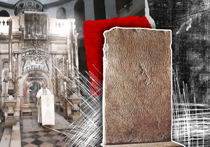
Multiple Attestation — Nine Sites, One Life
Methodological synthesis — multiple attestation across nine archaeological sites“These things were written, that ye might believe that Jesus is the Christ…” — John 20:31, KJV Across nine subcats, sites named in the Gospels have been independently excavated and confirmed: Capernaum (Peter’s house, synagogue foundations), Bethesda (five porticoes), Siloam (2004 stepped pool), Nazareth (2009 dwelling), Magdala (synagogue and Stone), Chorazin, Sepphoris, the Temple Mount platform, the Royal Stoa / Hulda Gates, and the Western Wall street. The sheer density of spatial attestation is the argument — no other ancient figure of comparable obscurity has this many named sites archaeologically verified.File Under: Jesus Christ > Life & Ministry > Historical & Physical Evidence > Cumulative Case Cross-References: Capernaum Excavations | Galilee Synagogues & VillagesCraig S. Keener in _The Historical Jesus of the Gospels_ (Eerdmans, 2009) treats spatial verification of this kind as a form of multiple attestation stronger than purely textual verification — because archaeological sites are public, testable, and local in a way that textual claims cannot be. Each excavation was conducted independently by different archaeologists (Franciscan, IAA, American, Mexican, French, Italian, British, Greek) — meaning the convergence is not the product of a single school or tradition. Citation: Craig S. Keener, _The Historical Jesus of the Gospels_, Eerdmans, 2009; John McRay, _Archaeology and the New Testament_, Baker, 1991.

THE FIRST-CENTURY SYNAGOGUE AT MAGDALA
Dr. Dina Gorni, archaeologist & excavator of the first-century synagogue at Magdala“The synagogue uncovered at Magdala dates to the first century and preserves the remarkable Magdala Stone, carved with an image of the Jerusalem Temple menorah. It offers a direct material window into the Jewish worship world of Galilee during Jesus’ public ministry.”Note: Magdala is associated in the Gospels with Mary Magdalene. The synagogue does not prove an individual episode in Jesus’ life, but it is an exceptionally well-preserved physical context for his reported synagogue teaching ministry. Evidence: First-century synagogue structure at Magdala, coins and ceramics from the Roman period, and the carved Magdala Stone. [Ontology: Jesus > Physical Evidence > Primary Archaeological Corroboration]+ Read More
File Under: Jesus’ Ministry > Historical Evidence
Cross Reference: Numismatics
Coherence Criteria — The Gospels’ Internal Consistency
Methodological synthesis — coherence criterion in historical Jesus research“Forasmuch as many have taken in hand to set forth in order a declaration of those things which are most surely believed among us, Even as they delivered them unto us, which from the beginning were eyewitnesses, and ministers of the word…” — Luke 1:1–2, KJV The coherence criterion — one of the standard criteria in historical Jesus research — asks whether a Gospel narrative coheres with what is already established about the Jesus tradition. Richard Bauckham in _Jesus and the Eyewitnesses_ (Eerdmans, 2006) argues that the Gospels exhibit the distinctive pattern of eyewitness testimony: named witnesses, specific local detail, and the kind of “informal controlled oral tradition” studied by Kenneth Bailey in Middle Eastern peasant societies. The architectural coherence between the Gospel narratives and the excavated sites is itself a cumulative argument — no individual narrative point is decisive, but the pattern is.File Under: Jesus Christ > Life & Ministry > Historical & Physical Evidence > Cumulative Case Cross-References: First-Century Jewish Burial Customs | His TeachingsBauckham’s thesis challenges the form-critical assumption that the Gospel traditions passed through decades of anonymous community redaction before reaching written form. He argues instead that named eyewitnesses — including the Bethany family, the Capernaum household, and specific women at the cross and tomb — remained authoritative sources for the Jesus tradition throughout the period of oral transmission. Kenneth Bailey‘s “informal controlled oral tradition” model shows that in Middle Eastern village culture, community traditions about respected teachers are controlled by the community — allowing flexibility in peripheral details but preserving the core with high fidelity. Citation: Richard Bauckham, _Jesus and the Eyewitnesses_, Eerdmans, 2006; Kenneth E. Bailey, “Informal Controlled Oral Tradition,” _Themelios_ 20:2 (1995).
ARCHAEOLOGY HAS NOT DISPROVED A SINGLE GOSPEL CLAIM
Dr. John McRay, professor of New Testament & archaeology at Wheaton College & author of Archaeology and the New Testament“After a lifetime of New Testament archaeology, I can say that archaeology has not disproved a single geographical, historical, or cultural claim in the New Testament. In case after case — the Pool of Bethesda, the Pavement of Gabbatha, the synagogue at Capernaum — archaeology has confirmed what critics said was legendary. The New Testament describes a real world.”Note: His comprehensive survey of New Testament archaeology produced the definitive academic reference work on the subject, concluding that the archaeological record consistently supports rather than undermines the historical credibility of the Gospel accounts. Evidence: Comprehensive archaeological survey of all New Testament geographical and historical claims, cross-referenced with excavation data. [Ontology: Jesus > Numismatics & Epigraphy]+ Read More
File Under: Jesus’ Ministry > Historical Evidence
Cross Reference: The Cumulative Case
Public-Site Testability — Named, Observable, Falsifiable Venues
Methodological synthesis — public-site testability criterion“And said unto them, It is written, My house shall be called the house of prayer; but ye have made it a den of thieves.” — Matthew 21:13, KJV Unlike purely theological claims, the Gospel setting is publicly testable — each site it names is a physical venue that anyone in the first century could visit and falsify. If John said Bethesda had five porticoes and it had four, a Jerusalem resident could have said so. If Mark said Capernaum had a synagogue and it didn’t, a Galilean could have corrected the record. John McRay and James H. Charlesworth both emphasize that the public-site testability of Gospel geography is what makes archaeological verification the strongest kind of corroboration available to New Testament scholarship.File Under: Jesus Christ > Life & Ministry > Historical & Physical Evidence > Cumulative Case Cross-References: Pool of Bethesda | Pool of SiloamThis is what distinguishes the Gospel narratives from purely interior theological claims: they are embedded in a publicly accessible landscape. The contrast with Hellenistic mythical lives — which are typically set in timeless, unlocated, or legendary spaces — is sharp. Jesus heals at a named pool (Bethesda), sends a man to a named pool (Siloam), teaches in a named synagogue (Capernaum), disputes in a named building (the Temple), and is buried in a named garden tomb. Each claim is falsifiable. The pattern — one verified site after another — inverts the skeptical prediction. Citation: John McRay, _Archaeology and the New Testament_, Baker, 1991; James H. Charlesworth, ed., _Jesus and Archaeology_, Eerdmans, 2006.

The Cumulative Pattern Vs. Single-Find Arguments
Methodological synthesis — cumulative vs. single-find arguments“And there are also many other things which Jesus did, the which, if they should be written every one, I suppose that even the world itself could not contain the books that should be written.” — John 21:25, KJV The strength of this page’s argument is cumulative, not reductive. No single find proves the case — Bethesda’s five porticoes alone would be an intriguing coincidence; the 2004 Siloam pool alone would be a curiosity; the Pilate Inscription alone would confirm one Roman official. But the pattern — multiple independent sites verified across multiple archaeological campaigns, plus independent literary witnesses from hostile sources — creates a convergence that no single-find dismissal can unravel. Gary Habermas in _The Historical Jesus_ (College Press, 1996) demonstrates this method using his “minimal facts” approach.File Under: Jesus Christ > Life & Ministry > Historical & Physical Evidence > Cumulative Case Cross-References: The Crucifixion — Physical Evidence Summary | The Resurrection — Tomb Evidence SummaryHabermas’s “minimal facts” are accepted by a broad majority of scholars across the skeptical-to-conservative spectrum: Jesus died by crucifixion, was buried, his disciples despaired, the tomb was found empty, the disciples had experiences they believed were risen-Jesus appearances, they were transformed and willing to die for this belief, and the resurrection proclamation appeared early in Jerusalem — the very city where the events occurred. Each fact is individually defensible; the cumulative pattern is far stronger than any one of them. The archaeological evidence surveyed in the preceding eleven subcats provides the material scaffolding for each. Citation: Gary Habermas, _The Historical Jesus: Ancient Evidence for the Life of Christ_, College Press, 1996.
Final Synthesis — The Galilee-to-Jerusalem Corridor of Evidence
Methodological synthesis — cumulative case summary for the Historical & Physical Evidence page“For we have not followed cunningly devised fables, when we made known unto you the power and coming of our Lord Jesus Christ, but were eyewitnesses of his majesty.” — 2 Peter 1:16, KJV The historical Jesus of the Gospels is rooted in a real Galilee-to-Jerusalem corridor of named places, named officials, and archaeologically verifiable topography. Craig S. Keener surveys the full picture in _The Historical Jesus of the Gospels_ (Eerdmans, 2009); N. T. Wright treats the historical stakes in _The Resurrection of the Son of God_ (Fortress, 2003). The cumulative case of this page — literary witnesses plus archaeological verifications — moves the burden of proof from those who claim the Gospels are rooted in first-century reality to those who would dismiss them as fictions. The pattern, not any isolated find, is the argument.File Under: Jesus Christ > Life & Ministry > Historical & Physical Evidence > Cumulative Case Cross-References: Jesus’ Ministry | The Crucifixion | The ResurrectionIf each of the nine Galilee-to-Jerusalem sites surveyed in this anchor page has been confirmed at or near its expected location: Bethesda (five porticoes), Siloam (2004 stepped pool), Capernaum (Peter’s house and basalt synagogue foundation), Nazareth (2009 dwelling), Magdala (synagogue with the Magdala Stone), Bethsaida (excavated fishing village), Chorazin (basalt synagogue), Sepphoris (Herodian capital), and the Temple Mount (Herodian platform, Royal Stoa, Hulda Gates, Western Wall street) — then the prior probability that the Gospel narratives are set in real first-century geography approaches certainty. The two Passion-summary subcats confirm the _Pilate_, _Caiaphas_, crucifixion-method, and tomb-specific corroborations. The literary subcat adds six hostile or neutral external witnesses. This is the cumulative case for the Historical & Physical Evidence of Jesus’ life and ministry. Citation: Craig S. Keener, _The Historical Jesus of the Gospels_, Eerdmans, 2009; N. T. Wright, _The Resurrection of the Son of God_, Fortress, 2003.
THE CHURCH BUILT OVER THE HOME OF PETER AND ANDREW
Professor Steven Notley, professor of New Testament & early Christianity at Nyack College & co-director of the Bethsaida Excavations“In 2017, we uncovered the remains of a Byzantine basilica near the Jordan River at el-Araj — almost certainly the Church of the Apostles described by the 7th-century pilgrim Willibald as built over the home of Peter, Andrew, and Philip. The site sits precisely where ancient sources place Bethsaida, and the mosaic floors and basilica architecture confirm a major early Christian veneration site. The disciples had a real home that real Christians immediately memorialized.” The discovery of the Church of the Apostles provides physical evidence that the earliest Christians immediately identified and preserved the actual homes of Jesus’ disciples, consistent with the Gospel’s geographical precision. Evidence: Byzantine basilica excavation at el-Araj, mosaic floor analysis, and correlation with 7th-century pilgrim accounts of the Church of the Apostles. [Ontology: Jesus > Broader Physical Evidence]+ Read More
File Under: Jesus’ Ministry > Historical Evidence
Cross Reference: Architectural Context