Decapolis Shore
Hippos, Gadara, Gerasa, Kursi and eastern-shore routes frame the Gospel traditions set across the lake. Competing locations and variant place-names make topographical conclusions provisional.
Cross References — Eastern Shore | Gerasene Tradition | Roman Cities | Gospel Geography
Kursi — A Byzantine Monastery Beside the Decapolis Shore
Kursi monastery — eastern Galilee shore, Byzantine period“And they came over unto the other side of the sea, into the country of the Gadarenes.” — Mark 5:1, KJVIn Mark 5:1–20Paul Bril, Landscape With the Exorcism of the Gerasene Demoniac, 1601 AD, Alte Pinakothek, Munich; public domain.Mark 5:1–20 — KJV
Mark describes Jesus crossing the sea, meeting a man among tombs and sending unclean spirits into swine that rush down a steep place into the water. Manuscripts vary over the regional name rendered “Gadarenes” in the KJV., Jesus crosses to the lake’s eastern side of GadarenesDaniel Case, Galilee-Golan Panorama From Umm Qais, 2008; CC BY-SA 3.0.Gadarenes
People associated with Gadara, the Decapolis city represented by the ruins at modern Umm Qais. Gadara stood southeast of the Sea of Galilee, although its territory may have extended toward the lake and Jordan Valley. “Gadarenes” appears in the KJV and parts of the manuscript tradition; other witnesses read forms associated with Gerasa or Gergesa. and meets a man living among tombs.
Centuries later, Christians built a large Byzantine monasteryPikiWiki Israel, Kursi Monastery Complex, photographed 2021, eastern Sea of Galilee; CC BY 2.5.Byzantine monastery
A walled religious complex with a basilica, atrium, domestic rooms, service installations and burial spaces. Its monumental scale documents organized pilgrimage and monastic life, not a 1st-Century AD settlement. at Kursi
An archaeological site on the eastern shore of the Sea of Galilee, near Wadi Samakh. Excavations exposed a large late 5th- to 8th-Century AD Christian complex containing a basilica, monastery, mosaics, baptistery, hostel, bathhouse and hillside chapel. Its remains document Byzantine Christian pilgrimage and commemoration; they do not independently identify the location of the Gospel exorcism., near the only sharply-descending lakeside slope in the vicinity. Road construction exposed the ruins in 1970; excavations followed from 1971 to 1974.
The complex included a three-aisled basilicaAvram Graicer, Kursi Basilica, photographed 2015, Kursi National Park; Wikimedia Commons.Three-aisled basilica
A longitudinal church divided by column rows into a central nave and two side aisles. The Kursi church had an atrium, mosaic floors and adjoining monastic facilities., mosaics, baptistery, bathhouse, hostel-like rooms and a hillside chapel near a prominent boulder. These remains establish later Christian commemoration, not the exorcism’s location or historicity.What the Complex Contained
The walled compound extended over several acres and combined worship, lodging, food production, water storage and burial. Its church received patterned mosaic pavements; an inscription dates a baptistery mosaicCrispins C. Crispian, Byzantine Mosaic at Kursi, photographed 2016; Wikimedia Commons. The photograph supplies mosaic context rather than depicting the dated inscription itself.Baptistery mosaic
The baptistery belonged to the church complex and contained a Greek dedicatory inscription dating its mosaic pavement to 585 AD. A baptistery was the part of a church used for Christian initiation by baptism. The inscription helps establish one documented phase in the complex’s architectural development; it does not date the beginning of the local Gospel association. to 585 AD. Olive-processing equipment and a marble-lined bathhouse illuminate the monastery’s economy and hospitality.
The hillside chapelPikiWiki Israel, Kursi Hillside, photographed 2021, eastern Sea of Galilee; CC BY 2.5.Hillside chapel
Excavators found a small chapel south of the monastery beside a large boulder. Its apse and successive mosaic floors show that pilgrims marked a more specific place within the broader sacred landscape. stood above the main enclosure. The relationship between that chapel, the boulder and the Gospel’s “steep place” belongs to Byzantine interpretation
The association created or monumentalized by Christians during the Byzantine period, centuries after the reported Gospel event. Kursi’s church, monastery and hillside chapel show that Christians identified this landscape with the exorcism tradition by Late Antiquity. Such construction establishes the existence of that later belief, but its date prevents it from functioning as direct 1st-Century AD testimony., not to independently preserved 1st-Century AD documentation.Lake Access and Anchorage
Survey and geophysical work have identified ancient shoreline installations near Kursi, supporting access by boat and a connection between the monastery and the lake. The proposed Kursi anchoragePikiWiki Israel, Kursi Beside the Sea of Galilee, photographed 2021; CC BY 2.5.Kursi anchorage
Stone features and subsurface investigations near the changing shoreline have been interpreted as landing infrastructure. Dating and function require caution because lake levels and later construction altered the coast. makes the pilgrimage center geographically intelligible but does not identify the landing place of Mark 5.
The Kursi monastic complex on the eastern shore of the Sea of Galilee. PikiWiki Israel, 2021; CC BY 2.5.
Three Gospel Presentations
Matthew 8:28–34Unknown mosaicist, Exorcism of the Gerasene Demoniac, early 6th Century AD, Sant’Apollinare Nuovo, Ravenna; public domain.Matthew 8:28–34 — KJV
Matthew describes two demon-possessed men coming from the tombs and places the encounter in “the country of the Gergesenes” in the KJV. The number of men and regional designation differ from Mark’s presentation. narrates two men; Mark 5 and Luke 8:26–39Julius Schnorr von Carolsfeld, The Gerasene Demoniac, 1860 AD, Die Bibel in Bildern; public domain.Luke 8:26–39 — KJV
Luke narrates one afflicted man, tombs, swine and a return voyage. The KJV reads “country of the Gadarenes,” while critical editions preserve a complex set of geographic variants. one. Their place-names also vary in surviving manuscripts and translations.
Evidence – Kursi preserves a major Byzantine monastery, basilica, mosaics, service buildings and hillside chapel created around a Christian localization of the eastern-shore exorcism tradition.
Conclusion – Archaeology securely establishes a substantial late antique pilgrimage center and its lakeside setting. It does not establish Kursi as the original Gospel location.
Criticisms – The monastery begins centuries after Jesus’ ministry. The Gospel place-name tradition is textually unstable, and proposed harbor features, chapel associations and precise destruction phases remain interpretive questions.
Citation – Vassilios Tzaferis, The Excavations of Kursi-Gergesa, ‘Atiqot 16, 1983; Vassilios Tzaferis, Nurit Feig, Alexander Onn and Eli Shukron, “New Archaeological Finds From Kursi-Gergesa,” ‘Atiqot 79, 2014, pp. 175–197; Matthew 8:28–34; Mark 5:1–20; Luke 8:26–39, KJV.
File Under – Evidence for Jesus Christ > Jesus’ Ministry > Archaeological Sites > Decapolis Shore > Kursi Monastery
Cross References – Ministry Miracles | Jesus Travels | Sea of Galilee | Northern Regions


Vassilios Tzaferis — What Kursi’s Monastery Actually Establishes
Vassilios Tzaferis, archaeologist, Kursi excavation report, 2014 AD“It is quite evident that the hostelry and the small but compact bathhouse were built within the monastery compound”Vassilios Tzaferis wrote this in his 2014 report on renewed excavations at KursiModern photograph of the Kursi archaeological site; PikiWiki Israel, Wikimedia Commons.Kursi, eastern Sea of Galilee
The monastery on the eastern shore marks a later Christian place of pilgrimage. Its buildings are archaeological evidence for Byzantine devotion, not a physical trace of a first-century exorcism., beside the eastern Sea of GalileeModern view toward the eastern hills; Wikimedia Commons.Sea of Galilee
The freshwater lake bordered Galilee on the west and the Kursi district on the east. The Gospels narrate a crossing and a herd descending toward its water, but several shoreline settings are possible.. The quoted buildings are a pilgrim hostelryKursi monastery remains; contextual photograph, not an identified hostel room; PikiWiki Israel, Wikimedia Commons.Monastery hostelry
A guest lodging within the monastic compound. Tzaferis connects the bathhouse to the hostel excavated in 1970–1971; their placement and finds illuminate facilities for travelers centuries after the Gospel period. and bathhouseKursi site context, not a claimed photograph of the bathhouse; PikiWiki Israel, Wikimedia Commons.Kursi monastery bathhouse
Excavated in renewed work from 2001 to 2003, this compact building had a furnace, heated-water pools, a hot room and a cool room. Pottery and stratigraphy place its use in the second quarter of the seventh century AD. The photograph shows other Kursi masonry, not the excavated bathhouse., whose excavated evidence belongs to the ByzantineLater monastic architecture at Kursi; Wikimedia Commons.Byzantine period at Kursi
The eastern Roman Christian period in which the church and monastery developed. Tzaferis dates the bathhouse’s operation specifically to the second quarter of the seventh century AD; that is much later than the Gospel setting. monastery, centuries after Jesus’ ministry.
The buildings document later Christian pilgrimage at Kursi. They do not locate the encounter with the demoniac and swine. The three Gospel accounts—Matthew 8:28–34Codex Sinaiticus folio containing Matthew 8:28; Wikimedia Commons.Matthew 8:28–34 — KJV
“there met him two possessed with devils, coming out of the tombs” (8:28); “the whole herd of swine ran violently down a steep place into the sea” (8:32).Matthew narrates two men. The KJV reads “Gergesenes” at 8:28; textual witnesses differ. Nothing here names a Byzantine monastery., Mark 5:1–20First-century Galilee boat; lake-crossing context, with no link to this specific episode; Wikimedia Commons.Mark 5:1–20 — KJV
“the herd ran violently down a steep place into the sea” (5:13); “he departed, and began to publish in Decapolis” (5:20).Mark focuses on one man and later proclamation in the Decapolis. The KJV place-name is “Gadarenes”; other witnesses vary. Neither detail identifies the landing as Kursi., and Luke 8:26–39A Herd of Pigs, Metropolitan Museum of Art; thematic illustration, not a Gospel reconstruction.Luke 8:26–39 — KJV
“the country of the Gadarenes, which is over against Galilee” (8:26); “the herd ran violently down a steep place into the lake” (8:33).Luke describes one man and a return crossing. The KJV geographical reading does not identify an excavated building or a particular slope.—differ in details and transmit competing geographical names.
Tzaferis’s excavations explain how later Christians used and remembered this shore; the first-century location remains a separate question.
What Tzaferis Excavated
The earlier Kursi work exposed a church, monastery and lodging for visitors. Renewed excavation in 2001–2003 brought to light the compact bathhouse. Tzaferis documented its water supply, furnace, heated pools, hot room and cool room. He connected it with the hostel excavated in 1970–1971, and dated its use to the second quarter of the seventh century AD by pottery and stratigraphy.
The hostel and bathhouse make practical sense within a destination receiving Christian travelers. A hillside chapelRemains of Kursi’s upper chapel, modern photograph; Wikimedia Commons.Kursi hillside chapel
A small sanctuary above the main complex served later local veneration. Like the monastery and bathhouse, its surviving remains date Christian use of the landscape, not the Gospel encounter itself. also marks veneration above the larger monastery. These findings establish the scale and organization of a later pilgrimage center. They do not date the Gospel event or identify a first-century dwelling beside the shore.Kursi basilica and monastic remains, modern photograph by Roded Shlomo / PikiWiki Israel. The visible buildings are later than the Gospel narratives.
The Names Behind the Identification
Gospel manuscripts and translations preserve names associated with GadaraLandscape near ancient Gadara, modern photograph; Wikimedia Commons.Gadara and its territory
Ancient Gadara stood at modern Umm Qais southeast of the lake. A territorial designation can refer to a wider district; the excavated city itself is not the boat’s lakeshore landing., GerasaGerasa/Jerash, contextual city photograph; Wikimedia Commons.Gerasa
Ancient Gerasa at modern Jerash lies much farther from the Sea of Galilee. A textual reading associated with this city creates a geographical difficulty if the city center is taken as the exact shore of the encounter., and GergesaKursi church and monastery, later commemoration; Wikimedia Commons.Gergesa
A lakeside name in ancient Christian geographical discussion and some textual witnesses. Its proposed link to Kursi is a historical identification, not a place-name proved by the monastery’s seventh-century bathhouse.. Gadara’s district could extend beyond its city, while Gerasa’s urban center is distant from the lake. Later Christian writers favored a lakeside Gergesa, and Kursi’s slope became part of that identification. The spelling question, the scale of a city’s territory, and the actual shore landing each require separate arguments.
The monastery shows that Christians commemorated this landscape centuries afterward. It cannot determine which geographical reading was earliest or establish that the encounter happened at the precise site of its church.A Distinct Alternative
Richard Bauckham proposed Tel HadarTel Hadar, a distinct proposed locality north of Kursi; Wikimedia Commons.Tel Hadar
A mound north of Kursi proposed by Richard Bauckham as an alternative to the traditional Kursi identification of Gergesa. The proposal remains debated and does not turn the monastery into first-century evidence. as Gergesa instead of Kursi. This is a scholarly proposal, not an excavated confirmation of the exorcism. Tzaferis’s monastic findings remain significant whichever lakeside identification proves most plausible: they document Byzantine and early Islamic use of Kursi, while the geographical case for the Gospel episode remains open.
Later work at Kursi Beach also tests occupation and shoreline structures independently of Tzaferis’s monastic excavations. A hillside resemblance, a later church, and a possible landing should not be combined as though they were one securely dated first-century find.Evidence – Excavated architecture, pottery and stratigraphy document a hostel and a bathhouse used within the Kursi monastic complex in the seventh century AD.
Conclusion – The Kursi finds establish later Christian pilgrimage and commemoration; they do not establish the precise setting of the Gospel exorcism.
Criticism – Manuscript place-names, possible city territories and alternative lakeside identifications limit an exact Kursi claim. The preserved structures are centuries later than the narrated event.
Citation – Vassilios Tzaferis, “New Archaeological Finds from Kursi-Gergesa,” ‘Atiqot 79 (2014), pp. 175–197, quotation p. 184; Tzaferis, “The Excavation of Kursi-Gergesa,” ‘Atiqot 16 (1983); Richard Bauckham, “Gergesa Is Tel Hadar, Not Kursi,” Revue Biblique 122 (2015), pp. 268–283; Matthew 8:28–34; Mark 5:1–20; Luke 8:26–39, KJV.
File Under – Evidence for Jesus Christ > Jesus’ Ministry > Archaeological Sites > Decapolis Shore > Tzaferis on Kursi
Cross References – Miracles & Testimonies | Jesus’ Travels | Findings & Theories


The Feeding of the Four Thousand — Decapolis Route and an Unfixed Shore
Eastern Galilee landscape; the feeding place remains unidentified“And they that did eat were four thousand men, beside women and children.” — Matthew 15:38, KJVMatthew 15:38Modern Galilee shore context; no claim that the meal occurred here.Matthew 15:38 — KJV
“And they that did eat were four thousand men, beside women and children.” Matthew counts the crowd after the meal; the verse does not name a village or specify the crowd’s ethnicity. counts four thousand men besides women and children after a meal beside the Sea of Galilee
Freshwater lake between Galilean communities and eastern districts. Boats and shore routes connected settlements around it; changing water levels complicate reconstructions of ancient landings.. Mark describes a route from Tyre and SidonModern Tyre, Lebanon; geographical context.Tyre and Sidon
Phoenician coastal cities north of Galilee. Mark 7:24–31 places travel from this area toward the Decapolis, but does not map each stage. to Mark 7:31Hippos/Sussita, a Decapolis city above the lake; modern aerial photograph.Mark 7:31 — KJV
“And again, departing from the coasts of Tyre and Sidon, he came unto the sea of Galilee, through the midst of the coasts of Decapolis.” Mark places the ensuing healing in this broad region; it does not name the later feeding site., a healing of a deaf man who had difficulty speaking (Mark 7:32–37Hippos, modern site view; region context, not the healing location.Mark 7:32–37 — KJV
“And they bring unto him one that was deaf, and had an impediment in his speech” (7:32). Mark narrates this healing after the Decapolis itinerary and before the feeding; the sequence does not identify a village.), and then the feeding of four thousand. Matthew’s earlier crowd praises “the God of Israel” (Matthew 15:31Modern Torah scroll ceremony; contextual image for Israelite scriptural tradition, not the Gospel crowd.Matthew 15:31 — KJV
“Insomuch that the multitude wondered, when they saw the dumb to speak, the maimed to be whole, the lame to walk, and the blind to see: and they glorified the God of Israel.” The phrase does not by itself settle the crowd’s ethnicity.). The sequence invites a regional reading, but neither Gospel identifies a shore or excavated site for the meal.
The lake connected landing places and roads serving Jewish communities and cities within the Decapolis
A shifting grouping of Hellenized cities east and south of Galilee under Roman influence. Hippos overlooked the eastern shore; Gadara lay farther southeast. “Decapolis” describes a region in Mark 7:31, not a coordinate for the feeding.. A crossing after the meal is explicit in Mark 8:10Later Galilee fishing boat; context for lake crossing.Mark 8:10 — KJV
“And straightway he entered into a ship with his disciples, and came into the parts of Dalmanutha.” This is the destination after the feeding in Mark, not the named site of the meal; the location of Dalmanutha is debated.; the route before it is less precise. The landscape makes movement between communities plausible without proving the crowd was uniformly Gentile.What the Two Accounts Actually Locate
Matthew 15:29Codex Sinaiticus, Matthew opening; contextual manuscript, not this verse.Matthew 15:29 — KJV
“And Jesus departed from thence, and came nigh unto the sea of Galilee; and went up into a mountain, and sat down there.” Matthew gives a lakeside hill setting but no town for the subsequent healing and feeding. says Jesus came near the Sea of Galilee and went up a mountain; 15:32–39 describes seven loaves, a few fishes, four thousand men besides women and children, and departure by boat. Mark 7:31 names the Decapolis in the preceding itinerary; Mark 8:2–9
“I have compassion on the multitude, because they have now been with me three days, and have nothing to eat:” (8:2). Seven loaves and a few fishes are distributed; about four thousand eat and seven baskets remain. Mark 8:10 then records a boat crossing.. Mark 8:1 names no town or landing place. Matthew 8:1 concerns a different scene, when Jesus descends from a mountain, and cannot supply this missing location. Matthew’s “coasts of Magdala” in the KJV at Matthew 15:39Modern archaeological view of Magdala; no evidence that the feeding was there.Matthew 15:39 — KJV
“And he sent away the multitude, and took ship, and came into the coasts of Magdala.” The KJV destination follows the meal; Greek witnesses have different place-name readings, including Magadan. is after the feeding, and manuscripts differ over that destination.
HipposHippos/Sussita, modern aerial photograph.Hippos/Sussita
Decapolis city on a ridge above the eastern lake. Its elevated city center was not itself a shore landing or an identified feeding place., Kursi, the northeast shore, and other proposed settings may help visualize routes. Bethsaida-JuliasEt-Tell, one proposed Bethsaida site; identification contested.Bethsaida-Julias
Town associated with the northeastern lake region and Philip the tetrarch; proposed locations include et-Tell and el-Araj. This separate identification debate does not fix the feeding site. belongs to a disputed northeastern identification and should not be silently treated as the feeding site. No known excavation independently locates this meal.Hippos and the lake, modern aerial photograph; this view does not locate the feeding.
Scriptural Resonance and the Crowd
The Exodus 16:4Torah scrolls; modern photograph illustrating the textual tradition of Exodus.Exodus 16:4 — KJV
“Behold, I will rain bread from heaven for you.” The wilderness manna account is a possible scriptural resonance for a crowd fed in a remote place; the Gospel does not explicitly identify its setting with Sinai. manna account and Isaiah’s promise of restored sight and hearing (Isaiah 35:5–6Isaiah manuscript; contextual illustration of the prophetic book.Isaiah 35:5–6 — KJV
“Then the eyes of the blind shall be opened, and the ears of the deaf shall be unstopped.” Isaiah continues with the lame and the speechless; compare Matthew 15:30–31 and Mark 7:32–37 as literary echoes, not proof that a location has been identified.) can help readers understand the narrative’s biblical language. Matthew 15:31’s “God of Israel” has been read both as a Gentile response to Israel’s God and as Jewish covenant language. Neither reading follows automatically from an archaeological map.
The earlier feeding of five thousand (Mark 6:30–44Later Tabgha mosaic in a historic photograph; no Gospel-period artifact.Mark 6:30–44 — KJV
“And they that did eat of the loaves were about five thousand men” (6:44). Mark’s earlier feeding has five loaves, two fishes and twelve baskets. Its differences from Mark 8:1–10 matter to the comparison.; Matthew 14:13–21Historic photograph of the later Tabgha mosaic; commemoration, not event evidence.Matthew 14:13–21 — KJV
“And they did all eat, and were filled: and they took up of the fragments that remained twelve baskets full” (14:20). Matthew’s earlier feeding is distinct in narrative placement and numbers from 15:32–39.) has different numbers, fragments, and narrative placement. The famous loaves-and-fishes mosaicFifth-century AD Tabgha pavement; photograph of the restored mosaic.Tabgha loaves-and-fishes mosaic
Fifth-century AD pavement in the Church of the Multiplication, depicting fish beside bread. It records later Christian commemoration and cannot identify the four-thousand site. at TabghaLater church at Tabgha; pilgrimage context.Tabgha
Northwestern lake district with a later church and loaves-and-fishes mosaic. Christian tradition connects it with the feeding of five thousand, not a secure excavation of the four-thousand meal. is later Christian commemoration generally linked with that other feeding, not physical evidence locating the four thousand.Limits of the Geographic Argument
An eastern route can be inferred from Mark’s sequence, but lake crossings, population mixtures, later place names, and the absence of a named feeding settlement prevent pinpointing the event. A predominantly Gentile crowd is a debated literary and historical inference, not an established demographic count. The geography gives context to the narrative, not a material trace of a miracle.Evidence – Mark 7:31 and 8:1–10 supply an itinerary and feeding sequence; Matthew 15:29–39 supplies a lakeside setting and the crowd’s praise. The lake and eastern cities form a plausible regional framework.
Conclusion – The Decapolis route makes an eastern setting possible, but neither text nor archaeology identifies the feeding site or conclusively determines the crowd’s ethnicity.
Criticism – Scholars disagree whether Matthew’s “God of Israel” suggests Gentile observers or a Jewish crowd; the broad itinerary also allows more than one lakeside location.
Citation – Matthew 15:29–39; Mark 7:31–37; 8:1–10; Exodus 16:4; Isaiah 35:5–6, KJV; J. R. C. Cousland, “The Feeding of the Four Thousand Gentiles in Matthew?,” Novum Testamentum 41 (1999), pp. 1–23; Benjamin Hussung, “Jesus’s Feeding of the Gentiles in Matt 15:29–39,” JETS 63 (2020), pp. 473–489.
File Under – Evidence for Jesus Christ > Jesus’ Ministry > Archaeological Sites > Decapolis Shore > The Feeding of the Four Thousand — Decapolis Route and an Unfixed Shore
Cross References – Jesus’ Travels | Miracles & Testimonies | Teachings & Parables | Findings & Theories


J. R. C. Cousland — Why the Feeding Site and Crowd Remain Debated
Cousland tests the route, location, and crowd in Matthew“the topographical data were ultimately insufficient to establish the locale of the feeding of the four thousand.”In his 1999 study of Matthew 15:29–39“they glorified the God of Israel” (15:31); “I have compassion on the multitude” (15:32); “they that did eat were four thousand men” (15:38). Matthew moves from healing and praise to the meal. The words do not identify every person’s ethnicity or the precise shore., J. R. C. Cousland tested a common argument: Mark’s Decapolis route and Matthew’s “God of Israel”Early printed Mishnah; contextual image for Jewish tradition, centuries later than Matthew.Matthew 15:31 — KJV
Matthew says the healed crowd “glorified the God of Israel.” Some read this as a Gentile expression; Cousland argues it fits Jewish scriptural and covenantal praise. The wording alone does not identify a village or the ethnicity of every listener. might indicate a Gentile crowd on the eastern side of the lake.
Matthew’sRembrandt, Saint Matthew and the Angel, 1661 AD, Louvre Museum; later art. Matthew
The first Gospel in canonical order, traditionally attributed to the apostle Matthew but anonymous in its text. Commonly dated about AD 80–90, it uses much of Mark while organizing teaching into major discourses and repeatedly interpreting Jesus through Israel’s Scriptures. Its special material requires separate historical evaluation. quoted conclusion addresses the location, not whether the narrative occurred. The route cannot select one feeding site from the possible shores.
Cousland goes further and argues that Matthew envisages a Jewish crowd. That ethnic conclusion remains contested, making his geographic limit especially valuable as a separate finding. The later Tabgha mosaic commemorates a different feeding and cannot settle the site.How Cousland Tests the Claim
Cousland weighs Mark 7:31Kursi monastery, centuries later; the scene does not locate the feeding.Mark 7:31 — KJV
“he came unto the sea of Galilee, through the midst of the coasts of Decapolis.” This broad itinerary precedes the healing and feeding, without naming the place of the meal. against Matthew 15:29–39 and asks whether the feeding must be placed in Gentile territory. Matthew says “near unto the sea of Galilee” rather than naming Hippos, Kursi, or Bethsaida. His topographical dataSea of Galilee at Tiberias, 1862; contextual landscape.Topographical data
Details of position, routes, hills, water, and distances used to test a proposed location. In this case Mark’s Decapolis itinerary is broad, while Matthew names no village for the feeding; topography constrains possibilities without furnishing coordinates. conclusion prevents a broad regional itinerary from becoming a precise site identification.
He then compares Matthew 15:31 with Jewish uses of “God of Israel,” including scriptural language associated with Israel’s history. Other scholars argue the phrase makes sense from outsiders praising Israel’s God. The disagreement concerns Matthew’s portrayal of the crowd, not a newly excavated feeding place.Loaves-and-fishes mosaic at Tabgha, later commemoration associated with another feeding.
The Old Testament Comparison
Exodus 16:4–18Modern Torah scrolls; context for Exodus as a scriptural book.Exodus 16:4–18 — KJV
“I will rain bread from heaven for you” (16:4); “gather of it every man according to his eating” (16:16). The wilderness manna narrative supplies a possible literary resonance; it gives no location for the Gospel feeding.narrates bread supplied in the wilderness. Isaiah 35:5–6Isaiah scroll image; manuscript context.Isaiah 35:5–6 — KJV
“Then the eyes of the blind shall be opened, and the ears of the deaf shall be unstopped” (35:5). Isaiah continues with the lame and speechless; the comparison is literary, not an archaeological identification. describes blind eyes, deaf ears, and the lame leaping—language adjacent to Matthew’s healing summary. These are interpretive parallels, not coordinates for the Gospel episode. Cousland’s method reminds the reader to test literary associations separately from the route around the lake.What This Companion Adds
The paired geography card maps the options; this assessment shows why a scholar can accept the Decapolis reference while rejecting an exact eastern-shore placement. Even agreement that Jesus moved in or near a Gentile sphere would not establish the composition of every crowd or the site of the meal.Evidence – Cousland’s published analysis explicitly evaluates the topographic and ethnic arguments surrounding Matthew 15:29–39.
Conclusion – The quoted sentence supports a restrained geographic conclusion; Cousland’s separate Jewish-crowd interpretation remains a scholarly position, not a fact settled by terrain.
Criticism – Benjamin Hussung’s 2020 analysis argues instead that Matthew’s literary context supports a Gentile crowd. The opposing readings should be identified, not collapsed into consensus.
Citation – J. R. C. Cousland, “The Feeding of the Four Thousand Gentiles in Matthew? Matthew 15:29–39 as a Test Case,” Novum Testamentum 41, no. 1 (1999), pp. 1–23, quotation p. 22; Benjamin Hussung, “Jesus’s Feeding of the Gentiles in Matt 15:29–39,” Journal of the Evangelical Theological Society 63, no. 3 (2020), pp. 473–489; Matthew 15:29–39; Mark 7:31–8:10, KJV.
File Under – Evidence for Jesus Christ > Jesus’ Ministry > Archaeological Sites > Decapolis Shore > J. R. C. Cousland — Why the Feeding Site and Crowd Remain Debated
Cross References – Jesus’ Travels | Miracles & Testimonies | Teachings & Parables | Findings & Theories
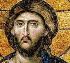


The Demoniac, the Decapolis and the Steep Shore
Eastern shore features suggest several locations, none established“And the herd ran violently down a steep place into the sea.” — Mark 5:13, KJVThe three accounts are Matthew 8:28–34Historical swineherd engraving; thematic illustration, not a Gospel scene.Matthew 8:28–34 — KJV
Matthew describes two afflicted men coming from tombs and a herd plunging into the sea. Its KJV place-name is “Gergesenes”; textual witnesses differ. The text names no excavated tomb or harbor., Mark 5:1–20Ancient Galilee boat; material context for lake crossings, not the Gospel vessel.Mark 5:1–20 — KJV
Mark describes a boat landing, one man among tombs, swine descending into the sea, and the healed man later publicizing the event in Decapolis (5:20). The KJV says “Gadarenes” at 5:1; Greek witnesses vary among regional names. and Luke 8:26–39
Luke has one man, tombs, a herd that plunges into the lake, and a return crossing. The KJV reads “Gadarenes” at 8:26. The lake reference constrains geography but does not identify a particular slope.. Together they give a crossing to the eastern side, an encounter near tombs, swine, and a descent into water. Mark ends by locating the healed man’s proclamation in the Decapolis. Those details narrow the kind of landscape a proposed setting must explain; they do not mark one verified shoreline point.
The eastern side had varied slopes, settlements, landing places, and routes. Its archaeology refutes the idea of an empty shore, but a harbor or tomb without a secure connection to the narrative is contextual evidence only. The variants Gadara, Gerasa, and Gergesa make the textual question as important as the terrain.Three Names and Two Scales of Geography
Gospel manuscripts and translations transmit names associated with GadaraUmm Qais/Gadara with Sea of Galilee in the background.Gadara
Decapolis city at modern Umm Qais, southeast of the Sea of Galilee. A wider district could have reached nearer the water; the urban ruins themselves are not a lakeside landing., Gerasa
Decapolis city at modern Jerash, much farther from the Sea of Galilee. The reading raises a distance problem if it names the city itself; a wider regional usage or textual change must be argued rather than assumed. and Gergesa
A name associated by later geographical traditions with the lake’s eastern side. Its relationship to Kursi, Tel Hadar, and manuscript readings is disputed; resemblance of names alone cannot establish a 1st-century village.. A city, its district, and a smaller lakeside locality need not occupy the same point. Yet the variant readings cannot be harmonized simply by assigning each name a different scale; the manuscript evidence and ancient geography must both be examined.
Matthew reports two men, whereas Mark and Luke focus on one. Mark alone supplies the approximate two-thousand figure for the herd. These differences belong in a geographic argument because selecting only a convenient detail can make a location appear more certain than the evidence allows.Gadara’s wider landscape; its urban ruins are not the lakeside landing.
Landing, Tombs and Slope
A boat could reach more than one eastern landing. Burial places occurred in the broader region, and several slopes descend toward the lake. Kursi’s steep terrain and later monastery explain its pilgrimage appeal; nearby shoreline investigations have generated proposals about access and occupation. The dating and function of individual features must be established before they are used as a 1st-century match.
Likewise, Isaiah 65:4
“Which remain among the graves, and lodge in the monuments, which eat swine’s flesh.” The combination of graves and swine is a contextual scriptural comparison, not a prediction identifying the Mark 5 location. joins graves and swine within an older prophetic setting. That thematic parallel helps a reader recognize ancient Jewish associations, but it is not independent testimony that the event occurred at Kursi or any other candidate.Comparing Candidates Without Declaring a Winner
Kursi has strong evidence of Byzantine commemoration. Hippos
Decapolis city on a ridge above the eastern lake. Its elevated city center was not itself a shore landing or an identified feeding place. overlooks the eastern shore but its urban center is elevated; Gadara and especially Gerasa pose distance questions if treated as the exact landing city. Tel Hadar and other lakeside proposals remain hypotheses. Bethsaida-Julias
Town associated with the northeastern lake region and Philip the tetrarch; proposed locations include et-Tell and el-Araj. This separate identification debate does not fix the feeding site. belongs to a separate northeastern identification debate and cannot be imported as the location merely because it borders the lake.
A convincing identification would need a defensible textual reading, a plausible route and lakeside topography, and appropriately dated evidence. No existing package proves the exorcism site.Evidence – The Synoptic texts describe a crossing, tombs, swine and a descent to water; eastern-shore terrain and occupation offer several possible settings.
Conclusion – The landscape makes the narrative geographically intelligible but does not archaeologically verify the exorcism or pinpoint its site.
Criticism – Gerasa, Gadara and Gergesa vary across textual witnesses; later Christian Kursi remains and proposed harbor features cannot by themselves fill the 1st-century evidentiary gap.
Citation – Matthew 8:28–34; Mark 5:1–20; Luke 8:26–39; Isaiah 65:4, KJV; Michal Artzy and Jennifer Munro, “Kursi, the Site of the ‘Miracle of the Swine’?,” Early Christianity 14, no. 3 (2023), pp. 379–391; Vassilios Tzaferis, The Excavations of Kursi-Gergesa, ‘Atiqot 16 (1983).
File Under – Evidence for Jesus Christ > Jesus’ Ministry > Archaeological Sites > Decapolis Shore > The Demoniac, the Decapolis and the Steep Shore
Cross References – Jesus’ Travels | Miracles & Testimonies | Teachings & Parables | Findings & Theories


Michal Artzy and Jennifer Munro — Testing the Kursi Shore Identification
Excavated Kursi strata challenge a precise Gospel site identification“the conclusions drawn from the topographical features of Wadi e-Kursi do not seem to be supported by the archaeological finds”In their 2023 peer-reviewed report, Michal Artzy and Jennifer Munro ask whether the familiar slope and the later monastic landscape are matched by excavated evidence for the Gospel period. The quoted sentence concerns the site identification. A plausible slope still needs dated occupation before it becomes a securely located settlement of Jesus’ time.
Their caution sharpens the companion geography card: a visually compelling shore, a monastery built centuries later, and a proposed landing cannot be merged into a single chain of 1st-century proof. The excavated layers and the later monastery answer different historical questions.What Their Excavations Actually Found
The researchers describe renewed investigations at Kursi Beach, including buildings, a proposed breakwater
A stone barrier protecting a landing from waves. An ancient-looking shore structure may have several construction or reuse phases; Artzy and Munro say the Kursi feature’s date is not decisive, with Iron Age II or earlier possible. and limited probes at Tel Kursi
A small mound near Kursi Beach. Limited probes found Iron Age material; Artzy and Munro report no securely identified Hellenistic or early Roman occupation in those excavated areas.. They report Byzantine-periodKursi monastery remains from later Christian use.Byzantine period
Here the eastern Roman era during which Christians developed the Kursi pilgrimage center. A Byzantine building is evidence for later activity, not automatically a 1st-century structure. structures associated with the broader pilgrimage landscape and Iron AgeTel Hazor, comparative earlier site illustration, not a Kursi find.Iron Age
An archaeological period far earlier than the 1st century AD; the local Iron II horizon is roughly 10th–6th centuries BC. Older pottery at Tel Kursi cannot establish Gospel-period settlement. material in a probed layer. The precise construction date of the breakwater remains uncertain; an older feature is not automatically a functioning 1st-century harbor.
They report no substantial early Roman occupationIron II pottery from Megiddo, a different site and era; illustrates why a pottery date must not be shifted to the Roman period.Early Roman occupation
Material securely dated to the late 1st century BC or 1st century AD would be relevant to the Gospel-period setting. Absence in limited trenches does not prove nobody lived anywhere nearby, but it limits claims based on excavated remains. in the areas investigated. This is a meaningful limitation on the Kursi identification, while the restricted extent of excavation keeps it from proving that every nearby place was unoccupied.How the Alternatives Fare
The traditional Kursi localization arose in later Christian pilgrimage and fits aspects of the visible terrain. Richard Bauckham proposed Tel Hadar
A site north of Kursi proposed by Richard Bauckham as an alternative Gergesa identification. Its placement and name argument are debated; Artzy and Munro note that a securely established Gospel-period occupation is a separate question. north of Kursi. Artzy and Munro question whether either candidate has the needed Hellenistic or early Roman material; they leave future discovery capable of changing the comparison.
The Gospel’s variant regional names and the distinction between city and territory remain separate textual issues. Their archaeological finding does not choose the original wording of Matthew, Mark, or Luke.Scripture and Chronology
Mark 5:1–20“they came over unto the other side of the sea” (5:1); “the herd ran violently down a steep place into the sea” (5:13); “began to publish in Decapolis” (5:20). Mark narrates one afflicted man and a later regional proclamation; manuscript place-names vary.and Luke 8:26–39Codex Sinaiticus page of Matthew 7:27–8:28; textual context, not Luke.Luke 8:26–39 — KJV
“they arrived at the country of the Gadarenes, which is over against Galilee” (8:26); “the herd ran violently down a steep place into the lake” (8:33). Luke describes one man and a return crossing; its KJV geographical reading is not a secure site identification.describe a crossing, one afflicted man and swine; Matthew 8:28–34“there met him two possessed with devils, coming out of the tombs” (8:28); “the whole herd of swine ran violently down a steep place into the sea” (8:32). Matthew’s two-men account and place-name witnesses must be considered alongside Mark and Luke.describes two men. Mark 5:20
“And he departed, and began to publish in Decapolis how great things Jesus had done for him: and all men did marvel.” Mark situates the man’s later proclamation in a broad regional setting; this does not name the boat’s landing site. says the man proclaimed his experience in the Decapolis. Isaiah 65:4
“Which remain among the graves, and lodge in the monuments, which eat swine’s flesh”. Isaiah describes a different prophetic setting. The shared images of tombs and swine do not establish a Gospel location. mentions graves and swine in a different prophetic context. None of these texts dates the visible Kursi monastery, whose construction belongs to Late AntiquityKursi church, later Christian architecture.Late Antiquity
The later Roman and early Byzantine centuries, broadly from the 3rd through 7th centuries AD in this setting. Kursi’s major Christian buildings belong centuries after the 1st-century Gospel narratives..Evidence – Artzy and Munro’s excavations and review distinguish the later Kursi pilgrimage complex, uncertain shoreline features, Iron Age evidence and the missing securely identified Gospel-period occupation in their trenches.
Conclusion – Their study weakens a confident identification of Kursi as the exact encounter site while leaving the wider eastern-shore question open to further evidence.
Criticism – Limited excavation and shifting shoreline conditions mean the absence of early Roman finds in sampled areas is a constraint, not a proof that no early Roman activity existed anywhere nearby.
Citation – Michal Artzy and Jennifer Munro, “Kursi, the Site of the ‘Miracle of the Swine’?,” Early Christianity 14, no. 3 (2023), pp. 379–391, quotation p. 389; DOI: 10.1628/ec-2023-0024; Matthew 8:28–34; Mark 5:1–20; Luke 8:26–39, KJV.
File Under – Evidence for Jesus Christ > Jesus’ Ministry > Archaeological Sites > Decapolis Shore > Michal Artzy and Jennifer Munro — Testing the Kursi Shore Identification
Cross References – Jesus’ Travels | Miracles & Testimonies | Teachings & Parables | Findings & Theories


